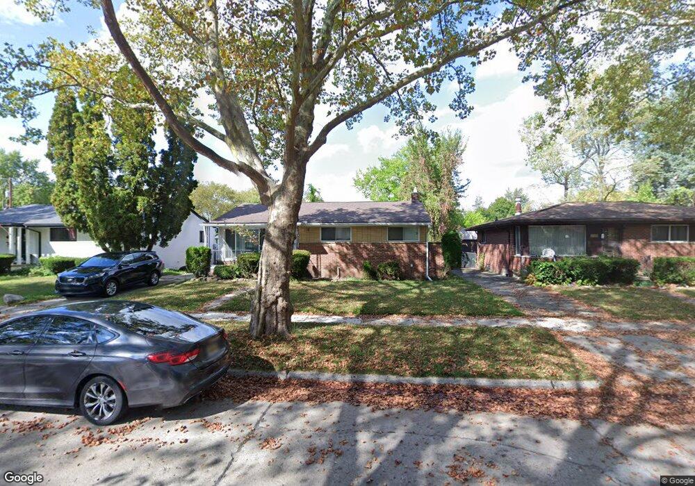
13650 Pearson St Unit Bldg-Unit Oak Park, MI 48237
Estimated Value: $206,000 - $224,000
3
Beds
2
Baths
1,152
Sq Ft
$185/Sq Ft
Est. Value
About This Home
This home is located at 13650 Pearson St Unit Bldg-Unit, Oak Park, MI 48237 and is currently estimated at $213,517, approximately $185 per square foot. 13650 Pearson St Unit Bldg-Unit is a home located in Oakland County with nearby schools including Einstein Elementary School, Oak Park Service Learning Academy, and Oak Park Service Learning Academy Opsla.
Ownership History
Date
Name
Owned For
Owner Type
Purchase Details
Closed on
Aug 23, 2018
Sold by
Communtiy Housing Network
Bought by
Mccray Dana
Current Estimated Value
Home Financials for this Owner
Home Financials are based on the most recent Mortgage that was taken out on this home.
Original Mortgage
$120,772
Interest Rate
4.87%
Mortgage Type
FHA
Purchase Details
Closed on
Apr 12, 2016
Sold by
Azzo Gus
Bought by
Community Housing Network Inc
Purchase Details
Closed on
Jan 17, 2012
Sold by
Scott Phillip and Scott Marjorie
Bought by
Nationstar Mortgage Llc and Centex Home Equity Company Llc
Purchase Details
Closed on
Sep 30, 1997
Sold by
Carter Samuel
Bought by
Scott Phillip
Home Financials for this Owner
Home Financials are based on the most recent Mortgage that was taken out on this home.
Original Mortgage
$91,122
Interest Rate
7.65%
Create a Home Valuation Report for This Property
The Home Valuation Report is an in-depth analysis detailing your home's value as well as a comparison with similar homes in the area
Home Values in the Area
Average Home Value in this Area
Purchase History
| Date | Buyer | Sale Price | Title Company |
|---|---|---|---|
| Mccray Dana | $123,000 | Cinnaire Title Services Dba | |
| Community Housing Network Inc | $90,000 | None Available | |
| Nationstar Mortgage Llc | $144,730 | None Available | |
| Scott Phillip | $91,700 | -- |
Source: Public Records
Mortgage History
| Date | Status | Borrower | Loan Amount |
|---|---|---|---|
| Previous Owner | Mccray Dana | $120,772 | |
| Previous Owner | Scott Phillip | $91,122 |
Source: Public Records
Tax History Compared to Growth
Tax History
| Year | Tax Paid | Tax Assessment Tax Assessment Total Assessment is a certain percentage of the fair market value that is determined by local assessors to be the total taxable value of land and additions on the property. | Land | Improvement |
|---|---|---|---|---|
| 2024 | $2,849 | $91,500 | $15,500 | $76,000 |
| 2023 | $2,732 | $80,400 | $13,700 | $66,700 |
| 2022 | $2,630 | $67,000 | $12,100 | $54,900 |
| 2021 | $2,619 | $60,000 | $6,200 | $53,800 |
| 2020 | $2,539 | $50,000 | $6,200 | $43,800 |
| 2018 | $2,662 | $32,600 | $0 | $0 |
| 2015 | -- | $26,200 | $0 | $0 |
| 2014 | -- | $22,900 | $0 | $0 |
| 2011 | -- | $30,600 | $0 | $0 |
Source: Public Records
Map
Nearby Homes
- 13711 Courtland St
- 13941 Pearson St
- 13341 Albany St
- 21701 Parklawn St
- 22001 Vale St
- 21460 Parklawn St
- 22030 Dante St
- 21661 Cloverlawn St
- 21900 Eastwood St
- 22191 Ridgedale St
- 22100 Dante St
- 22100 Dante St Unit bldg F unit 114
- 13333 W 9 Mile Rd
- 21301 Kipling St
- 21310 Gardner St
- 14211 Northend Ave
- 20800 Parklawn St
- 21741 Church St
- 22020 Sloman St
- 12761 Saratoga St
- 13650 Pearson St
- 13640 Pearson St
- 13660 Pearson St
- 13630 Pearson St
- 21820 Ridgedale St
- 13701 Courtland St
- 13700 Pearson St
- 13620 Pearson St
- 13651 Pearson St
- 21830 Ridgedale St
- 13721 Courtland St
- 13701 Pearson St
- 13641 Pearson St
- 13710 Pearson St
- 13631 Pearson St
- 21815 Coolidge Hwy
- 13616 Pearson St Unit 13616 Pearson
- 13711 Pearson St
- 13610 Pearson St
- 21821 Coolidge Hwy