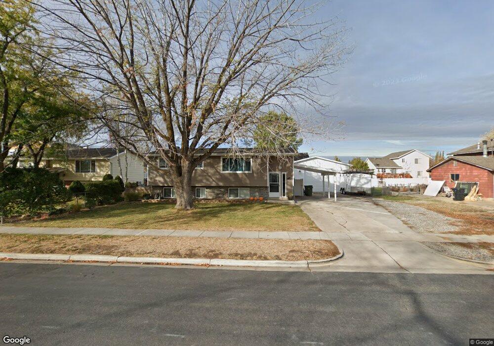
1366 David Dr Syracuse, UT 84075
Estimated Value: $389,000 - $418,000
4
Beds
2
Baths
1,932
Sq Ft
$211/Sq Ft
Est. Value
About This Home
This home is located at 1366 David Dr, Syracuse, UT 84075 and is currently estimated at $408,127, approximately $211 per square foot. 1366 David Dr is a home located in Davis County with nearby schools including Cook School, Syracuse Junior High School, and Syracuse High School.
Ownership History
Date
Name
Owned For
Owner Type
Purchase Details
Closed on
May 20, 2009
Sold by
Kline Jeremy D
Bought by
Kline Jeremy D
Current Estimated Value
Home Financials for this Owner
Home Financials are based on the most recent Mortgage that was taken out on this home.
Original Mortgage
$124,440
Outstanding Balance
$78,412
Interest Rate
4.8%
Mortgage Type
FHA
Estimated Equity
$329,715
Purchase Details
Closed on
Jun 29, 2005
Sold by
Logan James E and Logan Sylvia
Bought by
Klline Jeremy D
Create a Home Valuation Report for This Property
The Home Valuation Report is an in-depth analysis detailing your home's value as well as a comparison with similar homes in the area
Home Values in the Area
Average Home Value in this Area
Purchase History
| Date | Buyer | Sale Price | Title Company |
|---|---|---|---|
| Kline Jeremy D | -- | First American Title | |
| Klline Jeremy D | -- | Commercial Title Co |
Source: Public Records
Mortgage History
| Date | Status | Borrower | Loan Amount |
|---|---|---|---|
| Open | Kline Jeremy D | $124,440 |
Source: Public Records
Tax History Compared to Growth
Tax History
| Year | Tax Paid | Tax Assessment Tax Assessment Total Assessment is a certain percentage of the fair market value that is determined by local assessors to be the total taxable value of land and additions on the property. | Land | Improvement |
|---|---|---|---|---|
| 2025 | $1,984 | $191,400 | $122,652 | $68,748 |
| 2024 | $1,953 | $189,750 | $99,284 | $90,466 |
| 2023 | $1,831 | $324,000 | $138,462 | $185,538 |
| 2022 | $1,922 | $186,450 | $79,998 | $106,452 |
| 2021 | $1,804 | $271,000 | $117,976 | $153,024 |
| 2020 | $1,575 | $229,000 | $103,850 | $125,150 |
| 2019 | $1,470 | $211,000 | $100,190 | $110,810 |
| 2018 | $1,305 | $186,000 | $97,469 | $88,531 |
| 2016 | $1,099 | $82,115 | $37,459 | $44,656 |
| 2015 | $1,062 | $75,570 | $37,645 | $37,925 |
| 2014 | $1,037 | $75,246 | $37,645 | $37,601 |
| 2013 | -- | $68,875 | $28,435 | $40,440 |
Source: Public Records
Map
Nearby Homes