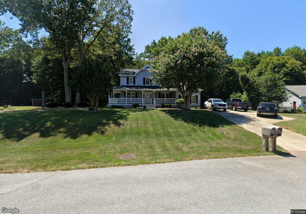
1366 Redwood Cir La Plata, MD 20646
Estimated Value: $419,255 - $520,000
--
Bed
3
Baths
2,124
Sq Ft
$228/Sq Ft
Est. Value
About This Home
This home is located at 1366 Redwood Cir, La Plata, MD 20646 and is currently estimated at $484,814, approximately $228 per square foot. 1366 Redwood Cir is a home located in Charles County with nearby schools including Walter J. Mitchell Elementary School, Milton M. Somers Middle School, and La Plata High School.
Ownership History
Date
Name
Owned For
Owner Type
Purchase Details
Closed on
Nov 6, 1995
Sold by
Ellis Kenneth J and Ellis Margaret T
Bought by
Davis Wayne T and Davis Linda M
Current Estimated Value
Purchase Details
Closed on
May 21, 1985
Sold by
Tradewind Development, Inc
Bought by
Ellis Kenneth J and Ellis Margaret T
Home Financials for this Owner
Home Financials are based on the most recent Mortgage that was taken out on this home.
Original Mortgage
$93,250
Interest Rate
12.94%
Purchase Details
Closed on
Jan 29, 1985
Sold by
Clark'S Run Ii, Inc
Bought by
Tradewind Development, Inc
Home Financials for this Owner
Home Financials are based on the most recent Mortgage that was taken out on this home.
Original Mortgage
$99,400
Interest Rate
12.96%
Create a Home Valuation Report for This Property
The Home Valuation Report is an in-depth analysis detailing your home's value as well as a comparison with similar homes in the area
Home Values in the Area
Average Home Value in this Area
Purchase History
| Date | Buyer | Sale Price | Title Company |
|---|---|---|---|
| Davis Wayne T | $167,000 | -- | |
| Ellis Kenneth J | $123,300 | -- | |
| Tradewind Development, Inc | $28,000 | -- |
Source: Public Records
Mortgage History
| Date | Status | Borrower | Loan Amount |
|---|---|---|---|
| Previous Owner | Ellis Kenneth J | $93,250 | |
| Previous Owner | Tradewind Development, Inc | $99,400 | |
| Closed | Davis Wayne T | -- |
Source: Public Records
Tax History Compared to Growth
Tax History
| Year | Tax Paid | Tax Assessment Tax Assessment Total Assessment is a certain percentage of the fair market value that is determined by local assessors to be the total taxable value of land and additions on the property. | Land | Improvement |
|---|---|---|---|---|
| 2025 | -- | $361,867 | -- | -- |
| 2024 | $2,580 | $338,333 | $0 | $0 |
| 2023 | $5,506 | $314,800 | $109,200 | $205,600 |
| 2022 | $4,596 | $306,000 | $0 | $0 |
| 2021 | $4,349 | $297,200 | $0 | $0 |
| 2020 | $4,349 | $288,400 | $98,700 | $189,700 |
| 2019 | $4,365 | $288,400 | $98,700 | $189,700 |
| 2018 | $4,347 | $288,400 | $98,700 | $189,700 |
| 2017 | $4,426 | $292,000 | $0 | $0 |
| 2016 | -- | $276,567 | $0 | $0 |
| 2015 | $4,099 | $261,133 | $0 | $0 |
| 2014 | $4,099 | $245,700 | $0 | $0 |
Source: Public Records
Map
Nearby Homes
- 507 Scarlet Oak Rd
- 511 Dogwood Ct
- 513 Clarks Run Rd
- 1319 Redwood Cir
- 721 Clarks Run Rd
- 7426 Robin Rd
- 7514 Glen Albin Rd
- 10226 Springhill Newtown Rd
- 10258 Springhill Newtown Rd
- 7406 Robin Rd
- 7351 Spring Hill Ct
- 10665 Horseshoe Ct
- 6635 Horseshoe Dr
- 9665 Docs Place
- 1061 Wales Dr
- 455 Patuxent Ct
- 14 Candleberry Dr
- 13 Candleberry Dr
- 9 Candleberry Dr
- 600 Edelen Station Place Unit 7402
- 1364 Redwood Cir
- 1368 Redwood Cir
- 1367 Redwood Cir
- 1370 Redwood Cir
- 1362 Redwood Cir
- 1369 Redwood Cir
- 1365 Redwood Cir
- 7413 Woodhaven Dr
- 1372 Redwood Cir
- 1371 Redwood Cir
- 1360 Redwood Cir
- 1363 Redwood Cir
- 1374 Redwood Cir
- 7419 Woodhaven Dr
- 1358 Redwood Cir
- 1373 Redwood Cir
- 7407 Woodhaven Dr
- 1376 Redwood Cir
- 7412 Woodhaven Dr
- 1375 Redwood Cir