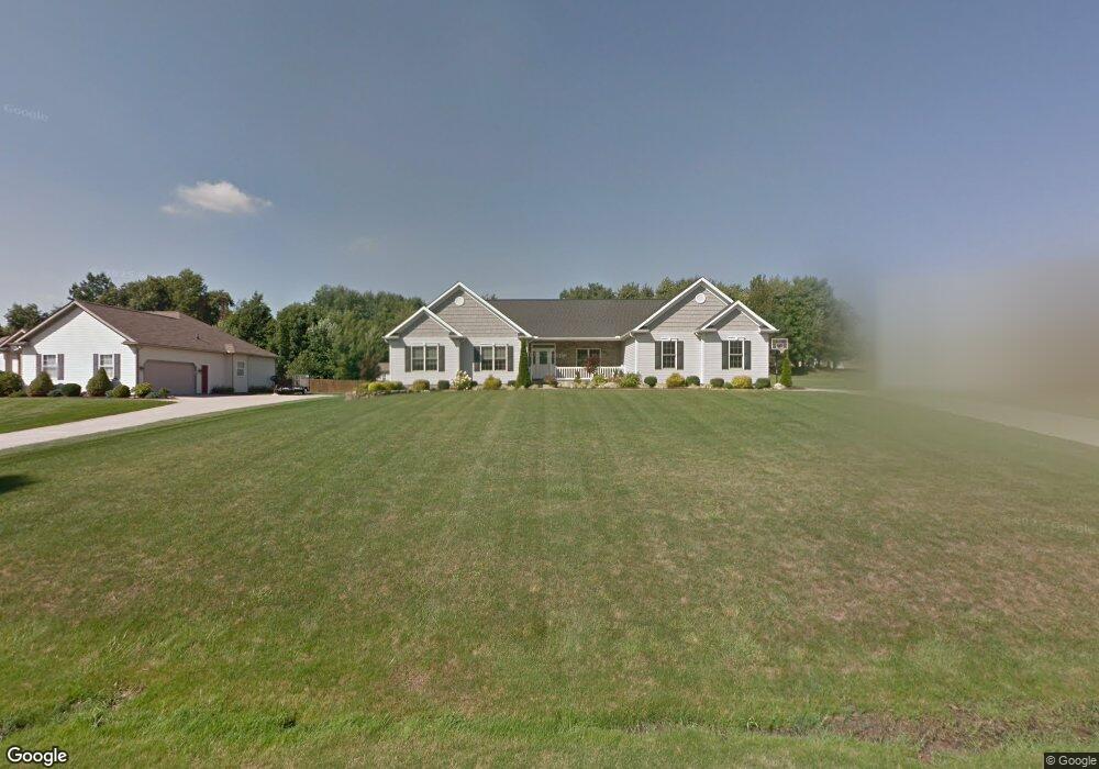
1367 Countryside Dr Mogadore, OH 44260
Estimated Value: $334,000 - $473,000
4
Beds
4
Baths
2,085
Sq Ft
$205/Sq Ft
Est. Value
About This Home
This home is located at 1367 Countryside Dr, Mogadore, OH 44260 and is currently estimated at $426,709, approximately $204 per square foot. 1367 Countryside Dr is a home located in Portage County with nearby schools including Suffield Elementary School, Field Middle School, and Field High School.
Ownership History
Date
Name
Owned For
Owner Type
Purchase Details
Closed on
Apr 25, 2013
Sold by
Roberts Daniel J and Roberts Erin M
Bought by
Roberts Daniel J and Roberts Erin M
Current Estimated Value
Purchase Details
Closed on
Sep 26, 2008
Sold by
Smith Michael W and Smith Cynthia A
Bought by
Roberts Daniel John and Lohr Erin Marie
Home Financials for this Owner
Home Financials are based on the most recent Mortgage that was taken out on this home.
Original Mortgage
$222,750
Interest Rate
6.57%
Mortgage Type
FHA
Purchase Details
Closed on
Feb 12, 2007
Sold by
Smith Michael W and Smith Cynthia A
Bought by
Smith Michael W and Smith Cynthia A
Purchase Details
Closed on
Jan 27, 2005
Sold by
D B Development Llc
Bought by
Smith Michael W and Smith Cynthia A
Home Financials for this Owner
Home Financials are based on the most recent Mortgage that was taken out on this home.
Original Mortgage
$51,210
Interest Rate
5.79%
Mortgage Type
Purchase Money Mortgage
Create a Home Valuation Report for This Property
The Home Valuation Report is an in-depth analysis detailing your home's value as well as a comparison with similar homes in the area
Home Values in the Area
Average Home Value in this Area
Purchase History
| Date | Buyer | Sale Price | Title Company |
|---|---|---|---|
| Roberts Daniel J | -- | None Available | |
| Roberts Daniel John | $240,000 | Portage Title Agency | |
| Smith Michael W | -- | Attorney | |
| Smith Michael W | $56,900 | Cardinal First Title Inc |
Source: Public Records
Mortgage History
| Date | Status | Borrower | Loan Amount |
|---|---|---|---|
| Previous Owner | Roberts Daniel John | $222,750 | |
| Previous Owner | Smith Michael W | $51,210 |
Source: Public Records
Tax History Compared to Growth
Tax History
| Year | Tax Paid | Tax Assessment Tax Assessment Total Assessment is a certain percentage of the fair market value that is determined by local assessors to be the total taxable value of land and additions on the property. | Land | Improvement |
|---|---|---|---|---|
| 2024 | $5,704 | $120,510 | $15,750 | $104,760 |
| 2023 | $6,128 | $104,410 | $17,330 | $87,080 |
| 2022 | $6,145 | $104,410 | $17,330 | $87,080 |
| 2021 | $6,004 | $104,410 | $17,330 | $87,080 |
| 2020 | $5,357 | $83,790 | $15,750 | $68,040 |
| 2019 | $5,278 | $83,790 | $15,750 | $68,040 |
| 2018 | $4,268 | $78,750 | $14,700 | $64,050 |
| 2017 | $4,197 | $78,750 | $14,700 | $64,050 |
| 2016 | $4,189 | $78,750 | $14,700 | $64,050 |
| 2015 | $4,053 | $78,750 | $14,700 | $64,050 |
| 2014 | $3,911 | $78,750 | $14,700 | $64,050 |
| 2013 | $3,950 | $78,750 | $14,700 | $64,050 |
Source: Public Records
Map
Nearby Homes
- 3241 State Route 43
- 1489 Old Forge Rd
- 3434 Lawndale Dr
- 3517 Jameson Dr
- 1330 Highpoint St
- 1707 Old Forge Rd
- 3658 Elmhurst Ct
- 3579 Elmhurst Ct
- 1418 Arcadia Rd
- 3672 Elmhurst Ct
- 1125 Dussel Rd
- 3793 Ranfield Rd
- 1088 Irish Rd
- 3362 Sunnybrook Rd
- 3946 Mctaggart Blvd
- 3868 Willow Way
- 2835 Sunnybrook Rd
- 1811 Randolph Rd
- 596 Ticknor Rd
- 4088 Lynwood Dr
- 1381 Countryside Dr
- 1359 Countryside Dr
- 1355 Countryside Dr
- 0 Hollybrook Ln Unit 3998597
- 0 Hollybrook Ln Unit 4140125
- 3207 Hollybrook Ln
- 1382 Countryside Dr
- 1368 Countryside Dr
- 3215 Hollybrook Ln
- 1350 Countryside Dr
- 1397 Countryside Dr
- 3146 Hollybrook Ln
- 1346 Countryside Dr
- 3204 Hollybrook Ln
- 1360 Countryside Dr
- 3225 Hollybrook Ln
- 1396 Countryside Dr
- 3210 Hollybrook Ln
- 1403 Countryside Dr
- 1372 Hilltop Rd