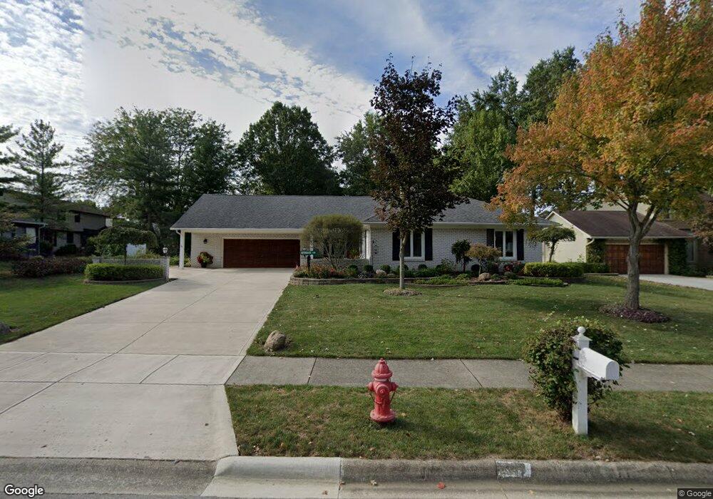
1367 Nutmeg Ct Westerville, OH 43081
Estimated Value: $486,000 - $509,000
4
Beds
3
Baths
2,076
Sq Ft
$240/Sq Ft
Est. Value
About This Home
This home is located at 1367 Nutmeg Ct, Westerville, OH 43081 and is currently estimated at $497,877, approximately $239 per square foot. 1367 Nutmeg Ct is a home located in Franklin County with nearby schools including Mcvay Elementary School, Walnut Springs Middle School, and Westerville-North High School.
Ownership History
Date
Name
Owned For
Owner Type
Purchase Details
Closed on
Aug 14, 2014
Sold by
Mcafee William S and Mcafee Melinda R
Bought by
The Faye A Rothhaar Living Trust
Current Estimated Value
Purchase Details
Closed on
Mar 29, 2001
Sold by
Clellen Mable M
Bought by
Mcafee William S and Mcafee Melinda R
Home Financials for this Owner
Home Financials are based on the most recent Mortgage that was taken out on this home.
Original Mortgage
$229,950
Interest Rate
7.05%
Purchase Details
Closed on
Aug 1, 1978
Create a Home Valuation Report for This Property
The Home Valuation Report is an in-depth analysis detailing your home's value as well as a comparison with similar homes in the area
Home Values in the Area
Average Home Value in this Area
Purchase History
| Date | Buyer | Sale Price | Title Company |
|---|---|---|---|
| The Faye A Rothhaar Living Trust | $225,000 | Talon Title | |
| Mcafee William S | $255,500 | Chicago Title West | |
| -- | $18,500 | -- |
Source: Public Records
Mortgage History
| Date | Status | Borrower | Loan Amount |
|---|---|---|---|
| Previous Owner | Mcafee William S | $229,950 |
Source: Public Records
Tax History Compared to Growth
Tax History
| Year | Tax Paid | Tax Assessment Tax Assessment Total Assessment is a certain percentage of the fair market value that is determined by local assessors to be the total taxable value of land and additions on the property. | Land | Improvement |
|---|---|---|---|---|
| 2024 | $8,386 | $157,360 | $33,250 | $124,110 |
| 2023 | $8,243 | $157,360 | $33,250 | $124,110 |
| 2022 | $7,632 | $113,510 | $21,000 | $92,510 |
| 2021 | $7,696 | $113,510 | $21,000 | $92,510 |
| 2020 | $7,674 | $113,510 | $21,000 | $92,510 |
| 2019 | $6,633 | $94,220 | $17,500 | $76,720 |
| 2018 | $5,838 | $94,220 | $17,500 | $76,720 |
| 2017 | $6,523 | $94,220 | $17,500 | $76,720 |
| 2016 | $5,341 | $72,460 | $25,380 | $47,080 |
| 2015 | $5,173 | $72,460 | $25,380 | $47,080 |
| 2014 | $5,888 | $72,460 | $25,380 | $47,080 |
| 2013 | $3,195 | $78,750 | $24,150 | $54,600 |
Source: Public Records
Map
Nearby Homes
- 1368 Nutmeg Ct
- 1146 Forest Rise Dr
- 1209 Chatham Ridge Rd
- 613 Valley Wood Ct
- 969 Farrington Dr
- 750 Autumn Branch Rd
- 1201 Wallean Dr
- 737 Autumn Branch Rd
- 1260 Autumn Park Ct
- 994 Autumn Lake Ct
- 90 Spring Creek Dr
- 73 Keethler Dr S
- 640 Brook Run Dr
- 800 S Spring Rd
- 192 Buckeye Ct
- 371 Delaware Dr
- 461 Delaware Ct
- 768 Collingwood Dr
- 6452 Rockhold Dr
- 203 N Hempstead Rd
- 1359 Nutmeg Ct
- 1377 Nutmeg Ct
- 337 Tallowwood Dr
- 1196 Smoke Burr Dr
- 1188 Smoke Burr Dr
- 345 Tallowwood Dr
- 1349 Nutmeg Ct
- 311 Tallowwood Dr
- 1180 Smoke Burr Dr
- 353 Tallowwood Dr
- 1352 Nutmeg Ct
- 332 Tallowwood Dr
- 1360 Nutmeg Ct
- 322 Tallowwood Dr
- 297 Tallowwood Dr
- 340 Tallowwood Dr
- 468 Buckhorn Ct
- 312 Tallowwood Dr
- 1172 Smoke Burr Dr
- 462 Buckhorn Ct