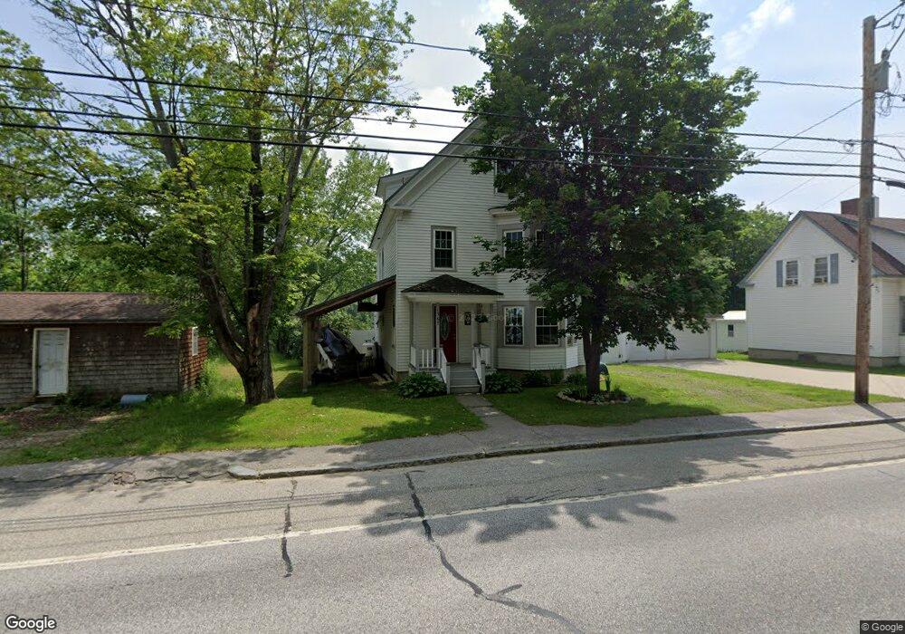
1367 Route 2 Rumford, ME 04276
Estimated Value: $223,000 - $271,000
4
Beds
2
Baths
1,875
Sq Ft
$134/Sq Ft
Est. Value
About This Home
This home is located at 1367 Route 2, Rumford, ME 04276 and is currently estimated at $251,934, approximately $134 per square foot. 1367 Route 2 is a home located in Oxford County with nearby schools including Rumford Elementary School, Meroby Elementary School, and Mountain Valley Middle School.
Create a Home Valuation Report for This Property
The Home Valuation Report is an in-depth analysis detailing your home's value as well as a comparison with similar homes in the area
Home Values in the Area
Average Home Value in this Area
Tax History Compared to Growth
Tax History
| Year | Tax Paid | Tax Assessment Tax Assessment Total Assessment is a certain percentage of the fair market value that is determined by local assessors to be the total taxable value of land and additions on the property. | Land | Improvement |
|---|---|---|---|---|
| 2024 | $3,025 | $182,000 | $17,700 | $164,300 |
| 2023 | $2,888 | $130,200 | $12,600 | $117,600 |
| 2022 | $2,888 | $130,200 | $12,600 | $117,600 |
| 2021 | $2,923 | $130,200 | $12,600 | $117,600 |
| 2020 | $2,943 | $130,200 | $12,600 | $117,600 |
| 2019 | $1,504 | $49,299 | $4,300 | $44,999 |
| 2018 | $1,412 | $47,452 | $4,300 | $43,152 |
| 2017 | $1,369 | $47,452 | $4,300 | $43,152 |
| 2016 | $1,329 | $47,452 | $4,300 | $43,152 |
| 2015 | $1,303 | $47,452 | $4,300 | $43,152 |
| 2014 | $1,279 | $47,452 | $4,300 | $43,152 |
Source: Public Records
Map
Nearby Homes
- 1359 Route 2
- 1019 U S Highway 2
- 1318 U S 2
- 17 Blackberry Ln
- Map 240 Lot 1 Map 239 Lot 4
- 1257 Route 2 Unit 1-5
- 1257 Route 2 Unit 23
- 018 Bear Ln
- 019 upper Bear Ln
- 019 lower Bear Ln
- 19 Bear Ln
- 18 Bear Ln
- 509 Blackberry Ln
- Lot 17 S Rumford Rd
- Map 402 Lot 8 Rd
- 19 Hawk Ln
- 159 Martin Rd
- 003 Western View Ln
- Lot 18-1 Isthmus Rd
- 0 Swain Rd