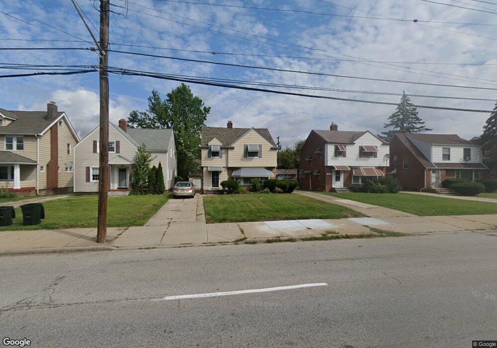
13673 Cedar Rd University Heights, OH 44118
Estimated Value: $179,124 - $197,000
3
Beds
2
Baths
1,441
Sq Ft
$133/Sq Ft
Est. Value
About This Home
This home is located at 13673 Cedar Rd, University Heights, OH 44118 and is currently estimated at $191,531, approximately $132 per square foot. 13673 Cedar Rd is a home located in Cuyahoga County with nearby schools including Canterbury Elementary School, Roxboro Middle School, and Cleveland Heights High School.
Ownership History
Date
Name
Owned For
Owner Type
Purchase Details
Closed on
Sep 30, 1994
Sold by
Freireich Zoltan
Bought by
Hammond Christine M
Current Estimated Value
Home Financials for this Owner
Home Financials are based on the most recent Mortgage that was taken out on this home.
Original Mortgage
$60,750
Interest Rate
8.6%
Mortgage Type
New Conventional
Purchase Details
Closed on
Jul 11, 1983
Sold by
Freireich Zoltan and Freireich Eva
Bought by
Zoltan Freireich
Purchase Details
Closed on
Jan 1, 1975
Bought by
Freireich Zoltan and Freireich Eva
Create a Home Valuation Report for This Property
The Home Valuation Report is an in-depth analysis detailing your home's value as well as a comparison with similar homes in the area
Home Values in the Area
Average Home Value in this Area
Purchase History
| Date | Buyer | Sale Price | Title Company |
|---|---|---|---|
| Hammond Christine M | $67,500 | -- | |
| Zoltan Freireich | -- | -- | |
| Freireich Zoltan | -- | -- |
Source: Public Records
Mortgage History
| Date | Status | Borrower | Loan Amount |
|---|---|---|---|
| Previous Owner | Hammond Christine M | $60,750 |
Source: Public Records
Tax History Compared to Growth
Tax History
| Year | Tax Paid | Tax Assessment Tax Assessment Total Assessment is a certain percentage of the fair market value that is determined by local assessors to be the total taxable value of land and additions on the property. | Land | Improvement |
|---|---|---|---|---|
| 2024 | $4,424 | $60,760 | $9,870 | $50,890 |
| 2023 | $3,584 | $41,240 | $7,880 | $33,360 |
| 2022 | $3,611 | $41,230 | $7,875 | $33,355 |
| 2021 | $3,540 | $41,230 | $7,880 | $33,360 |
| 2020 | $3,388 | $36,820 | $7,040 | $29,790 |
| 2019 | $3,206 | $105,200 | $20,100 | $85,100 |
| 2018 | $3,629 | $36,820 | $7,040 | $29,790 |
| 2017 | $3,298 | $35,640 | $5,570 | $30,070 |
| 2016 | $4,270 | $35,640 | $5,570 | $30,070 |
| 2015 | $3,970 | $35,640 | $5,570 | $30,070 |
| 2014 | $3,970 | $34,930 | $5,460 | $29,470 |
Source: Public Records
Map
Nearby Homes
- 13605 Cedar Rd
- 3621 Cedarbrook Rd
- 2208 Cranston Rd
- 2216 Barrington Rd
- 3554 Raymont Blvd
- 3631 Cummings Rd
- 13785 Cedar Rd Unit 302
- 3526 Raymont Blvd
- 3525 Raymont Blvd
- 13526 Cedar Rd
- 2244 Edgerton Rd
- 3730 E Antisdale Rd
- 3790 Bushnell Rd
- 3742 E Antisdale Rd
- 3575 Grosvenor Rd
- 3809 Warrendale Rd
- 3649 Antisdale Ave
- 3494 Raymont Blvd
- 3733 E Antisdale Rd
- 3798 Grosvenor Rd
- 13669 Cedar Rd
- 13665 Cedar Rd
- 13681 Cedar Rd
- 3678 Washington Blvd
- 13661 Cedar Rd
- 3670 Washington Blvd
- 13687 Cedar Rd
- 3682 Washington Blvd
- 3666 Washington Blvd
- 3686 Washington Blvd
- 13657 Cedar Rd
- 13693 Cedar Rd
- 3662 Raymont Blvd
- 3690 Washington Blvd
- 3662 Washington Blvd
- 13670 Cedar Rd
- 3658 Raymont Blvd
- 13682 Cedar Rd
- 13660 Cedar Rd
- 3694 Washington Blvd