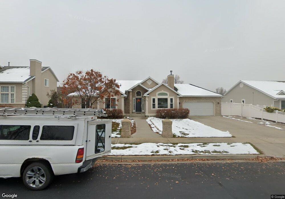
1368 N 1020 E American Fork, UT 84003
Estimated Value: $600,000 - $681,000
5
Beds
4
Baths
3,214
Sq Ft
$201/Sq Ft
Est. Value
About This Home
This home is located at 1368 N 1020 E, American Fork, UT 84003 and is currently estimated at $645,012, approximately $200 per square foot. 1368 N 1020 E is a home located in Utah County with nearby schools including Deerfield Elementary School, Mountain Ridge Junior High School, and American Fork High School.
Ownership History
Date
Name
Owned For
Owner Type
Purchase Details
Closed on
Jan 21, 2022
Sold by
Peter Burnett
Bought by
Burnett Oic Trust
Current Estimated Value
Purchase Details
Closed on
Aug 31, 2010
Sold by
Simpson Mark D and Simpson Heidi K
Bought by
Burnett Peter and Burnett Rebecca
Home Financials for this Owner
Home Financials are based on the most recent Mortgage that was taken out on this home.
Original Mortgage
$150,000
Interest Rate
4.45%
Mortgage Type
New Conventional
Purchase Details
Closed on
Oct 2, 2002
Sold by
Bank One Na
Bought by
Simpson Mark D and Simpson Heidi K
Home Financials for this Owner
Home Financials are based on the most recent Mortgage that was taken out on this home.
Original Mortgage
$206,045
Interest Rate
6.22%
Mortgage Type
VA
Purchase Details
Closed on
Aug 8, 2002
Sold by
Lebaron Jeffrey L and Lebaron Susan E
Bought by
Bank One Na
Home Financials for this Owner
Home Financials are based on the most recent Mortgage that was taken out on this home.
Original Mortgage
$206,045
Interest Rate
6.22%
Mortgage Type
VA
Create a Home Valuation Report for This Property
The Home Valuation Report is an in-depth analysis detailing your home's value as well as a comparison with similar homes in the area
Home Values in the Area
Average Home Value in this Area
Purchase History
| Date | Buyer | Sale Price | Title Company |
|---|---|---|---|
| Burnett Oic Trust | -- | Prp Law Pllc | |
| Burnett Peter | -- | Eagle Pointe Title Insuranc | |
| Simpson Mark D | -- | Bonneville Title | |
| Bank One Na | $175,100 | First American Title Co |
Source: Public Records
Mortgage History
| Date | Status | Borrower | Loan Amount |
|---|---|---|---|
| Previous Owner | Burnett Peter | $150,000 | |
| Previous Owner | Simpson Mark D | $206,045 |
Source: Public Records
Tax History
| Year | Tax Paid | Tax Assessment Tax Assessment Total Assessment is a certain percentage of the fair market value that is determined by local assessors to be the total taxable value of land and additions on the property. | Land | Improvement |
|---|---|---|---|---|
| 2025 | $2,641 | $312,510 | -- | -- |
| 2024 | $2,641 | $293,425 | $0 | $0 |
| 2023 | $2,473 | $291,335 | $0 | $0 |
| 2022 | $2,615 | $304,040 | $0 | $0 |
| 2021 | $2,299 | $417,400 | $164,200 | $253,200 |
| 2020 | $2,232 | $393,100 | $152,000 | $241,100 |
| 2019 | $2,069 | $376,800 | $141,400 | $235,400 |
| 2018 | $2,123 | $369,800 | $134,400 | $235,400 |
| 2017 | $2,122 | $199,485 | $0 | $0 |
| 2016 | $1,935 | $168,960 | $0 | $0 |
| 2015 | $1,858 | $154,000 | $0 | $0 |
| 2014 | $1,701 | $139,095 | $0 | $0 |
Source: Public Records
Map
Nearby Homes
- 9587 N 4500 W
- 9617 N 4500 W
- 4675 W Ferguson Way
- 1125 N 1270 E
- 1089 N 950 E
- 1077 N 950 E
- 4552 W Windsor Cir
- 1058 N 930 E Unit 64
- 4531 W Cambridge Dr
- 9752 N Dorchester Dr
- 1045 N 930 E Unit 58
- 4979 W Willowbank Dr
- 4968 W Evergreen Ln
- 5061 W Evergreen Ln
- 5034 W Green Ash Ln
- 5042 W Green Ash Ln
- 4998 W Green Ash Ln
- 4992 W Green Ash Ln
- 5056 W Green Ash Ln
- 1793 E Kern Mountain
Your Personal Tour Guide
Ask me questions while you tour the home.