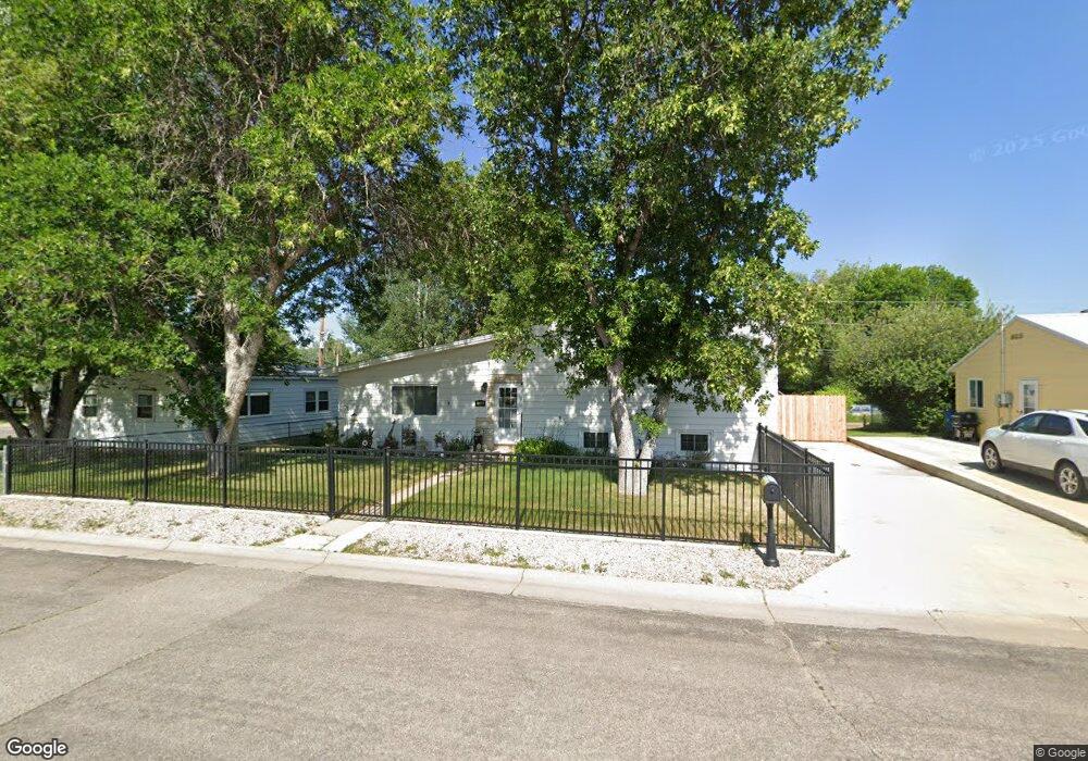
1369 Holloway Ave Sheridan, WY 82801
Estimated Value: $314,000 - $345,000
4
Beds
2
Baths
1,129
Sq Ft
$292/Sq Ft
Est. Value
About This Home
This home is located at 1369 Holloway Ave, Sheridan, WY 82801 and is currently estimated at $329,704, approximately $292 per square foot. 1369 Holloway Ave is a home with nearby schools including Sheridan High School and Martin Luther Grammar School.
Ownership History
Date
Name
Owned For
Owner Type
Purchase Details
Closed on
Sep 24, 2008
Sold by
Livingston Jamie E
Bought by
Livingston Jamie E and Livingston Cindy L
Current Estimated Value
Create a Home Valuation Report for This Property
The Home Valuation Report is an in-depth analysis detailing your home's value as well as a comparison with similar homes in the area
Home Values in the Area
Average Home Value in this Area
Purchase History
| Date | Buyer | Sale Price | Title Company |
|---|---|---|---|
| Livingston Jamie E | -- | None Available |
Source: Public Records
Tax History Compared to Growth
Tax History
| Year | Tax Paid | Tax Assessment Tax Assessment Total Assessment is a certain percentage of the fair market value that is determined by local assessors to be the total taxable value of land and additions on the property. | Land | Improvement |
|---|---|---|---|---|
| 2025 | $1,874 | $13,496 | $2,937 | $10,559 |
| 2024 | $1,874 | $26,210 | $5,874 | $20,336 |
| 2023 | $1,845 | $25,810 | $5,874 | $19,936 |
| 2022 | $1,682 | $23,525 | $5,669 | $17,856 |
| 2021 | $1,512 | $21,153 | $5,655 | $15,498 |
| 2020 | $1,338 | $18,715 | $4,676 | $14,039 |
| 2019 | $1,302 | $18,210 | $4,486 | $13,724 |
| 2018 | $1,183 | $16,550 | $3,806 | $12,744 |
| 2017 | $1,173 | $16,405 | $3,806 | $12,599 |
| 2015 | $1,120 | $15,667 | $3,331 | $12,336 |
| 2014 | $1,100 | $15,387 | $2,842 | $12,545 |
| 2013 | -- | $15,661 | $2,842 | $12,819 |
Source: Public Records
Map
Nearby Homes
- 1430 Omarr Ave
- 1613 Taylor Ave
- 1629 Taylor Ave
- 1507 Omarr Ave
- 505 W 8th St
- 1349 Dana Ave
- 1335 Highland Ave
- 1615 Holmes Ave
- 1405 Ridgeway Ave
- 430 W 11th St
- 426 W 11th St
- 0 N Heights Dr
- 945 Bellevue Ave
- 1134 W 15th St
- 216 W 7th St
- 1805 Kennedy St
- 1290 Burton St Unit D
- 1301 Avon St Unit B
- 148 W 5th St
- 1030 N Main St Unit 110
- 1379 Holloway Ave
- 844 W 10th St
- 1357 Holloway Ave
- 1340 Bowman Ave
- 810 W 10th St
- 1351 Holloway Ave
- 1330 Bowman Ave
- 1345 Holloway Ave
- 1384 Holloway Ave
- 1396 Holloway Ave
- 1404 Bowman Ave
- 910 W 10th St
- 1308 Bowman Ave
- 1368 Holloway Ave
- 1337 Holloway Ave
- 1419 Holloway Ave
- 1343 Bowman Ave
- 1323 Bowman Ave
- 1331 Holloway Ave
- 1360 Holloway Ave