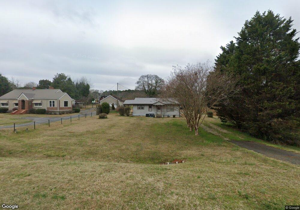
1369 Hull Rd Athens, GA 30601
Estimated Value: $183,493 - $232,000
2
Beds
1
Bath
864
Sq Ft
$250/Sq Ft
Est. Value
About This Home
This home is located at 1369 Hull Rd, Athens, GA 30601 and is currently estimated at $216,373, approximately $250 per square foot. 1369 Hull Rd is a home located in Clarke County with nearby schools including Judia Jackson Harris Elementary School, Coile Middle School, and Cedar Shoals High School.
Ownership History
Date
Name
Owned For
Owner Type
Purchase Details
Closed on
May 17, 2021
Sold by
Clack Larry G
Bought by
Clack Larry G and Ledbetter Anthony W
Current Estimated Value
Home Financials for this Owner
Home Financials are based on the most recent Mortgage that was taken out on this home.
Original Mortgage
$71,500
Outstanding Balance
$64,659
Interest Rate
3.1%
Mortgage Type
New Conventional
Estimated Equity
$151,714
Purchase Details
Closed on
Aug 11, 2006
Sold by
Not Provided
Bought by
Clack Larry G
Home Financials for this Owner
Home Financials are based on the most recent Mortgage that was taken out on this home.
Original Mortgage
$77,100
Interest Rate
6.67%
Mortgage Type
New Conventional
Purchase Details
Closed on
Apr 27, 1999
Sold by
Thompson William D and Mary Strickland
Bought by
Teaster Properties Llc
Purchase Details
Closed on
Dec 15, 1990
Sold by
Thompson Henrietta Mrs
Bought by
Thompson William D
Create a Home Valuation Report for This Property
The Home Valuation Report is an in-depth analysis detailing your home's value as well as a comparison with similar homes in the area
Home Values in the Area
Average Home Value in this Area
Purchase History
| Date | Buyer | Sale Price | Title Company |
|---|---|---|---|
| Clack Larry G | -- | -- | |
| Clack Larry G | $77,100 | -- | |
| Teaster Properties Llc | $43,000 | -- | |
| Thompson William D | -- | -- |
Source: Public Records
Mortgage History
| Date | Status | Borrower | Loan Amount |
|---|---|---|---|
| Open | Clack Larry G | $71,500 | |
| Previous Owner | Clack Larry G | $77,100 |
Source: Public Records
Tax History Compared to Growth
Tax History
| Year | Tax Paid | Tax Assessment Tax Assessment Total Assessment is a certain percentage of the fair market value that is determined by local assessors to be the total taxable value of land and additions on the property. | Land | Improvement |
|---|---|---|---|---|
| 2025 | $463 | $47,024 | $12,000 | $35,024 |
| 2024 | $463 | $40,538 | $12,000 | $28,538 |
| 2023 | $466 | $37,782 | $12,000 | $25,782 |
| 2022 | $602 | $35,121 | $12,000 | $23,121 |
| 2021 | $543 | $28,422 | $10,800 | $17,622 |
| 2020 | $517 | $26,531 | $10,800 | $15,731 |
| 2019 | $506 | $25,485 | $10,800 | $14,685 |
| 2018 | $467 | $23,749 | $10,800 | $12,949 |
| 2017 | $476 | $24,027 | $10,800 | $13,227 |
| 2016 | $489 | $24,399 | $10,800 | $13,599 |
| 2015 | $494 | $24,586 | $10,800 | $13,786 |
| 2014 | $487 | $24,334 | $10,800 | $13,534 |
Source: Public Records
Map
Nearby Homes
- 1309 Hull Rd
- 300 Harve Mathis Rd
- 0 Virginia Ln Unit Lot 15 CL336098
- 0 Virginia Ln Unit LOT 15 10579204
- 540 & 542 Harve Mathis Rd
- 336 Old Pittard Rd
- 1226 Hull Rd
- 838 Virginia Ln
- 0 Woodland Creek Place Unit 10421130
- 525 Virginia Ln
- 0 Spratlin Mill Rd Unit 1025918
- 0 Spratlin Mill Rd Unit 10526335
- 181 Bedford Dr
- 481 Bedford Dr
- 685 Bedford Dr
- 136 Wellington Dr
- 151 Rolling Woods Ln
- 1329 Spratlin Mill Dr