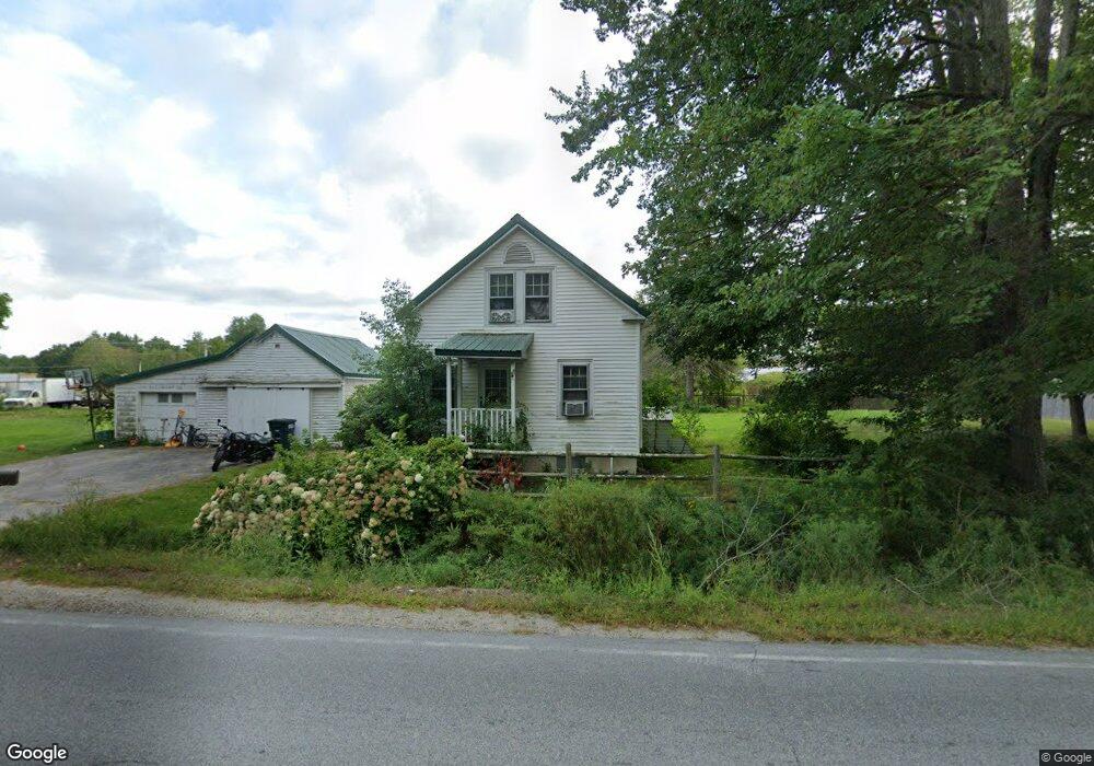
1369 Long Plains Rd Buxton, ME 04093
Estimated Value: $318,159 - $417,000
3
Beds
2
Baths
962
Sq Ft
$381/Sq Ft
Est. Value
About This Home
This home is located at 1369 Long Plains Rd, Buxton, ME 04093 and is currently estimated at $366,540, approximately $381 per square foot. 1369 Long Plains Rd is a home located in York County with nearby schools including Bonny Eagle High School.
Ownership History
Date
Name
Owned For
Owner Type
Purchase Details
Closed on
May 15, 2008
Sold by
Longhorn Ent Inc
Bought by
C & R Farms Llc
Current Estimated Value
Home Financials for this Owner
Home Financials are based on the most recent Mortgage that was taken out on this home.
Original Mortgage
$300,000
Outstanding Balance
$186,024
Interest Rate
5.91%
Mortgage Type
Purchase Money Mortgage
Estimated Equity
$180,516
Create a Home Valuation Report for This Property
The Home Valuation Report is an in-depth analysis detailing your home's value as well as a comparison with similar homes in the area
Home Values in the Area
Average Home Value in this Area
Purchase History
| Date | Buyer | Sale Price | Title Company |
|---|---|---|---|
| C & R Farms Llc | -- | -- |
Source: Public Records
Mortgage History
| Date | Status | Borrower | Loan Amount |
|---|---|---|---|
| Open | C & R Farms Llc | $300,000 |
Source: Public Records
Tax History
| Year | Tax Paid | Tax Assessment Tax Assessment Total Assessment is a certain percentage of the fair market value that is determined by local assessors to be the total taxable value of land and additions on the property. | Land | Improvement |
|---|---|---|---|---|
| 2025 | $2,637 | $231,300 | $100,000 | $131,300 |
| 2024 | $2,542 | $231,300 | $100,000 | $131,300 |
| 2023 | $2,412 | $231,300 | $100,000 | $131,300 |
| 2022 | $2,371 | $231,500 | $100,000 | $131,500 |
| 2021 | $2,076 | $143,556 | $60,800 | $82,756 |
| 2020 | $2,093 | $143,556 | $60,800 | $82,756 |
| 2019 | $1,940 | $130,900 | $60,800 | $70,100 |
| 2018 | $1,851 | $130,900 | $60,800 | $70,100 |
| 2017 | $4,062 | $130,900 | $60,800 | $70,100 |
| 2016 | $1,708 | $130,900 | $60,800 | $70,100 |
| 2015 | $1,695 | $130,900 | $60,800 | $70,100 |
| 2014 | $1,662 | $130,900 | $60,800 | $70,100 |
| 2013 | $1,636 | $130,900 | $60,800 | $70,100 |
Source: Public Records
Map
Nearby Homes
- 1306 Long Plains Rd
- 9 Johnson Farm Rd
- 0 Waterman
- 82 Carll Rd
- 207 Dunnell Rd
- 430 Narragansett Trail
- 00 Deering Dr
- 00 Miso Way
- 48 Tickle Way
- 14 David Dr
- 222 Main St
- 12 David Dr
- 18 Eaton Dr
- 281 Narragansett Trail
- 83 Main St
- 69 Old Orchard Rd
- 177 Old Orchard Rd
- 3 S Branch Dr
- 19 Depot St
- 3 Trapper John Rd
- 16 Pierce Dr
- 1360 Long Plains Rd
- 1380 Long Plains Rd
- 1355 Long Plains Rd
- 1354 Long Plains Rd
- 1348 Long Plains Rd
- 1393 Long Plains Rd
- 760 Narragansett Trail
- 728 Narragansett Trail
- 780 Narragansett Trail
- 757 Narragansett Trail
- 751 Narragansett Trail
- 761 Narragansett Trail
- 739 Narragansett Trail
- 771 Narragansett Trail
- 1411 Long Plains Rd
- 1341 Long Plains Rd
- 1331 Long Plains Rd
- 723 Narragansett Trail
- 1322 Long Plains Rd
Your Personal Tour Guide
Ask me questions while you tour the home.