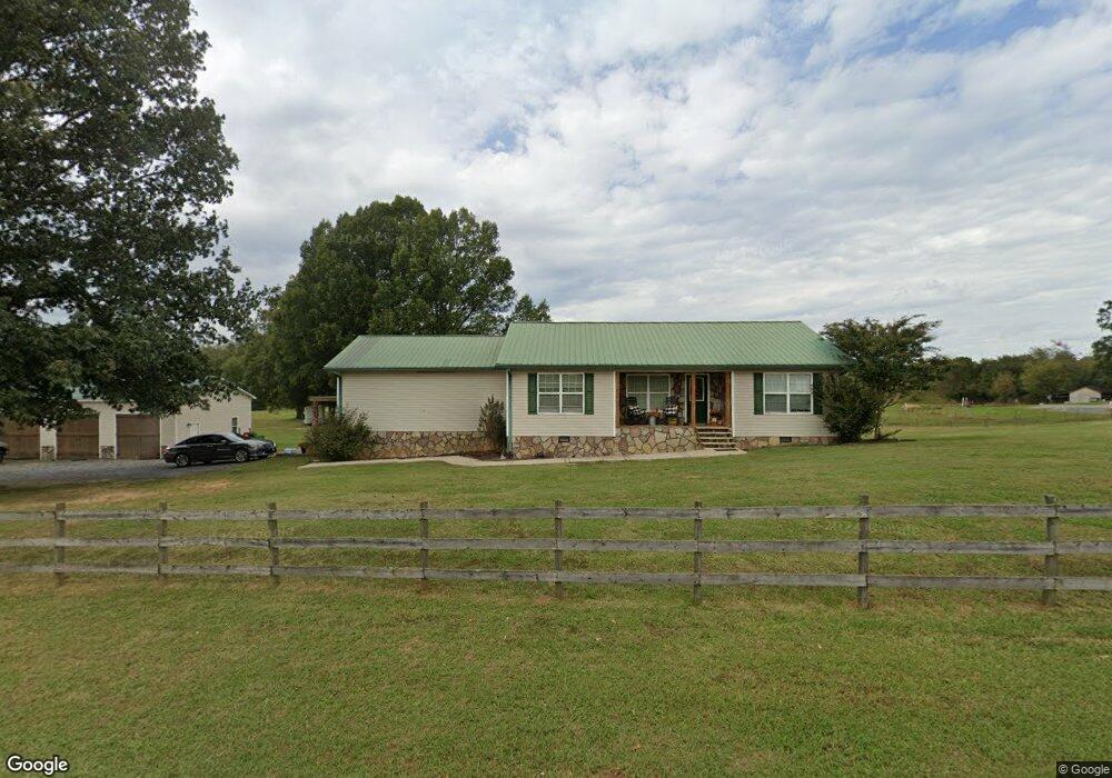
1369 Shields Rd Crandall, GA 30711
Cisco NeighborhoodEstimated Value: $258,000 - $325,000
3
Beds
2
Baths
1,312
Sq Ft
$220/Sq Ft
Est. Value
About This Home
This home is located at 1369 Shields Rd, Crandall, GA 30711 and is currently estimated at $288,688, approximately $220 per square foot. 1369 Shields Rd is a home located in Murray County with nearby schools including Northwest Elementary School, Bagley Middle School, and North Murray High School.
Ownership History
Date
Name
Owned For
Owner Type
Purchase Details
Closed on
Dec 7, 2005
Sold by
Saylor Justin Chad
Bought by
Barnes Michael J and Barnes Hollie M
Current Estimated Value
Home Financials for this Owner
Home Financials are based on the most recent Mortgage that was taken out on this home.
Original Mortgage
$131,929
Outstanding Balance
$73,815
Interest Rate
6.29%
Mortgage Type
FHA
Estimated Equity
$214,873
Purchase Details
Closed on
Sep 27, 2004
Sold by
Saylor Justin Chad and Saylor Brittany
Bought by
Saylor Justin Chad and Saylor Brittany
Purchase Details
Closed on
Jan 30, 2004
Sold by
Hartman James D
Bought by
Saylor Justin Chad and Brittany Colli
Purchase Details
Closed on
Jul 23, 2001
Sold by
Weaver Edward L Est
Bought by
Hartman James D
Create a Home Valuation Report for This Property
The Home Valuation Report is an in-depth analysis detailing your home's value as well as a comparison with similar homes in the area
Home Values in the Area
Average Home Value in this Area
Purchase History
| Date | Buyer | Sale Price | Title Company |
|---|---|---|---|
| Barnes Michael J | $134,000 | -- | |
| Saylor Justin Chad | -- | -- | |
| Saylor Justin Chad | $24,500 | -- | |
| Hartman James D | $19,300 | -- |
Source: Public Records
Mortgage History
| Date | Status | Borrower | Loan Amount |
|---|---|---|---|
| Open | Barnes Michael J | $131,929 |
Source: Public Records
Tax History Compared to Growth
Tax History
| Year | Tax Paid | Tax Assessment Tax Assessment Total Assessment is a certain percentage of the fair market value that is determined by local assessors to be the total taxable value of land and additions on the property. | Land | Improvement |
|---|---|---|---|---|
| 2024 | $1,217 | $104,600 | $14,280 | $90,320 |
| 2023 | $1,206 | $98,000 | $14,280 | $83,720 |
| 2022 | $1,205 | $80,600 | $13,600 | $67,000 |
| 2021 | $1,236 | $68,400 | $13,600 | $54,800 |
| 2020 | $1,236 | $60,560 | $12,960 | $47,600 |
| 2019 | $1,241 | $58,560 | $12,960 | $45,600 |
| 2018 | $1,175 | $51,440 | $8,400 | $43,040 |
| 2017 | $0 | $44,840 | $8,400 | $36,440 |
| 2016 | $935 | $43,200 | $10,640 | $32,560 |
| 2015 | -- | $43,200 | $10,640 | $32,560 |
| 2014 | -- | $43,200 | $10,640 | $32,560 |
| 2013 | -- | $43,200 | $10,640 | $32,560 |
Source: Public Records
Map
Nearby Homes
- 0 Doctor Johnson Rd
- 396 Doctor Johnson Rd
- 1639 Tennga Gregory Rd
- 000 Liberty Church Rd
- 1339 Richard Bennett Rd
- 1141 Brush Town Rd
- 6801 Spring Place Rd SE
- 44 Brush Town Rd
- 910 Brushtown Rd
- 332 Harris Rd SE
- 19 Highway 411
- 10104 Georgia 225 Unit 4
- 137.6 Acre Melton Rd SE
- 2499 Sugar Creek Rd
- Landlot 19 Highway 411
- 00 Ball Play Rd
- 5694 Ladd Springs Rd
- 247 Ac Maddron Rd
- 242 AC Maddron Rd
- 205+ Ac Maddron Rd
- 1459 Shields Rd
- 475 Booger Branch Spur
- 1653 Shields Rd
- 00 Shields Rd
- 1065 Shields Rd
- 880 Shields Rd
- 556 Booger Branch Spur
- 0 Booger Branch Spur Unit 9642 8073888
- 763 Shields Rd
- 1879 Shields Rd
- 1961 Shields Rd
- 2021 Shields Rd
- 275 Booger Branch Rd
- 800 Shields Rd
- 1924 Shields Rd
- 242 Booger Branch Rd
- 244 Booger Branch Rd
- 387 Booger Branch Rd
- 14023 Highway 411 N
- 695 Booger Branch Rd