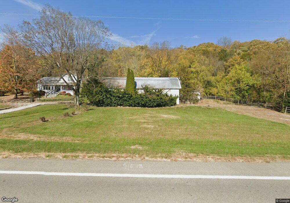
1369 Us Highway 52 Georgetown, OH 45121
Estimated Value: $188,000 - $448,000
2
Beds
2
Baths
1,308
Sq Ft
$231/Sq Ft
Est. Value
About This Home
This home is located at 1369 Us Highway 52, Georgetown, OH 45121 and is currently estimated at $302,477, approximately $231 per square foot. 1369 Us Highway 52 is a home located in Brown County with nearby schools including Ripley Union Lewis Huntington Elementary School, Ripley Union Lewis Huntington Middle School, and Ripley-Union-Lewis-Huntington High School.
Ownership History
Date
Name
Owned For
Owner Type
Purchase Details
Closed on
Jul 11, 2008
Sold by
Huffman Judith M and Huffman Calvin A
Bought by
Garrison Steven and Garrison Cynthia
Current Estimated Value
Home Financials for this Owner
Home Financials are based on the most recent Mortgage that was taken out on this home.
Original Mortgage
$133,600
Outstanding Balance
$86,538
Interest Rate
6.15%
Mortgage Type
Unknown
Estimated Equity
$215,939
Purchase Details
Closed on
May 22, 2006
Sold by
Shepherd Lee R and Shepherd Sue C
Bought by
Huffman Judith M
Home Financials for this Owner
Home Financials are based on the most recent Mortgage that was taken out on this home.
Original Mortgage
$116,000
Interest Rate
6.62%
Mortgage Type
Balloon
Create a Home Valuation Report for This Property
The Home Valuation Report is an in-depth analysis detailing your home's value as well as a comparison with similar homes in the area
Home Values in the Area
Average Home Value in this Area
Purchase History
| Date | Buyer | Sale Price | Title Company |
|---|---|---|---|
| Garrison Steven | $167,000 | Titlequest Agency Inc | |
| Huffman Judith M | $311,666 | None Available |
Source: Public Records
Mortgage History
| Date | Status | Borrower | Loan Amount |
|---|---|---|---|
| Open | Garrison Steven | $133,600 | |
| Previous Owner | Huffman Judith M | $116,000 |
Source: Public Records
Tax History Compared to Growth
Tax History
| Year | Tax Paid | Tax Assessment Tax Assessment Total Assessment is a certain percentage of the fair market value that is determined by local assessors to be the total taxable value of land and additions on the property. | Land | Improvement |
|---|---|---|---|---|
| 2024 | $2,258 | $72,570 | $17,930 | $54,640 |
| 2023 | $2,258 | $49,380 | $12,080 | $37,300 |
| 2022 | $1,734 | $49,380 | $12,080 | $37,300 |
| 2021 | $1,618 | $49,380 | $12,080 | $37,300 |
| 2020 | $1,492 | $42,940 | $10,500 | $32,440 |
| 2019 | $1,481 | $42,940 | $10,500 | $32,440 |
| 2018 | $734 | $42,940 | $10,500 | $32,440 |
| 2017 | $1,362 | $39,320 | $11,550 | $27,770 |
| 2016 | $1,337 | $39,320 | $11,550 | $27,770 |
| 2015 | $1,384 | $39,320 | $11,550 | $27,770 |
| 2014 | $1,384 | $38,270 | $10,500 | $27,770 |
| 2013 | $1,284 | $38,270 | $10,500 | $27,770 |
Source: Public Records
Map
Nearby Homes
- 404 E 2nd St
- 207 E 3rd St
- 414 E 2nd St
- 301 Elizabeth St
- 310 E 3rd St
- 305 Bracken St
- 105 E 4th St
- 114 E 4th St
- 401 E 4th St
- 508 E 3rd St
- 307 Hamilton Ave
- Lot 49 Boudes Ferry Rd
- 4900 Mary Ingles Hwy E
- 4465 W Augusta Chatham Rd
- ac Shinkle Ridge Rd
- 1920 Shinkles Ridge
- 5104 Dutch Ridge Rd
- 312 White Oak St
- 106 Center St
- 80 Center St
- 1369 Us Highway 52
- 1348 Us Highway 52
- 1356 Us Highway 52
- 1348 Us Rt 52
- 1275 Us Highway 52 Unit 1A
- 1275 Us Highway 52 Unit 2A
- 1489 Us Highway 52
- 1489 Us Highway 52
- 1513 Us Highway 52
- 1535 Us Highway 52
- 1535 Us Rt 52
- 19 Doe Point
- 18 Doe Point
- 1713 U S Route 52
- 1016 U S Route 52
- 1241 Doe Point Rd
- 5454 Buck Run Rd
- 202 E Riverside Dr
- 104 E Riverside Dr
- 110 E Riverside Dr