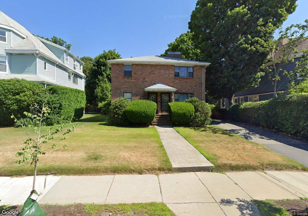
137-139 Crafts St Unit 139 Newton, MA 02460
Nonantum NeighborhoodEstimated Value: $1,359,000 - $2,090,000
3
Beds
1
Bath
1,500
Sq Ft
$1,060/Sq Ft
Est. Value
About This Home
This home is located at 137-139 Crafts St Unit 139, Newton, MA 02460 and is currently estimated at $1,590,429, approximately $1,060 per square foot. 137-139 Crafts St Unit 139 is a home located in Middlesex County with nearby schools including Horace Mann Elementary School, Lincoln-Eliot Elementary School, and F.A. Day Middle School.
Ownership History
Date
Name
Owned For
Owner Type
Purchase Details
Closed on
Sep 19, 2025
Sold by
Bba Developments Llc
Bought by
Mascarenhas Anika and Nazareth David
Current Estimated Value
Purchase Details
Closed on
Sep 10, 2024
Sold by
Louie Ying Wong T and Louie Wong
Bought by
Bba Developments Llc
Home Financials for this Owner
Home Financials are based on the most recent Mortgage that was taken out on this home.
Original Mortgage
$1,875,000
Interest Rate
6.78%
Mortgage Type
Purchase Money Mortgage
Create a Home Valuation Report for This Property
The Home Valuation Report is an in-depth analysis detailing your home's value as well as a comparison with similar homes in the area
Home Values in the Area
Average Home Value in this Area
Purchase History
| Date | Buyer | Sale Price | Title Company |
|---|---|---|---|
| Mascarenhas Anika | $982,500 | -- | |
| Bba Developments Llc | $1,300,000 | None Available |
Source: Public Records
Mortgage History
| Date | Status | Borrower | Loan Amount |
|---|---|---|---|
| Previous Owner | Bba Developments Llc | $1,875,000 |
Source: Public Records
Tax History Compared to Growth
Tax History
| Year | Tax Paid | Tax Assessment Tax Assessment Total Assessment is a certain percentage of the fair market value that is determined by local assessors to be the total taxable value of land and additions on the property. | Land | Improvement |
|---|---|---|---|---|
| 2025 | $10,069 | $1,027,400 | $651,300 | $376,100 |
| 2024 | $9,736 | $997,500 | $632,300 | $365,200 |
| 2023 | $9,218 | $905,500 | $508,800 | $396,700 |
| 2022 | $8,820 | $838,400 | $471,100 | $367,300 |
| 2021 | $8,277 | $769,200 | $432,200 | $337,000 |
| 2020 | $8,030 | $769,200 | $432,200 | $337,000 |
| 2019 | $7,513 | $718,900 | $403,900 | $315,000 |
| 2018 | $7,498 | $693,000 | $378,800 | $314,200 |
| 2017 | $7,070 | $635,800 | $347,500 | $288,300 |
| 2016 | $6,638 | $583,300 | $318,800 | $264,500 |
| 2015 | $6,329 | $545,100 | $297,900 | $247,200 |
Source: Public Records
Map
Nearby Homes
- 42-44 Judkins St
- 49 Hawthorn St
- 3 Ashmont Ave
- 22-24 Emerald St
- 77 Court St Unit 205
- 11 Murphy Ct
- 168 Walnut St
- 286 Nevada St Unit 286
- 158 Adams St
- 282 Nevada St Unit 282
- 188-190 Adams St
- 53 West St
- 611 Watertown St Unit 14
- 57 Walnut St
- 32-34 Rossmere St
- 34 West St Unit A
- 191 Linwood Ave
- 86 West St
- 354 Linwood Ave Unit 1
- 12-14 Middle St
- 137-139 Crafts St
- 137-139 Crafts St Unit 137
- 137 Crafts St Unit 139
- 139 Crafts St Unit 139
- 141 Crafts St
- 131 Crafts St
- 8 Jenison St
- 147 Crafts St
- 12 Jenison St
- 4 Jenison St
- 55 Lothrop St Unit 55
- 55 Lothrop St Unit 1
- 18 Jenison St
- 42 Judkins St Unit 44
- 52 Judkins St
- 134 Crafts St
- 140 Crafts St Unit 142
- 22 Jenison St Unit B
- 22 Jenison St Unit A
- 22 Jenison St Unit 2