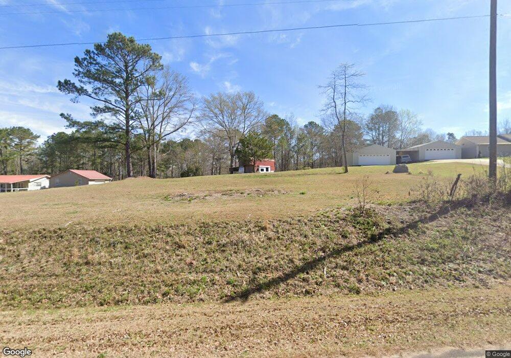
137 Abbottsford Rd Lagrange, GA 30240
Estimated Value: $212,689 - $317,000
3
Beds
2
Baths
1,432
Sq Ft
$181/Sq Ft
Est. Value
About This Home
This home is located at 137 Abbottsford Rd, Lagrange, GA 30240 and is currently estimated at $259,422, approximately $181 per square foot. 137 Abbottsford Rd is a home located in Troup County with nearby schools including Berta Weathersbee Elementary School, Whitesville Road Elementary School, and Long Cane Elementary School.
Ownership History
Date
Name
Owned For
Owner Type
Purchase Details
Closed on
Apr 10, 2003
Sold by
Sammons Dorothy
Bought by
Sammons Clarence J and Sammons Dorothy V
Current Estimated Value
Purchase Details
Closed on
Nov 1, 1988
Sold by
Wm C Pilgrim
Bought by
Sammons Dorothy
Purchase Details
Closed on
Jan 1, 1972
Sold by
Wm C Pilgram
Bought by
Wm C Pilgrim
Create a Home Valuation Report for This Property
The Home Valuation Report is an in-depth analysis detailing your home's value as well as a comparison with similar homes in the area
Purchase History
| Date | Buyer | Sale Price | Title Company |
|---|---|---|---|
| Sammons Clarence J | -- | -- | |
| Sammons Dorothy | -- | -- | |
| Wm C Pilgrim | -- | -- |
Source: Public Records
Tax History
| Year | Tax Paid | Tax Assessment Tax Assessment Total Assessment is a certain percentage of the fair market value that is determined by local assessors to be the total taxable value of land and additions on the property. | Land | Improvement |
|---|---|---|---|---|
| 2025 | $1,649 | $70,432 | $19,880 | $50,552 |
| 2024 | $1,649 | $62,452 | $19,880 | $42,572 |
| 2023 | $1,553 | $58,932 | $19,880 | $39,052 |
| 2022 | $1,533 | $56,932 | $19,880 | $37,052 |
| 2021 | $1,292 | $44,828 | $16,120 | $28,708 |
| 2020 | $1,292 | $44,828 | $16,120 | $28,708 |
| 2019 | $1,346 | $46,628 | $16,120 | $30,508 |
| 2018 | $1,264 | $43,892 | $16,120 | $27,772 |
| 2017 | $1,264 | $43,892 | $16,120 | $27,772 |
| 2016 | $1,268 | $44,024 | $16,144 | $27,880 |
| 2015 | $1,270 | $44,024 | $16,144 | $27,880 |
| 2014 | $1,228 | $42,556 | $16,144 | $26,412 |
| 2013 | -- | $43,768 | $16,144 | $27,624 |
Source: Public Records
Map
Nearby Homes
- 177 Abbottsford Rd
- 511 Williams Rd
- 205 Long Cove Dr
- 108 Stonebridge Ln
- 0 Leisure Cove Dr Unit 10619411
- 15 Williams Ct
- 226 Linda Ln
- 201 Lakeview Ct
- 109 Riverbluff Dr
- 213 Linda Ln
- 114 Riverbluff Dr
- 101 Riverbluff Dr
- 106 Landings Way
- 102 Landings Way
- 104 Landings Way
- 104 Dogwood Point
- 103 Dogwood Ct
- 40 River Point Dr
- 474 Newton Rd
- 104 Hidden Springs Dr
- 115 Abbottsford Rd
- 87 Abbottsford Rd
- 126 Abbottsford Rd
- 220 Abbottsford Rd
- 5525 Roanoke Rd
- 219 Abbottsford Rd
- 5511 Roanoke Rd
- 99 Langford Rd
- 0 Rock Mills Rd Unit 8238263
- 0 Rock Mills Rd Unit 10210170
- 0 Rock Mills Rd Unit 20093958
- 0 Rock Mills Rd Unit 20087468
- 0 Rock Mills Rd Unit 7087985
- 0 Rock Mills Rd Unit 3256281
- 0 Rock Mills Rd Unit 7382192
- 0 Rock Mills Rd Unit 8022563
- 0 Rock Mills Rd Unit 7382191
- 0 Rock Mills Rd Unit 3051002
- 0 Rock Mills Rd Unit 8921908
- 0 Rock Mills Rd Unit 8472149
