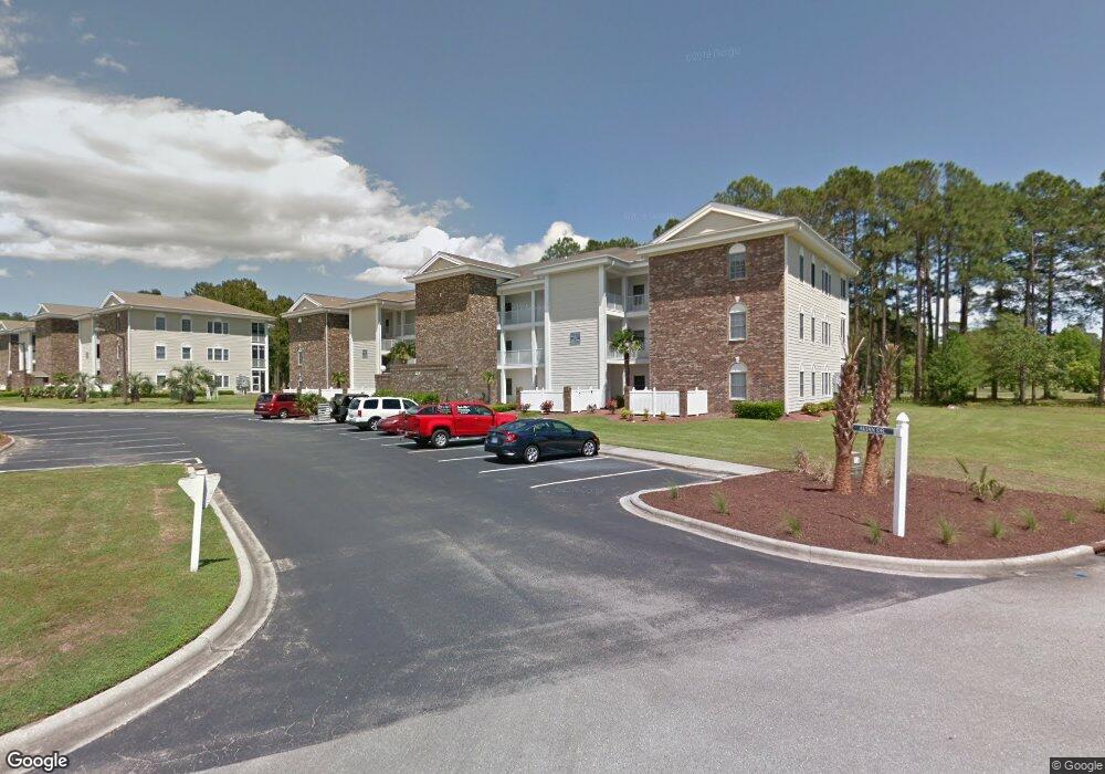
137 Avian Drive #20 Unit 3520 Sunset Beach, NC 28468
Estimated Value: $204,000 - $236,000
1
Bed
1
Bath
801
Sq Ft
$276/Sq Ft
Est. Value
About This Home
This home is located at 137 Avian Drive #20 Unit 3520, Sunset Beach, NC 28468 and is currently estimated at $221,119, approximately $276 per square foot. 137 Avian Drive #20 Unit 3520 is a home located in Brunswick County with nearby schools including Jessie Mae Monroe Elementary School, Shallotte Middle School, and West Brunswick High School.
Ownership History
Date
Name
Owned For
Owner Type
Purchase Details
Closed on
Nov 7, 2024
Sold by
Swashport Partners Llc
Bought by
Hoekstra William E and Hoekstra Mary E
Current Estimated Value
Purchase Details
Closed on
Nov 27, 2019
Sold by
Leonard Larry J and Leonard Edna F
Bought by
Swashport Partners Llc
Purchase Details
Closed on
Apr 7, 2011
Sold by
Kiely Claire A and Kiely John V
Bought by
Leonard Larry J and Leonard Edna F
Create a Home Valuation Report for This Property
The Home Valuation Report is an in-depth analysis detailing your home's value as well as a comparison with similar homes in the area
Home Values in the Area
Average Home Value in this Area
Purchase History
| Date | Buyer | Sale Price | Title Company |
|---|---|---|---|
| Hoekstra William E | $215,000 | None Listed On Document | |
| Hoekstra William E | $215,000 | None Listed On Document | |
| Swashport Partners Llc | $130,000 | None Available | |
| Leonard Larry J | $80,000 | None Available |
Source: Public Records
Tax History Compared to Growth
Tax History
| Year | Tax Paid | Tax Assessment Tax Assessment Total Assessment is a certain percentage of the fair market value that is determined by local assessors to be the total taxable value of land and additions on the property. | Land | Improvement |
|---|---|---|---|---|
| 2025 | -- | $207,190 | $0 | $207,190 |
| 2024 | $1,140 | $207,190 | $0 | $207,190 |
| 2023 | $735 | $207,190 | $0 | $207,190 |
| 2022 | $0 | $99,180 | $0 | $99,180 |
| 2021 | $0 | $99,180 | $0 | $99,180 |
| 2020 | $735 | $99,180 | $0 | $99,180 |
| 2019 | $735 | $0 | $0 | $0 |
| 2018 | $745 | $0 | $0 | $0 |
| 2017 | $727 | $0 | $0 | $0 |
| 2016 | $714 | $0 | $0 | $0 |
| 2015 | $714 | $102,990 | $0 | $102,990 |
| 2014 | $714 | $121,260 | $0 | $121,260 |
Source: Public Records
Map
Nearby Homes
- 133 Avian Dr Unit 3412
- 140 Avian Dr Unit 3709
- 141 Avian Dr Unit 3818
- 320 Crooked Gulley Cir
- 1200 Black Wolf Run
- 126 Ricemill Cir Unit 1
- 135 Forest Walk SW
- 1235 Black Wolf Run
- 301 Planter's Ridge Dr
- 725 Bermuda Walk
- 1239 Black Wolf Run
- 1273 Black Wolf Run
- 1256 Black Wolf Run
- 1264 Black Wolf Run
- 1286 Black Wolf Run
- 1281 Black Wolf Run
- 602 Planters Ridge Dr
- 591 Lot 33 Eastwood Park Rd
- 1185 Montclair Place Unit 97
- 1177 Montclair Place Unit 98
- 137 Avian Dr Unit 3521
- 137 Avian Dr
- 137 Avian Dr
- 137 Avian Dr Unit 3518
- 137 Avian Dr Unit 3514
- 137 Avian Dr Unit 3503
- 137 Avian Dr Unit 3518
- 137 Avian Dr Unit 3504
- 137 Avian Dr Unit 3501
- 137 Avian Dr Unit 3510
- 137 Avian Dr Unit 3519
- 137 Avian Dr Unit 3516
- 137 Avian Dr Unit 3514
- 137 Avian Dr Unit 3505
- 137 Avian Dr Unit 3503
- 137 Avian Dr Unit 3519
- 137 Avian Dr Unit 3511
- 137 Avian Dr Unit 351
- 137 Avian Dr Unit 3506
- 137 Avian Dr Unit 3520