Estimated Value: $165,000 - $225,000
3
Beds
2
Baths
1,116
Sq Ft
$184/Sq Ft
Est. Value
About This Home
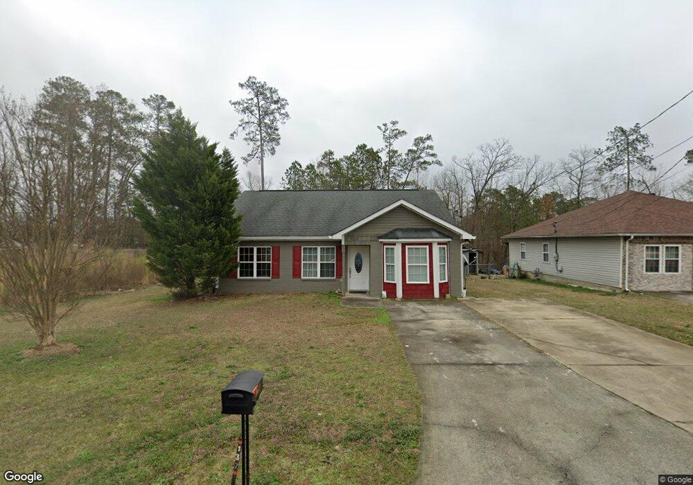
This home is located at 137 Beverly Dr SW, Rome, GA 30165 and is currently estimated at $205,756, approximately $184 per square foot. 137 Beverly Dr SW is a home located in Floyd County with nearby schools including Coosa Middle School, Coosa High School, and Darlington School.
Ownership History
Date
Name
Owned For
Owner Type
Purchase Details
Closed on
May 28, 2004
Sold by
Moore Devorah
Bought by
Allen April D
Current Estimated Value
Purchase Details
Closed on
Jan 10, 2001
Sold by
Abh Developers Inc
Bought by
Moore Devorah
Purchase Details
Closed on
Jun 3, 1998
Sold by
Autry Eugene
Bought by
Abh Developers Inc
Purchase Details
Closed on
Sep 7, 1993
Bought by
Autry Eugene
Create a Home Valuation Report for This Property
The Home Valuation Report is an in-depth analysis detailing your home's value as well as a comparison with similar homes in the area
Home Values in the Area
Average Home Value in this Area
Purchase History
| Date | Buyer | Sale Price | Title Company |
|---|---|---|---|
| Allen April D | $93,800 | -- | |
| Moore Devorah | $81,400 | -- | |
| Abh Developers Inc | $1,300 | -- | |
| Autry Eugene | $500 | -- |
Source: Public Records
Tax History Compared to Growth
Tax History
| Year | Tax Paid | Tax Assessment Tax Assessment Total Assessment is a certain percentage of the fair market value that is determined by local assessors to be the total taxable value of land and additions on the property. | Land | Improvement |
|---|---|---|---|---|
| 2024 | $1,630 | $69,634 | $9,360 | $60,274 |
| 2023 | $1,600 | $66,653 | $8,320 | $58,333 |
| 2022 | $1,441 | $55,289 | $6,760 | $48,529 |
| 2021 | $1,355 | $49,807 | $6,760 | $43,047 |
| 2020 | $1,295 | $46,086 | $5,200 | $40,886 |
| 2019 | $1,237 | $43,823 | $5,200 | $38,623 |
| 2018 | $1,188 | $41,530 | $5,200 | $36,330 |
| 2017 | $1,153 | $40,272 | $5,200 | $35,072 |
| 2016 | $1,145 | $39,544 | $5,200 | $34,344 |
| 2015 | $1,073 | $39,944 | $5,200 | $34,744 |
| 2014 | $1,073 | $37,874 | $5,200 | $32,674 |
Source: Public Records
Map
Nearby Homes
- 506 Wilkerson Rd SW
- 438 Wilkerson Rd SW
- 28 Southfork Dr
- 40 Hawk Spring Dr SW
- 31 Southfork Dr
- 0 E Clinton Dr SW Unit 7497950
- 0 E Clinton Dr SW Unit 10427155
- 110 Williamson St SW
- 3 Pebble Bend Ct
- 0 Brookvalley Ct SW Unit 10444714
- 0 Brookvalley Ct SW Unit 7512814
- 103 Wooten Dr SW
- 40 Paris Dr SW
- 50 Melton Ave SW
- 0 Leafmore Rd SW Unit 10562671
- 3 Walker Dr SW
- 358A&B Leafmore Rd SW
- 0 Cedartown Rd Unit 10479932
- 16 Jefferson Dr SW
- 43 Westwood Cir SW
- 139 Beverly Dr SW
- 133 Beverly Dr SW
- 141 Beverly Dr SW
- 128 Norcross Way SW
- 126 Norcross Way SW
- 130 Norcross Way SW
- 131 Beverly Dr SW
- 124 Norcross Way SW
- 138 Beverly Dr SW
- 136 Beverly Dr SW
- 140 Beverly Dr SW
- 132 Norcross Way SW
- 134 Beverly Dr SW
- 142 Beverly Dr SW
- 142 Beverly Dr SW Unit 128
- 122 Norcross Way SW
- 129 Beverly Dr SW
- 132 Beverly Dr SW
- 120 Norcross Way SW
- 0 Norcross Way Rd SW