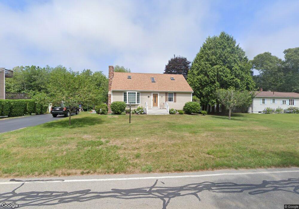
137 Brandt Island Rd Mattapoisett, MA 02739
Estimated Value: $597,912 - $723,000
4
Beds
2
Baths
1,482
Sq Ft
$447/Sq Ft
Est. Value
About This Home
This home is located at 137 Brandt Island Rd, Mattapoisett, MA 02739 and is currently estimated at $662,478, approximately $447 per square foot. 137 Brandt Island Rd is a home located in Plymouth County with nearby schools including Center School, Old Hammondtown Elementary, and Old Rochester Regional High School.
Ownership History
Date
Name
Owned For
Owner Type
Purchase Details
Closed on
Jun 23, 1987
Sold by
Damaro Rt
Bought by
Oliviera Wayne J
Current Estimated Value
Create a Home Valuation Report for This Property
The Home Valuation Report is an in-depth analysis detailing your home's value as well as a comparison with similar homes in the area
Home Values in the Area
Average Home Value in this Area
Purchase History
| Date | Buyer | Sale Price | Title Company |
|---|---|---|---|
| Oliviera Wayne J | $160,000 | -- |
Source: Public Records
Mortgage History
| Date | Status | Borrower | Loan Amount |
|---|---|---|---|
| Open | Oliviera Wayne J | $50,000 | |
| Open | Oliviera Wayne J | $132,000 | |
| Closed | Oliviera Wayne J | $127,800 | |
| Closed | Oliviera Wayne J | $6,270 |
Source: Public Records
Tax History Compared to Growth
Tax History
| Year | Tax Paid | Tax Assessment Tax Assessment Total Assessment is a certain percentage of the fair market value that is determined by local assessors to be the total taxable value of land and additions on the property. | Land | Improvement |
|---|---|---|---|---|
| 2025 | $5,089 | $473,000 | $209,200 | $263,800 |
| 2024 | $4,939 | $469,900 | $209,200 | $260,700 |
| 2023 | $4,910 | $436,400 | $178,700 | $257,700 |
| 2022 | $4,734 | $381,800 | $148,900 | $232,900 |
| 2021 | $4,206 | $324,500 | $135,400 | $189,100 |
| 2020 | $3,974 | $294,600 | $128,900 | $165,700 |
| 2019 | $3,892 | $294,600 | $128,900 | $165,700 |
| 2018 | $3,682 | $282,800 | $114,000 | $168,800 |
| 2017 | $3,745 | $286,500 | $125,400 | $161,100 |
| 2016 | $3,502 | $265,300 | $119,700 | $145,600 |
| 2015 | $3,494 | $268,800 | $123,200 | $145,600 |
| 2014 | $3,405 | $267,700 | $123,200 | $144,500 |
Source: Public Records
Map
Nearby Homes
- 0 Marina Dr Unit 72497908
- 0 Marina Dr Unit 72497877
- 6 Meadowbrook Ln
- 2 Marthas Vineyard Dr
- 5 Island View Ave
- 0 Brandt Beach Ave
- 41 Starboard Way
- 1 Starboard Way
- 2 Port Way
- 0 Whalers Way
- 0 Harbor Acres Ln - Lot B
- 8 Highland View Ave
- 7 Anawan Rd
- 3 Daisy Way
- 86 Fairhaven Rd
- 58 Ocean Ave
- 12 Cannon St
- 33 Sylvia St
- 20 Cannon St
- 43 Grandview Ave
- 135 Brandt Island Rd
- 139 Brandt Island Rd
- 10 Marina Dr
- 133 Brandt Island Rd
- 12 Marina Dr
- 8 Marina Dr
- 14 Marina Dr
- 2 Marina Dr
- 143 Brandt Island Rd
- 130 Brandt Island Rd
- 128 Brandt Island Rd
- 4 Marina Dr
- 4 Marina Dr Unit 1
- 9 Marina Dr
- 0 Marina Dr Unit 70047834
- 000 Marina Dr
- 0.0 Marina Dr
- 0 Marina Dr Unit 73000333
- lot 43 Marina Dr
- 0 Marina Dr Unit 72883187