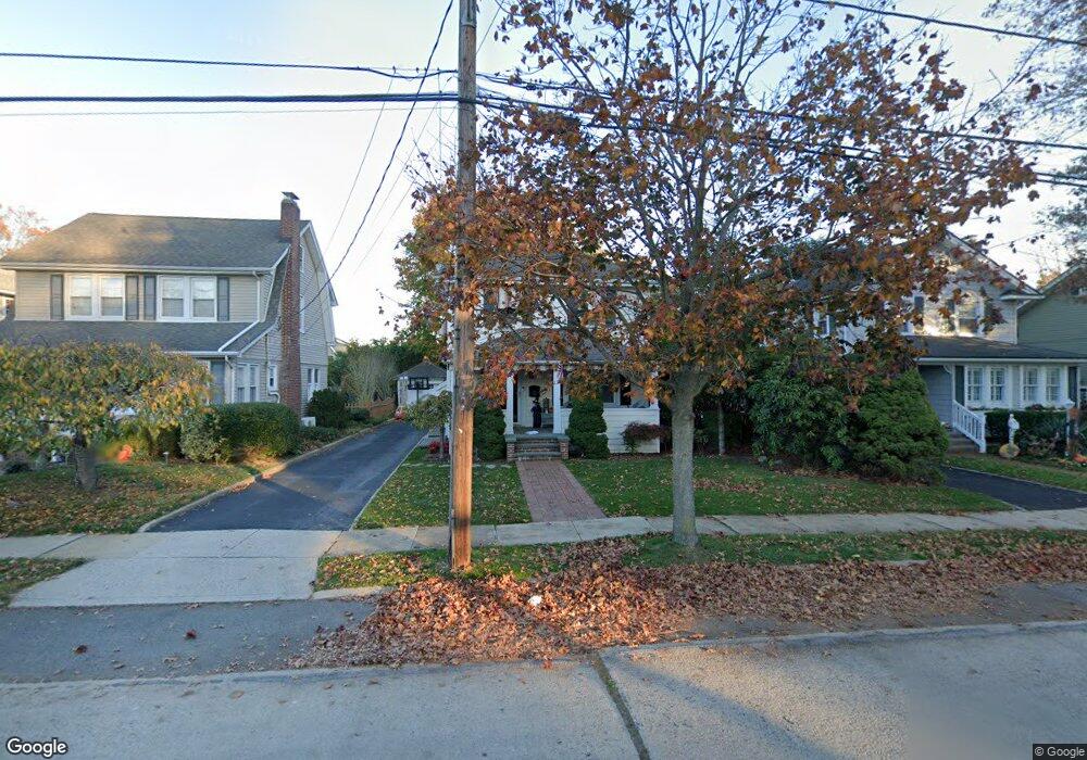
137 Brower Ave Rockville Centre, NY 11570
Estimated Value: $780,160 - $842,000
--
Bed
1
Bath
1,216
Sq Ft
$667/Sq Ft
Est. Value
About This Home
This home is located at 137 Brower Ave, Rockville Centre, NY 11570 and is currently estimated at $811,080, approximately $667 per square foot. 137 Brower Ave is a home located in Nassau County with nearby schools including South Side Middle School, South Side High School, and St Agnes Cathedral School.
Ownership History
Date
Name
Owned For
Owner Type
Purchase Details
Closed on
Aug 18, 2011
Sold by
Petruzska Lucille Celis and Celis Lucille
Bought by
Calabrese Maria Ann
Current Estimated Value
Home Financials for this Owner
Home Financials are based on the most recent Mortgage that was taken out on this home.
Original Mortgage
$400,000
Outstanding Balance
$276,309
Interest Rate
4.52%
Mortgage Type
Purchase Money Mortgage
Estimated Equity
$534,771
Purchase Details
Closed on
Jan 25, 2008
Sold by
Vaupel Christian
Bought by
Celis Lucille
Purchase Details
Closed on
Sep 19, 2002
Sold by
Cluess Timothy
Bought by
Vaupel Christian
Purchase Details
Closed on
Aug 7, 1997
Sold by
Passamanno Antonio
Bought by
Cluess Timoth
Create a Home Valuation Report for This Property
The Home Valuation Report is an in-depth analysis detailing your home's value as well as a comparison with similar homes in the area
Home Values in the Area
Average Home Value in this Area
Purchase History
| Date | Buyer | Sale Price | Title Company |
|---|---|---|---|
| Calabrese Maria Ann | $500,000 | -- | |
| Celis Lucille | $545,000 | -- | |
| Vaupel Christian | $429,000 | -- | |
| Cluess Timoth | $200,000 | -- |
Source: Public Records
Mortgage History
| Date | Status | Borrower | Loan Amount |
|---|---|---|---|
| Open | Calabrese Maria Ann | $400,000 |
Source: Public Records
Tax History Compared to Growth
Tax History
| Year | Tax Paid | Tax Assessment Tax Assessment Total Assessment is a certain percentage of the fair market value that is determined by local assessors to be the total taxable value of land and additions on the property. | Land | Improvement |
|---|---|---|---|---|
| 2025 | $12,333 | $505 | $217 | $288 |
| 2024 | $1,118 | $505 | $217 | $288 |
| 2023 | $12,393 | $535 | $264 | $271 |
| 2022 | $12,393 | $505 | $217 | $288 |
| 2021 | $16,990 | $504 | $217 | $287 |
| 2020 | $12,297 | $1,003 | $860 | $143 |
| 2019 | $13,824 | $1,003 | $860 | $143 |
| 2018 | $12,729 | $1,003 | $0 | $0 |
| 2017 | $9,714 | $1,003 | $860 | $143 |
| 2016 | $11,219 | $1,003 | $860 | $143 |
| 2015 | $1,449 | $1,003 | $860 | $143 |
| 2014 | $1,449 | $1,003 | $860 | $143 |
| 2013 | $1,324 | $970 | $860 | $110 |
Source: Public Records
Map
Nearby Homes
- 265 Raymond St
- 473 Lakeview Ave
- 206 Brower Ave
- 327 N Forest Ave
- 25 Greystone Rd
- 1 Jefferson Ave Unit D2
- 1 Jefferson Ave Unit J10
- 104 Cedar Ave
- 12 Shepherd St
- 15 Shepherd St
- 217 Hamilton Rd
- 39 Gateway
- 46 Ongley St
- 33 Purdy Ct
- 10 Purdy Ct
- 43 N Forest Ave Unit C-23
- 43 N Forest Ave Unit E21
- 134 Fonda Rd
- 6 Blenheim Ct
- 14 Dover Ct
- 141 Brower Ave
- 135 Brower Ave
- 234 Raymond St
- 145 Brower Ave
- 129 Brower Ave
- 238 Raymond St
- 144 Brower Ave
- 125 Brower Ave
- 136 Brower Ave
- 58 Southard Ave
- 240 Raymond St
- 212 Raymond St
- 132 Brower Ave
- 50 Southard Ave
- 119 Brower Ave
- 126 Brower Ave
- 62 Southard Ave
- 210 Raymond St
- 46 Southard Ave
- 227 Raymond St