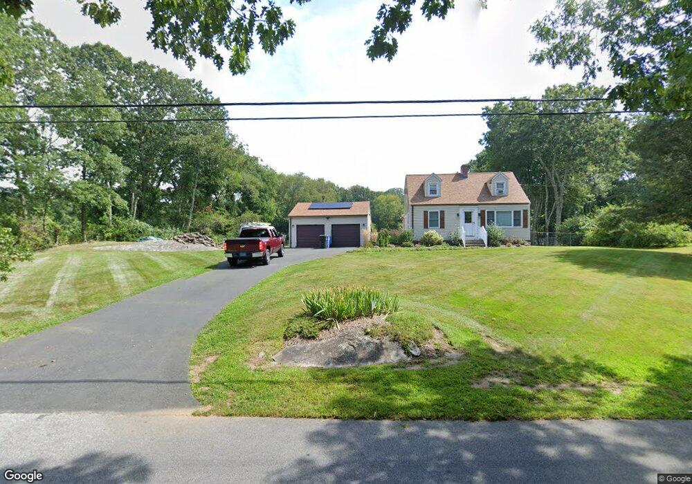
137 Cedar Swamp Rd Tolland, CT 06084
Estimated Value: $360,000 - $431,000
3
Beds
3
Baths
1,272
Sq Ft
$316/Sq Ft
Est. Value
About This Home
This home is located at 137 Cedar Swamp Rd, Tolland, CT 06084 and is currently estimated at $401,427, approximately $315 per square foot. 137 Cedar Swamp Rd is a home located in Tolland County with nearby schools including Birch Grove Primary School, Tolland Intermediate School, and Tolland Middle School.
Ownership History
Date
Name
Owned For
Owner Type
Purchase Details
Closed on
Feb 16, 2021
Sold by
Dupont Karen A and Ellott Robert T
Bought by
Elliott Karen A and Elliott Robert T
Current Estimated Value
Home Financials for this Owner
Home Financials are based on the most recent Mortgage that was taken out on this home.
Original Mortgage
$158,900
Outstanding Balance
$142,119
Interest Rate
2.7%
Mortgage Type
Balloon
Estimated Equity
$259,308
Purchase Details
Closed on
Jun 5, 1990
Sold by
Dennis Kenneth
Bought by
Dupont Karen
Purchase Details
Closed on
Aug 13, 1987
Sold by
West Kenneth
Bought by
Dennis Kenneth
Create a Home Valuation Report for This Property
The Home Valuation Report is an in-depth analysis detailing your home's value as well as a comparison with similar homes in the area
Home Values in the Area
Average Home Value in this Area
Purchase History
| Date | Buyer | Sale Price | Title Company |
|---|---|---|---|
| Elliott Karen A | -- | None Available | |
| Elliott Karen A | -- | None Available | |
| Dupont Karen | $168,500 | -- | |
| Dennis Kenneth | $155,500 | -- |
Source: Public Records
Mortgage History
| Date | Status | Borrower | Loan Amount |
|---|---|---|---|
| Open | Elliott Karen A | $158,900 | |
| Closed | Elliott Karen A | $158,900 | |
| Previous Owner | Dennis Kenneth | $180,000 | |
| Previous Owner | Dennis Kenneth | $189,000 | |
| Previous Owner | Dennis Kenneth | $146,500 |
Source: Public Records
Tax History Compared to Growth
Tax History
| Year | Tax Paid | Tax Assessment Tax Assessment Total Assessment is a certain percentage of the fair market value that is determined by local assessors to be the total taxable value of land and additions on the property. | Land | Improvement |
|---|---|---|---|---|
| 2025 | $6,368 | $234,200 | $66,600 | $167,600 |
| 2024 | $5,480 | $145,100 | $63,400 | $81,700 |
| 2023 | $5,417 | $145,100 | $63,400 | $81,700 |
| 2022 | $5,308 | $145,100 | $63,400 | $81,700 |
| 2021 | $5,385 | $145,100 | $63,400 | $81,700 |
| 2020 | $5,231 | $145,100 | $63,400 | $81,700 |
| 2019 | $5,090 | $141,200 | $65,400 | $75,800 |
| 2018 | $4,942 | $141,200 | $65,400 | $75,800 |
| 2017 | $4,828 | $141,200 | $65,400 | $75,800 |
| 2016 | $4,828 | $141,200 | $65,400 | $75,800 |
| 2015 | $4,710 | $141,200 | $65,400 | $75,800 |
| 2014 | $4,524 | $145,700 | $72,700 | $73,000 |
Source: Public Records
Map
Nearby Homes
- 16 Julia Rd
- 93 Dockerel Rd
- 28 Columbine Rd
- 64 Columbine Rd
- 70 Branden Way
- 15 Elm Rd
- 101 Dockerel Rd
- 109 Timber Trail
- 65 Bolton Branch Rd
- 39 Josephine Way
- 7 Laurelwood Ln Unit Lot 15
- 12 Laurelwood Ln Unit lot 8
- 38 Josephine Way
- 32 Josephine Way
- 26 Josephine Way
- 231 Brandy Hill Rd
- 5 Laurelwood Ln Unit lot 16
- 395 Grant Hill Rd Unit Lot21
- 395 Grant Hill (Mill Race Drive) Lot #21 Rd
- 676 Bolton Rd
- 32 Cedar Swamp Road Extension
- 148 Cedar Swamp Rd
- 149 Cedar Swamp Rd
- 127 Cedar Swamp Rd
- 157 Cedar Swamp Rd
- 1386 Cedar Swamp Rd
- 1404 Cedar Swamp Rd
- 116 Cedar Swamp Rd
- 112 Cedar Swamp Rd
- 1340 Cedar Swamp Rd
- 1350 Cedar Swamp Rd
- 28 Heather Ln
- 520 Mile Hill Rd
- 32 Heather Ln
- 1330 Cedar Swamp Rd
- 504 Mile Hill Rd
- 106 Cedar Swamp Rd
- 1320 Cedar Swamp Rd
- 1063 Bread and Milk St
- 114 Cedar Swamp Rd