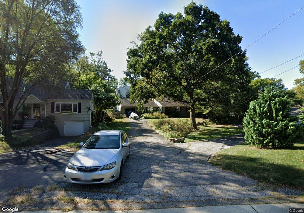
137 Central Ave Westerville, OH 43081
Estimated Value: $422,000 - $510,000
3
Beds
2
Baths
1,917
Sq Ft
$238/Sq Ft
Est. Value
About This Home
This home is located at 137 Central Ave, Westerville, OH 43081 and is currently estimated at $455,898, approximately $237 per square foot. 137 Central Ave is a home located in Franklin County with nearby schools including Whittier Elementary School, Blendon Middle School, and Westerville South High School.
Ownership History
Date
Name
Owned For
Owner Type
Purchase Details
Closed on
Jan 7, 2005
Sold by
Snow Alan H
Bought by
Snow Sheri R
Current Estimated Value
Home Financials for this Owner
Home Financials are based on the most recent Mortgage that was taken out on this home.
Original Mortgage
$129,300
Outstanding Balance
$53,150
Interest Rate
2.99%
Mortgage Type
New Conventional
Estimated Equity
$402,748
Purchase Details
Closed on
Jul 19, 1999
Sold by
Orndorff Gray Floy
Bought by
Borcherding John F and Borcherding Cynthia M
Home Financials for this Owner
Home Financials are based on the most recent Mortgage that was taken out on this home.
Original Mortgage
$116,000
Interest Rate
7.54%
Purchase Details
Closed on
Apr 21, 1964
Bought by
Gray Floy O
Create a Home Valuation Report for This Property
The Home Valuation Report is an in-depth analysis detailing your home's value as well as a comparison with similar homes in the area
Home Values in the Area
Average Home Value in this Area
Purchase History
| Date | Buyer | Sale Price | Title Company |
|---|---|---|---|
| Snow Sheri R | -- | Tri Star Bo | |
| Borcherding John F | $145,000 | Chicago Title West | |
| Gray Floy O | -- | -- |
Source: Public Records
Mortgage History
| Date | Status | Borrower | Loan Amount |
|---|---|---|---|
| Open | Snow Sheri R | $129,300 | |
| Closed | Borcherding John F | $116,000 |
Source: Public Records
Tax History Compared to Growth
Tax History
| Year | Tax Paid | Tax Assessment Tax Assessment Total Assessment is a certain percentage of the fair market value that is determined by local assessors to be the total taxable value of land and additions on the property. | Land | Improvement |
|---|---|---|---|---|
| 2024 | $7,426 | $130,660 | $35,740 | $94,920 |
| 2023 | $7,268 | $130,655 | $35,735 | $94,920 |
| 2022 | $6,301 | $86,490 | $41,060 | $45,430 |
| 2021 | $6,354 | $86,490 | $41,060 | $45,430 |
| 2020 | $6,336 | $86,490 | $41,060 | $45,430 |
| 2019 | $5,595 | $72,100 | $34,230 | $37,870 |
| 2018 | $5,101 | $72,100 | $34,230 | $37,870 |
| 2017 | $5,855 | $89,600 | $34,230 | $55,370 |
| 2016 | $4,871 | $58,100 | $26,600 | $31,500 |
| 2015 | $4,718 | $58,100 | $26,600 | $31,500 |
| 2014 | $4,721 | $58,100 | $26,600 | $31,500 |
| 2013 | $2,357 | $58,100 | $26,600 | $31,500 |
Source: Public Records
Map
Nearby Homes
- 502 Foxtrail Cir E Unit 502
- 206 Charring Cross Dr S Unit 2206
- 466 S State St
- 53 W College Ave
- 465 W Schrock Rd
- 559 Allview Ct
- 63 N West St
- 199 E College Ave
- 25 King Arthur Blvd
- 360 Potawatomi Dr
- 92 N Vine St
- 0 Cherrington Rd Unit 225023909
- 106 E Ticonderoga Dr
- 106 E Ticonderoga Dr Unit A
- 0 Cooper Rd
- 175 N State St
- 101 W Ticonderoga Dr Unit B
- 364 E College Ave
- 368 E College Ave
- 693 Pointview Dr
- 125 Central Ave
- 142 Parkview Ave
- 151 Central Ave
- 152 Parkview Ave
- 121 Central Ave
- 148 Parkview Ave
- 136 Parkview Ave
- 132 Parkview Ave
- 156 Parkview Ave
- 126 Parkview Ave
- 164 Parkview Ave
- 122 Parkview Ave
- 122 Parkview Ave
- 112 Central Ave
- 165 Central Ave
- 111 Central Ave
- 140 Central Ave
- 141 Parkview Ave
- 147 Parkview Ave
- 137 Parkview Ave