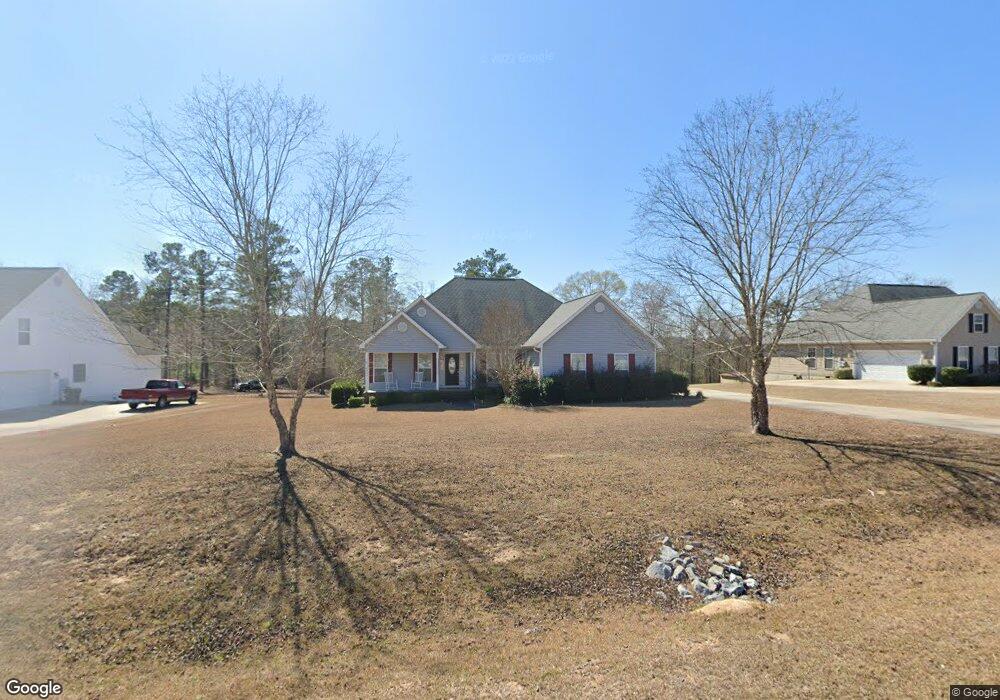
137 Chapman Ridge Rd Macon, GA 31211
Estimated Value: $241,797 - $301,000
3
Beds
2
Baths
1,773
Sq Ft
$149/Sq Ft
Est. Value
About This Home
This home is located at 137 Chapman Ridge Rd, Macon, GA 31211 and is currently estimated at $263,949, approximately $148 per square foot. 137 Chapman Ridge Rd is a home located in Jones County with nearby schools including Dames Ferry Elementary School, Clifton Ridge Middle School, and Jones County High School.
Ownership History
Date
Name
Owned For
Owner Type
Purchase Details
Closed on
Dec 12, 2022
Sold by
Perdue Gordon Wimbley
Bought by
Perdue Renellda Jean and Perdue Dennis
Current Estimated Value
Purchase Details
Closed on
Jan 21, 2011
Sold by
State Bank
Bought by
Perdue Gordon W
Home Financials for this Owner
Home Financials are based on the most recent Mortgage that was taken out on this home.
Original Mortgage
$134,988
Interest Rate
4.75%
Mortgage Type
FHA
Purchase Details
Closed on
Jan 25, 2007
Sold by
Not Provided
Bought by
Perdue Gordon W
Home Financials for this Owner
Home Financials are based on the most recent Mortgage that was taken out on this home.
Original Mortgage
$149,500
Interest Rate
6.07%
Mortgage Type
New Conventional
Create a Home Valuation Report for This Property
The Home Valuation Report is an in-depth analysis detailing your home's value as well as a comparison with similar homes in the area
Home Values in the Area
Average Home Value in this Area
Purchase History
| Date | Buyer | Sale Price | Title Company |
|---|---|---|---|
| Perdue Renellda Jean | -- | -- | |
| Perdue Gordon W | $138,500 | -- | |
| Perdue Gordon W | $84,000 | -- |
Source: Public Records
Mortgage History
| Date | Status | Borrower | Loan Amount |
|---|---|---|---|
| Previous Owner | Perdue Gordon W | $134,988 | |
| Previous Owner | Perdue Gordon W | $149,500 |
Source: Public Records
Tax History Compared to Growth
Tax History
| Year | Tax Paid | Tax Assessment Tax Assessment Total Assessment is a certain percentage of the fair market value that is determined by local assessors to be the total taxable value of land and additions on the property. | Land | Improvement |
|---|---|---|---|---|
| 2023 | $2,279 | $63,431 | $8,000 | $55,431 |
| 2022 | $2,062 | $61,102 | $8,000 | $53,102 |
| 2021 | $1,985 | $58,890 | $8,000 | $50,890 |
| 2020 | $1,914 | $56,902 | $8,000 | $48,902 |
| 2019 | $1,914 | $56,902 | $8,000 | $48,902 |
| 2018 | $1,914 | $56,902 | $8,000 | $48,902 |
| 2017 | $1,914 | $56,902 | $8,000 | $48,902 |
| 2016 | $1,914 | $56,902 | $8,000 | $48,902 |
| 2015 | $1,807 | $56,902 | $8,000 | $48,902 |
| 2014 | $1,670 | $56,902 | $8,000 | $48,902 |
Source: Public Records
Map
Nearby Homes
- Oakville Plan at Chapman Ridge
- Westwind Plan at Chapman Ridge
- Yarborough Plan at Chapman Ridge
- Fairfield Plan at Chapman Ridge
- 120 Chapman Ridge Lot #40 Rd
- 912 Chapman Dr
- 912 Chapman Dr Unit 45
- 168 Chapman Ridge Rd
- 168 Chapman Ridge Rd Unit 28
- 906 Chapman Dr
- 906 Chapman Dr Unit 46
- 894 Chapman Dr
- 190 Chapman Ridge Lot #22 Rd
- 190 Chapman Ridge Rd Unit LOT 22
- 190 Chapman Ridge Lot 22 Rd
- 192 Chapman Ridge Rd Unit LOT 21
- 224 Rebel Dr
- 170 Graystone Cir
- 218 Rebel Dr
- 246 Joycliff Cir
- 131 Chapman Ridge Rd
- 143 Chapman Ridge Rd
- 124 Chapman Ridge Rd
- 127 Chapman Ridge Rd
- 125 Chapman Ridge Rd
- Lot 35 Chapman Ridge Rd Unit 35
- Lot 34 Chapman Ridge Rd Unit 34
- Lot 2 Chapman Ridge Rd Unit 2
- Lot 1 Chapman Ridge Rd Unit 1
- Lot 13 Chapman Ridge Rd Unit 13
- Lot 36 Chapman Ridge Rd Unit 36
- Lot 26 Chapman Ridge Rd Unit 26
- Lot 17 Chapman Ridge Rd Unit 19
- Lot 46 Chapman Ridge Rd Unit 46
- Lot 47 Chapman Ridge Rd Unit 47
- Lot 40 Chapman Ridge Rd Unit 40
- Lot 45 Chapman Ridge Rd Unit 45
- Lot 37 Chapman Ridge Rd Unit 37
- Lot 39 Chapman Ridge Rd Unit 39
- Lot 32 Chapman Ridge Rd Unit 32