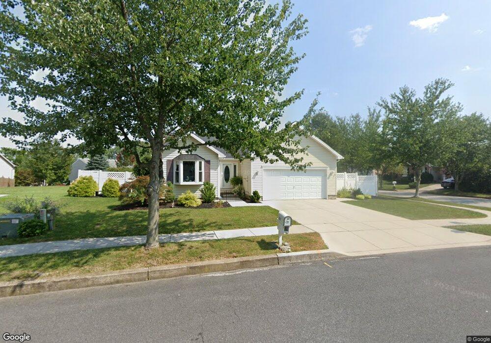
137 Colorado Ave Littlestown, PA 17340
Estimated Value: $291,000 - $318,000
3
Beds
2
Baths
1,256
Sq Ft
$243/Sq Ft
Est. Value
About This Home
This home is located at 137 Colorado Ave, Littlestown, PA 17340 and is currently estimated at $304,738, approximately $242 per square foot. 137 Colorado Ave is a home located in Adams County with nearby schools including Rolling Acres El School, Maple Avenue Middle School, and Littlestown Senior High School.
Ownership History
Date
Name
Owned For
Owner Type
Purchase Details
Closed on
Jun 26, 2008
Sold by
Barnard Georger L and Barnard Foye A
Bought by
Eckr Donald W and Eckr Carol L
Current Estimated Value
Home Financials for this Owner
Home Financials are based on the most recent Mortgage that was taken out on this home.
Original Mortgage
$165,000
Outstanding Balance
$106,985
Interest Rate
6.17%
Mortgage Type
New Conventional
Estimated Equity
$197,753
Create a Home Valuation Report for This Property
The Home Valuation Report is an in-depth analysis detailing your home's value as well as a comparison with similar homes in the area
Home Values in the Area
Average Home Value in this Area
Purchase History
| Date | Buyer | Sale Price | Title Company |
|---|---|---|---|
| Eckr Donald W | $215,000 | -- |
Source: Public Records
Mortgage History
| Date | Status | Borrower | Loan Amount |
|---|---|---|---|
| Open | Eckr Donald W | $165,000 |
Source: Public Records
Tax History Compared to Growth
Tax History
| Year | Tax Paid | Tax Assessment Tax Assessment Total Assessment is a certain percentage of the fair market value that is determined by local assessors to be the total taxable value of land and additions on the property. | Land | Improvement |
|---|---|---|---|---|
| 2025 | $4,427 | $192,600 | $38,300 | $154,300 |
| 2024 | $4,267 | $192,600 | $38,300 | $154,300 |
| 2023 | $4,101 | $192,600 | $38,300 | $154,300 |
| 2022 | $4,076 | $192,600 | $38,300 | $154,300 |
| 2021 | $3,956 | $192,600 | $38,300 | $154,300 |
| 2020 | $3,908 | $192,600 | $38,300 | $154,300 |
| 2019 | $3,791 | $192,600 | $38,300 | $154,300 |
| 2018 | $3,722 | $192,600 | $38,300 | $154,300 |
| 2017 | $3,626 | $192,600 | $38,300 | $154,300 |
| 2016 | -- | $192,600 | $38,300 | $154,300 |
| 2015 | -- | $192,600 | $38,300 | $154,300 |
| 2014 | -- | $192,600 | $38,300 | $154,300 |
Source: Public Records
Map
Nearby Homes
- 140 Apple Grove Ln Unit 425
- 22 Rita Marie Ave
- 440 N Queen St
- 129 W King St
- 161 Stoners Cir
- 115 Charles St
- 117 Charles St
- 61 E King St
- 58 Windsor Ct
- 48 Windsor Ct
- 162 Newark St
- 20c Locust Dr
- 0 Locust Dr Unit PAAD2015910
- 211 E King St
- 1024 Frederick Pike Unit 6
- 41 Smith Cir
- 449 Glenwyn Dr
- 535 Lumber St
- 559 Lumber St
- 567 Lumber St
- 137 Colorado Ave Unit 20
- 139 Colorado Ave Unit 21
- 12 Smokehouse Ct Unit 19
- 22 Smokehouse Ct Unit 18
- 133 Colorado Ave Unit 7
- 136 Colorado Ave Unit 92
- 140 Colorado Ave Unit 91
- 24 Smokehouse Ct Unit 17
- 5 Smokehouse Ct Unit 8
- 141 Colorado Ave Unit 22
- 9 Smokehouse Ct Unit 9
- 132 Colorado Ave Unit 93
- 144 Colorado Ave Unit 90
- 11 Smokehouse Ct Unit 10
- 129 Colorado Ave Unit 6
- 26 Smokehouse Ct Unit 16
- 126 Colorado Ave Unit 94
- 145 Colorado Ave Unit 24
- 148 Colorado Ave Unit 89
- 58 Stayman Way Unit 79