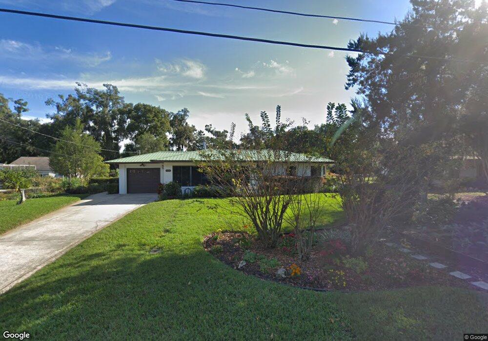
137 Cranor Ave Deland, FL 32720
Estimated Value: $279,000 - $304,000
3
Beds
2
Baths
1,953
Sq Ft
$151/Sq Ft
Est. Value
About This Home
This home is located at 137 Cranor Ave, Deland, FL 32720 and is currently estimated at $294,251, approximately $150 per square foot. 137 Cranor Ave is a home located in Volusia County with nearby schools including Woodward Avenue Elementary School, Deland High School, and Southwestern Middle School.
Ownership History
Date
Name
Owned For
Owner Type
Purchase Details
Closed on
Jun 11, 2021
Sold by
Thompson Claude and Thompson Family Trust
Bought by
Texter Summer Mackenzie
Current Estimated Value
Home Financials for this Owner
Home Financials are based on the most recent Mortgage that was taken out on this home.
Original Mortgage
$192,000
Outstanding Balance
$173,832
Interest Rate
2.9%
Mortgage Type
New Conventional
Estimated Equity
$120,419
Purchase Details
Closed on
Jul 27, 2005
Sold by
Thompson Claude and Thompson Carol Ann
Bought by
Thompson Claude and Thompson Carol
Purchase Details
Closed on
Jul 15, 1973
Bought by
Thompson Claude Tr
Create a Home Valuation Report for This Property
The Home Valuation Report is an in-depth analysis detailing your home's value as well as a comparison with similar homes in the area
Home Values in the Area
Average Home Value in this Area
Purchase History
| Date | Buyer | Sale Price | Title Company |
|---|---|---|---|
| Texter Summer Mackenzie | $240,000 | Volusia Title Services | |
| Thompson Claude | -- | -- | |
| Thompson Claude Tr | $28,500 | -- |
Source: Public Records
Mortgage History
| Date | Status | Borrower | Loan Amount |
|---|---|---|---|
| Open | Texter Summer Mackenzie | $192,000 |
Source: Public Records
Tax History Compared to Growth
Tax History
| Year | Tax Paid | Tax Assessment Tax Assessment Total Assessment is a certain percentage of the fair market value that is determined by local assessors to be the total taxable value of land and additions on the property. | Land | Improvement |
|---|---|---|---|---|
| 2025 | $3,323 | $221,481 | -- | -- |
| 2024 | $3,323 | $215,240 | -- | -- |
| 2023 | $3,323 | $208,971 | $0 | $0 |
| 2022 | $3,258 | $202,884 | $41,528 | $161,356 |
| 2021 | $1,205 | $86,810 | $0 | $0 |
| 2020 | $1,179 | $85,611 | $0 | $0 |
| 2019 | $1,191 | $83,686 | $0 | $0 |
| 2018 | $1,165 | $82,126 | $0 | $0 |
| 2017 | $1,132 | $80,437 | $0 | $0 |
| 2016 | $1,070 | $78,783 | $0 | $0 |
| 2015 | $1,085 | $78,235 | $0 | $0 |
| 2014 | $1,074 | $77,614 | $0 | $0 |
Source: Public Records
Map
Nearby Homes
- 0 N Spring Garden Ave Unit MFRO6340602
- 0 N Spring Garden Ave Unit 1112700
- 0 N Spring Garden Ave Unit V4920996
- W SR 44, New York Ave W
- 128 S Montgomery Ave
- 289 E Fiesta Key Loop
- 186 E Fiesta Key Loop
- 1126 W Minnesota Ave
- 243 S Hull Ave
- 807 W Church St
- 139 Crawl Key Ct
- 1405 Talton Ave
- 1314 Talton Ave
- 1415 Talton Ave
- 1628 Andover Ridge Dr
- 600 Brittle Fern Ave
- 0 No Name St Unit MFRV4945045
- 0 No Name Unit MFRNS1085318
- 0 No Name St Unit 1121841
- 1601 Andover Ridge Dr