Estimated Value: $563,555
Studio
--
Bath
3,000
Sq Ft
$188/Sq Ft
Est. Value
About This Home
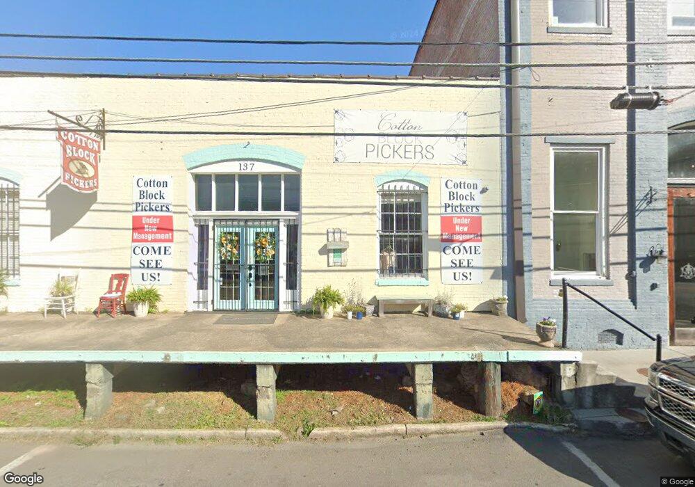
This home is located at 137 E 1st St, Rome, GA 30161 and is currently estimated at $563,555, approximately $187 per square foot. 137 E 1st St is a home located in Floyd County with nearby schools including Rome High School, St. Mary School, and Darlington School.
Ownership History
Date
Name
Owned For
Owner Type
Purchase Details
Closed on
Aug 20, 2015
Sold by
Wade Roger
Bought by
Kuber Properties Llc
Current Estimated Value
Home Financials for this Owner
Home Financials are based on the most recent Mortgage that was taken out on this home.
Original Mortgage
$211,650
Interest Rate
4.09%
Mortgage Type
Commercial
Purchase Details
Closed on
Oct 22, 2007
Sold by
Not Provided
Bought by
Wade Roger
Home Financials for this Owner
Home Financials are based on the most recent Mortgage that was taken out on this home.
Original Mortgage
$256,725
Interest Rate
6.27%
Mortgage Type
Commercial
Create a Home Valuation Report for This Property
The Home Valuation Report is an in-depth analysis detailing your home's value as well as a comparison with similar homes in the area
Home Values in the Area
Average Home Value in this Area
Purchase History
We collect this data history from publicly available records. To have your information removed, we recommend requesting removal directly through your county’s website.
| Date | Buyer | Sale Price | Title Company |
|---|---|---|---|
| Kuber Properties Llc | $249,000 | -- | |
| Wade Roger | $262,500 | -- |
Source: Public Records
Mortgage History
We collect this data history from publicly available records. To have your information removed, we recommend requesting removal directly through your county’s website.
| Date | Status | Borrower | Loan Amount |
|---|---|---|---|
| Closed | Kuber Properties Llc | $211,650 | |
| Previous Owner | Wade Roger | $256,725 |
Source: Public Records
Tax History
| Year | Tax Paid | Tax Assessment Tax Assessment Total Assessment is a certain percentage of the fair market value that is determined by local assessors to be the total taxable value of land and additions on the property. | Land | Improvement |
|---|---|---|---|---|
| 2025 | $6,272 | $168,385 | $47,667 | $120,718 |
| 2024 | $6,272 | $134,924 | $47,667 | $87,257 |
| 2023 | $4,913 | $115,023 | $47,667 | $67,356 |
| 2022 | $3,828 | $100,760 | $40,858 | $59,902 |
| 2021 | $3,821 | $98,969 | $40,858 | $58,111 |
| 2020 | $3,851 | $98,969 | $40,858 | $58,111 |
| 2019 | $3,676 | $95,434 | $40,858 | $54,576 |
| 2018 | $3,676 | $95,434 | $40,858 | $54,576 |
| 2017 | $3,330 | $86,449 | $5,914 | $80,535 |
| 2016 | $3,178 | $82,248 | $5,040 | $77,208 |
| 2015 | $2,966 | $82,248 | $5,040 | $77,208 |
| 2014 | $2,966 | $82,248 | $5,040 | $77,208 |
Source: Public Records
Map
Nearby Homes
- 0 Brook Valley Ct Unit 10665224
- 0 Brook Valley Ct Unit 7743143
- 8 E 3rd Ave
- 10 E 3rd Ave
- 1 E 3rd Ave Unit 302
- 1 E 3rd Ave
- 1 E 3rd Ave Unit 310
- 1 E 3rd Ave Unit 304
- 214 E 3rd St
- 312 E 3rd St
- 320 E 3rd Ave
- 407 E 3rd St
- 232 S Broad St SW
- 204 E 5th Ave
- 18 Cherokee St SW
- 214 Pennington Ave SW
- 204 Myrtle St SW
- 167 Sweet Water Ln
- 11 Hart Dr
- 110 Cherokee St SW
- 114 Broad St
- 114 Broad St Unit 208
- 114 Broad St Unit 205
- 114 Broad St Unit 206
- 114 Broad St Unit 207
- 114 Broad St Unit 201
- 110 Broad St
- 122 Broad St
- 112 Broad St
- 2 E 2nd Ave Unit 11071
- 124 Broad St
- 32 E 2nd Ave
- 128 Broad St
- 100 Broad St
- 206208 Broad St
- 116118 Broad St Unit 11
- 202 Broad St
- 77 Brooke Cir
- 204 Broad St
- 100 E 2nd Ave
Your Personal Tour Guide
Ask me questions while you tour the home.