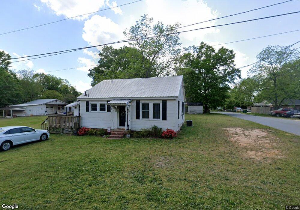
137 E Kimball St Winder, GA 30680
Estimated Value: $182,000 - $244,000
2
Beds
1
Bath
960
Sq Ft
$236/Sq Ft
Est. Value
About This Home
This home is located at 137 E Kimball St, Winder, GA 30680 and is currently estimated at $226,870, approximately $236 per square foot. 137 E Kimball St is a home located in Barrow County with nearby schools including Holsenbeck Elementary School, Bear Creek Middle School, and Winder-Barrow High School.
Ownership History
Date
Name
Owned For
Owner Type
Purchase Details
Closed on
Oct 23, 2024
Sold by
Lanthier Joseph M
Bought by
Lanthier House Properties Llc
Current Estimated Value
Purchase Details
Closed on
Oct 1, 2001
Sold by
Barnette Virginia
Bought by
Lanthier Joseph M and Lanthier Susan H
Home Financials for this Owner
Home Financials are based on the most recent Mortgage that was taken out on this home.
Original Mortgage
$112,000
Interest Rate
6.99%
Mortgage Type
New Conventional
Create a Home Valuation Report for This Property
The Home Valuation Report is an in-depth analysis detailing your home's value as well as a comparison with similar homes in the area
Home Values in the Area
Average Home Value in this Area
Purchase History
| Date | Buyer | Sale Price | Title Company |
|---|---|---|---|
| Lanthier House Properties Llc | -- | -- | |
| Lanthier Joseph M | $55,000 | -- |
Source: Public Records
Mortgage History
| Date | Status | Borrower | Loan Amount |
|---|---|---|---|
| Previous Owner | Lanthier Joseph M | $112,000 |
Source: Public Records
Tax History
| Year | Tax Paid | Tax Assessment Tax Assessment Total Assessment is a certain percentage of the fair market value that is determined by local assessors to be the total taxable value of land and additions on the property. | Land | Improvement |
|---|---|---|---|---|
| 2025 | $2,233 | $79,859 | $11,600 | $68,259 |
| 2024 | $2,215 | $77,782 | $11,600 | $66,182 |
| 2023 | $2,208 | $77,782 | $11,600 | $66,182 |
| 2022 | $1,794 | $51,321 | $11,600 | $39,721 |
| 2021 | $1,769 | $47,501 | $11,600 | $35,901 |
| 2020 | $1,446 | $39,979 | $11,600 | $28,379 |
| 2019 | $1,383 | $37,472 | $11,600 | $25,872 |
| 2018 | $1,379 | $37,472 | $11,600 | $25,872 |
| 2017 | $990 | $33,194 | $11,600 | $21,594 |
| 2016 | $1,147 | $33,194 | $11,600 | $21,594 |
| 2015 | $1,148 | $33,194 | $11,600 | $21,594 |
| 2014 | $997 | $28,454 | $6,860 | $21,594 |
| 2013 | -- | $27,414 | $6,860 | $20,554 |
Source: Public Records
Map
Nearby Homes
- 122 Capitol Ave
- 88 E Stephens St
- 122 Advent Dr
- 209 Georgia Ave
- 184 Capitol Ave
- 168 Park Ave
- 18 E New St
- 5 W Kimball St
- 3 W Kimball St
- 1 W Kimball St
- 163 Wood Cir
- 24 Richardson St
- 208 Shields St
- 160 N Broad St
- 221 Martin Luther King jr Dr
- 0 Georgia Highway 211 Unit 7483562
- 0 W Athens St Unit 10544465
- 227 Martin Luther King jr Dr
- 17 W Wright St
- 37 Wade St
- 132 Capitol Ave
- 140 Capitol Ave
- 143 E Kimball St
- E E Kimball St
- 127 E Kimball St
- 126 Capitol Ave
- 124 Griffith St
- 125 Griffith St
- 112 King St
- 128 E Kimball St
- 116 King St
- 123 E Kimball St
- 122 E Kimball St
- 815 E Kimball St
- 102 King St
- 102 King St
- 119 Griffith St
- 118 Griffith St
- 121 Capitol Ave
- 119 E Kimball St
Your Personal Tour Guide
Ask me questions while you tour the home.