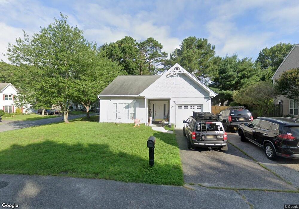
137 E Mourning Dove Way Unit 48A Galloway, NJ 08205
Estimated Value: $306,465 - $331,000
2
Beds
2
Baths
1,224
Sq Ft
$261/Sq Ft
Est. Value
About This Home
This home is located at 137 E Mourning Dove Way Unit 48A, Galloway, NJ 08205 and is currently estimated at $319,616, approximately $261 per square foot. 137 E Mourning Dove Way Unit 48A is a home located in Atlantic County with nearby schools including Absegami High School, Cedar Creek High School, and Oakcrest High School.
Ownership History
Date
Name
Owned For
Owner Type
Purchase Details
Closed on
Jun 13, 2017
Sold by
Davoudikia Roland
Bought by
Mann Jennifer Marie
Current Estimated Value
Home Financials for this Owner
Home Financials are based on the most recent Mortgage that was taken out on this home.
Original Mortgage
$144,444
Outstanding Balance
$119,916
Interest Rate
3.95%
Mortgage Type
New Conventional
Estimated Equity
$199,700
Purchase Details
Closed on
Nov 28, 2011
Sold by
Marrone Susan
Bought by
Davoudikia Roland
Purchase Details
Closed on
Jun 18, 1997
Sold by
Vetter John F and Vetter Rosemarie Ewing
Bought by
Lucci Dominick and Lucci Angelina
Purchase Details
Closed on
Aug 6, 1993
Sold by
K Hovnanian At Galloway Viii Inc
Bought by
Vetter John F
Create a Home Valuation Report for This Property
The Home Valuation Report is an in-depth analysis detailing your home's value as well as a comparison with similar homes in the area
Home Values in the Area
Average Home Value in this Area
Purchase History
| Date | Buyer | Sale Price | Title Company |
|---|---|---|---|
| Mann Jennifer Marie | $143,000 | Surety Title Co Llc | |
| Davoudikia Roland | $114,000 | None Available | |
| Lucci Dominick | $106,000 | Congress Title Division | |
| Vetter John F | $110,600 | -- |
Source: Public Records
Mortgage History
| Date | Status | Borrower | Loan Amount |
|---|---|---|---|
| Open | Mann Jennifer Marie | $144,444 |
Source: Public Records
Tax History Compared to Growth
Tax History
| Year | Tax Paid | Tax Assessment Tax Assessment Total Assessment is a certain percentage of the fair market value that is determined by local assessors to be the total taxable value of land and additions on the property. | Land | Improvement |
|---|---|---|---|---|
| 2025 | $4,540 | $136,000 | $39,000 | $97,000 |
| 2024 | $4,540 | $136,000 | $39,000 | $97,000 |
| 2023 | $4,367 | $136,000 | $39,000 | $97,000 |
| 2022 | $4,367 | $136,000 | $39,000 | $97,000 |
| 2021 | $4,280 | $136,000 | $39,000 | $97,000 |
| 2020 | $4,212 | $136,000 | $39,000 | $97,000 |
| 2019 | $4,134 | $136,000 | $39,000 | $97,000 |
| 2018 | $4,193 | $136,000 | $39,000 | $97,000 |
| 2017 | $4,193 | $136,000 | $39,000 | $97,000 |
| 2016 | $4,156 | $136,000 | $39,000 | $97,000 |
| 2015 | $4,137 | $136,000 | $39,000 | $97,000 |
| 2014 | $4,000 | $136,000 | $39,000 | $97,000 |
Source: Public Records
Map
Nearby Homes
- 152 Club Place Unit 26B
- 41 Federal Ct Unit 3E2
- 24 Federal Ct
- 10 Iroquois Dr Unit D1
- 106 Club Place Unit C2
- 126 Club Place
- 41 Seneca Dr Unit 1062
- 41 Seneca Dr
- 181 Rumson Dr Unit 1084
- 27 Seneca Dr Unit 4D
- 25 Seneca Dr Unit 25
- 127 Iroquois Dr Unit F1
- 82 Iroquois Dr
- 66 Iroquois Dr Unit 24
- 37 Colonial Ct Unit H1
- 213 Patriots Ct Unit 29B
- 96 Iroquois Dr Unit 18
- 161 Patriots Ct Unit 3601
- 36 Apache Ct Unit 36
- 19 Mohave Dr Unit 19
- 137 E Mourning Dove Way
- 160 E Nightingale Way
- 135 E Mourning Dove Way
- 154 E Nightingale Way
- 165 E Nightingale Way
- 133 E Mourning Dove Way
- 163 E Nightingale Way
- 161 E Nightingale Way
- 142 E Mourning Dove Way
- 144 E Mourning Dove Way
- 152 E Nightingale Way
- 159 E Nightingale Way
- 140 E Mourning Dove Way
- 131 E Mourning Dove Way
- 157 E Nightingale Way
- 141 E Mourning Dove Way
- 155 E Nightingale Way
- 144 E Nightingale Way
- 138 E Mourning Dove Way Unit 114A
- 150 E Nightingale Way Unit 52A