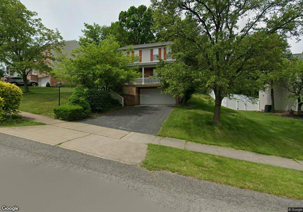
137 Elmhurst Dr Coraopolis, PA 15108
Estimated Value: $341,587 - $416,000
3
Beds
3
Baths
1,560
Sq Ft
$238/Sq Ft
Est. Value
About This Home
This home is located at 137 Elmhurst Dr, Coraopolis, PA 15108 and is currently estimated at $370,647, approximately $237 per square foot. 137 Elmhurst Dr is a home located in Allegheny County with nearby schools including Moon Area High School.
Ownership History
Date
Name
Owned For
Owner Type
Purchase Details
Closed on
Aug 16, 2023
Sold by
Webster Michael A
Bought by
Webster Michael A
Current Estimated Value
Purchase Details
Closed on
May 21, 2010
Sold by
Volek Timothy J
Bought by
Webster Michael A
Home Financials for this Owner
Home Financials are based on the most recent Mortgage that was taken out on this home.
Original Mortgage
$180,074
Interest Rate
5.11%
Mortgage Type
FHA
Purchase Details
Closed on
Jul 6, 2004
Sold by
Laipple Joseph
Bought by
Volek Timothy
Home Financials for this Owner
Home Financials are based on the most recent Mortgage that was taken out on this home.
Original Mortgage
$133,000
Interest Rate
6.3%
Mortgage Type
New Conventional
Purchase Details
Closed on
Apr 29, 1994
Sold by
Scott Ralph F and Scott Linda J
Bought by
Laipple Joseph S and Laipple Mary Pat
Create a Home Valuation Report for This Property
The Home Valuation Report is an in-depth analysis detailing your home's value as well as a comparison with similar homes in the area
Home Values in the Area
Average Home Value in this Area
Purchase History
| Date | Buyer | Sale Price | Title Company |
|---|---|---|---|
| Webster Michael A | -- | -- | |
| Webster Michael A | $182,500 | -- | |
| Volek Timothy | $175,000 | -- | |
| Laipple Joseph S | $129,400 | -- |
Source: Public Records
Mortgage History
| Date | Status | Borrower | Loan Amount |
|---|---|---|---|
| Previous Owner | Webster Michael A | $180,074 | |
| Previous Owner | Volek Timothy | $133,000 |
Source: Public Records
Tax History Compared to Growth
Tax History
| Year | Tax Paid | Tax Assessment Tax Assessment Total Assessment is a certain percentage of the fair market value that is determined by local assessors to be the total taxable value of land and additions on the property. | Land | Improvement |
|---|---|---|---|---|
| 2025 | $5,279 | $168,900 | $45,100 | $123,800 |
| 2024 | $5,279 | $168,900 | $45,100 | $123,800 |
| 2023 | $5,091 | $168,900 | $45,100 | $123,800 |
| 2022 | $5,091 | $168,900 | $45,100 | $123,800 |
| 2021 | $5,091 | $168,900 | $45,100 | $123,800 |
| 2020 | $4,964 | $168,900 | $45,100 | $123,800 |
| 2019 | $4,828 | $168,900 | $45,100 | $123,800 |
| 2018 | $799 | $168,900 | $45,100 | $123,800 |
| 2017 | $4,565 | $168,900 | $45,100 | $123,800 |
| 2016 | $799 | $168,900 | $45,100 | $123,800 |
| 2015 | $799 | $168,900 | $45,100 | $123,800 |
| 2014 | $4,445 | $168,900 | $45,100 | $123,800 |
Source: Public Records
Map
Nearby Homes
- 105 Springwater Ct
- 001 Spring Run Road Extension
- 116 Mesa Dr
- 0 Spring Run Road Extension Unit 1684623
- 108 Economy Grade Rd
- 121 Shelbourne Dr
- Somerset Plan at Victoria Ridge
- Rockford Plan at Victoria Ridge
- Birmingham Plan at Victoria Ridge
- Eisenhower Plan at Victoria Ridge
- Carlisle Plan at Victoria Ridge
- Truman Plan at Victoria Ridge
- Chattanooga Plan at Victoria Ridge
- Cleveland Plan at Victoria Ridge
- 121 Victoria Dr
- 120 Scottsdale Dr
- 110 Victoria Dr
- Bristol Plan at Victoria Ridge
- Galen Plan at Victoria Ridge
- Hanover Plan at Victoria Ridge
- 135 Elmhurst Dr
- 139 Elmhurst Dr
- 133 Elmhurst Dr
- 136 Elmhurst Dr
- 131 Elmhurst Dr
- 138 Elmhurst Dr
- 130 Elmhurst Dr
- 134 Elmhurst Dr
- 285 Shady Glen Dr
- 132 Elmhurst Dr
- 281 Shady Glen Dr
- 283 Shady Glen Dr
- 128 Elmhurst Dr
- 129 Elmhurst Dr
- 301 Shady Glen Dr
- 126 Elmhurst Dr
- 287 Shady Glen Dr
- 303 Shady Glen Dr
- 305 Shady Glen Dr
- 127 Elmhurst Dr