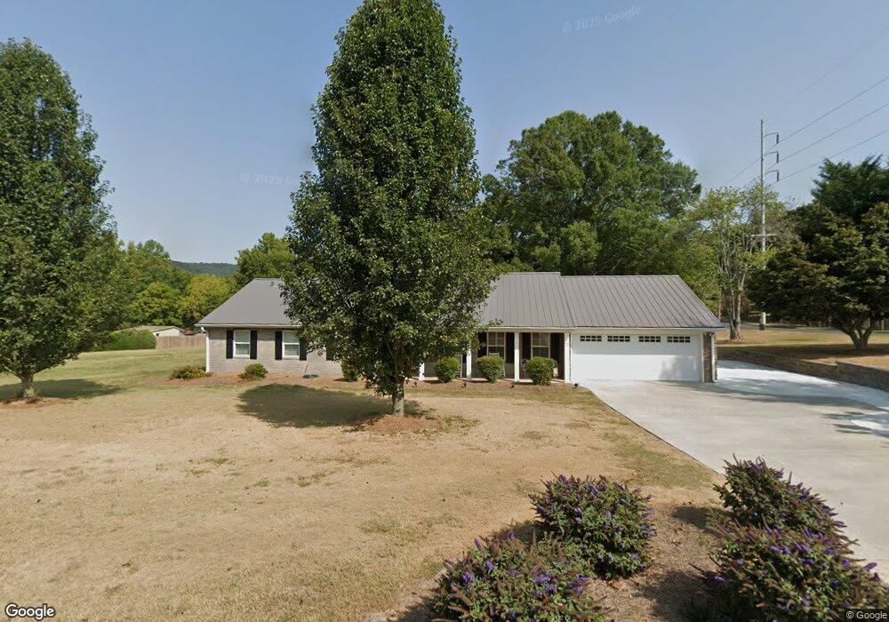
137 Huntington Rd Dalton, GA 30720
Estimated Value: $377,244 - $451,000
3
Beds
2
Baths
2,039
Sq Ft
$208/Sq Ft
Est. Value
About This Home
This home is located at 137 Huntington Rd, Dalton, GA 30720 and is currently estimated at $423,811, approximately $207 per square foot. 137 Huntington Rd is a home located in Whitfield County with nearby schools including City Park Elementary School, Dalton Middle School, and Dalton High School.
Ownership History
Date
Name
Owned For
Owner Type
Purchase Details
Closed on
May 20, 2022
Sold by
Renee Buckner Connie
Bought by
Morgan John and Morgan April
Current Estimated Value
Purchase Details
Closed on
Apr 5, 2021
Sold by
Morgan John R and Morgn April
Bought by
Trowell Daniel Allen and Trowell Dana Leigh-Anne
Purchase Details
Closed on
Mar 30, 2021
Sold by
Morgan John R and Morgan April
Bought by
Moore James Bryan and Moore Chandler Rose
Purchase Details
Closed on
Sep 22, 2010
Sold by
Gowin James M
Bought by
Morgan John
Home Financials for this Owner
Home Financials are based on the most recent Mortgage that was taken out on this home.
Original Mortgage
$124,480
Interest Rate
4.42%
Mortgage Type
New Conventional
Create a Home Valuation Report for This Property
The Home Valuation Report is an in-depth analysis detailing your home's value as well as a comparison with similar homes in the area
Home Values in the Area
Average Home Value in this Area
Purchase History
| Date | Buyer | Sale Price | Title Company |
|---|---|---|---|
| Morgan John | $207,000 | None Listed On Document | |
| Trowell Daniel Allen | -- | None Listed On Document | |
| Moore James Bryan | -- | None Listed On Document | |
| Morgan John | $155,600 | -- |
Source: Public Records
Mortgage History
| Date | Status | Borrower | Loan Amount |
|---|---|---|---|
| Previous Owner | Morgan John | $124,480 |
Source: Public Records
Tax History Compared to Growth
Tax History
| Year | Tax Paid | Tax Assessment Tax Assessment Total Assessment is a certain percentage of the fair market value that is determined by local assessors to be the total taxable value of land and additions on the property. | Land | Improvement |
|---|---|---|---|---|
| 2024 | $3,412 | $128,731 | $36,680 | $92,051 |
| 2023 | $3,412 | $98,245 | $26,200 | $72,045 |
| 2022 | $2,329 | $75,014 | $26,200 | $48,814 |
| 2021 | $2,333 | $75,014 | $26,200 | $48,814 |
| 2020 | $2,411 | $75,014 | $26,200 | $48,814 |
| 2019 | $2,482 | $75,014 | $26,200 | $48,814 |
| 2018 | $2,514 | $75,014 | $26,200 | $48,814 |
| 2017 | $2,501 | $77,432 | $26,200 | $51,232 |
| 2016 | $2,483 | $76,556 | $27,720 | $48,836 |
| 2014 | $2,069 | $69,636 | $25,200 | $44,436 |
| 2013 | -- | $68,732 | $25,200 | $43,532 |
Source: Public Records
Map
Nearby Homes
- 1804 Woodvalley Ct
- 503 Loveman Ln
- 1833 Woodvalley Dr
- 604 Lenna Ln
- 111 Broadview Terrace
- 101 Jernell St
- 610 Audubon Way
- 1104 W Crawford St
- 1600 Beverly Dr
- 1402 Beverly Dr
- 1900 Tibbs Terrace
- 00 Shugart Rd
- 203 Auburn Dr
- 1903 Valley Ln
- 912 W Crawford St
- 503 Leighton's Landing
- 1934 Spring Chase Way
- 2305 Ravine Way
- 00 Botany Woods Dr
- 1122 Ridgeleigh Cir
- 135 Huntington Rd
- 107 S Tibbs Rd
- 203 S Tibbs Rd
- 1803 Wood Valley Dr
- 1801 Wood Valley Dr
- 301 S Tibbs Rd
- 105 S Tibbs Rd
- 303 S Tibbs Rd
- 103 S Tibbs Rd
- 506 Rainsong Rd
- 508 Rainsong Rd
- 305 S Tibbs Rd
- 1805 Wood Valley Dr
- 132 Huntington Rd
- 133 Huntington Rd
- 504 Rainsong Rd
- 101 S Tibbs Rd
- 514 Rainsong Rd
- 306 S Tibbs Rd
- 502 Rainsong Rd