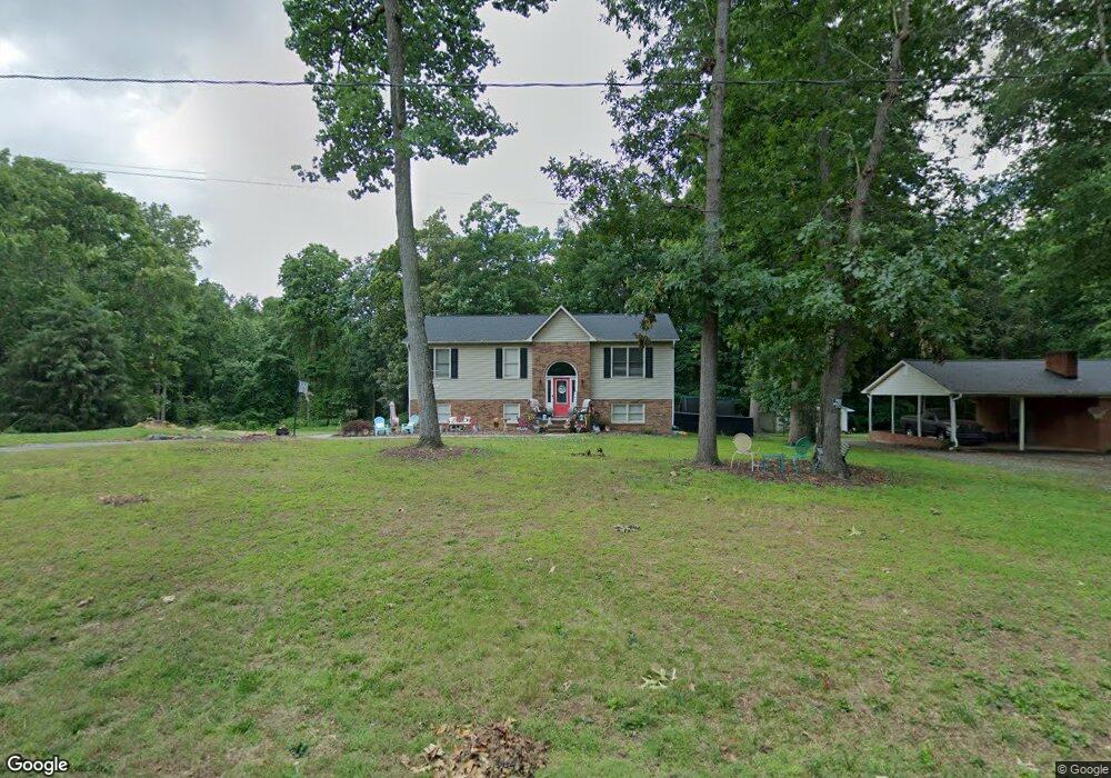
137 Kim St Winston Salem, NC 27107
Estimated Value: $249,000 - $318,000
3
Beds
2
Baths
2,918
Sq Ft
$96/Sq Ft
Est. Value
About This Home
This home is located at 137 Kim St, Winston Salem, NC 27107 and is currently estimated at $281,324, approximately $96 per square foot. 137 Kim St is a home located in Davidson County with nearby schools including Wallburg Elementary School, Oak Grove Middle School, and Oak Grove High School.
Ownership History
Date
Name
Owned For
Owner Type
Purchase Details
Closed on
Jun 2, 2017
Sold by
Burnette Herman T
Bought by
Greer Christopher and Greer Leslie
Current Estimated Value
Purchase Details
Closed on
Jun 7, 2007
Sold by
Richardson John Allen and Richardson Peggy Miller
Bought by
Burnette Herman J and Burnette Donna N
Home Financials for this Owner
Home Financials are based on the most recent Mortgage that was taken out on this home.
Original Mortgage
$129,600
Interest Rate
6.1%
Mortgage Type
Purchase Money Mortgage
Purchase Details
Closed on
Dec 1, 1997
Purchase Details
Closed on
Aug 1, 1995
Purchase Details
Closed on
Sep 1, 1993
Create a Home Valuation Report for This Property
The Home Valuation Report is an in-depth analysis detailing your home's value as well as a comparison with similar homes in the area
Home Values in the Area
Average Home Value in this Area
Purchase History
| Date | Buyer | Sale Price | Title Company |
|---|---|---|---|
| Greer Christopher | $128,500 | None Available | |
| Burnette Herman J | $144,000 | None Available | |
| -- | $112,500 | -- | |
| -- | $99,500 | -- | |
| -- | $10,500 | -- |
Source: Public Records
Mortgage History
| Date | Status | Borrower | Loan Amount |
|---|---|---|---|
| Previous Owner | Burnette Herman J | $129,600 | |
| Closed | Greer Christopher | $0 |
Source: Public Records
Tax History Compared to Growth
Tax History
| Year | Tax Paid | Tax Assessment Tax Assessment Total Assessment is a certain percentage of the fair market value that is determined by local assessors to be the total taxable value of land and additions on the property. | Land | Improvement |
|---|---|---|---|---|
| 2025 | $1,027 | $155,680 | $0 | $0 |
| 2024 | $1,024 | $155,680 | $0 | $0 |
| 2023 | $986 | $149,890 | $0 | $0 |
| 2022 | $986 | $149,890 | $0 | $0 |
| 2021 | $945 | $149,890 | $0 | $0 |
| 2020 | $858 | $136,050 | $0 | $0 |
| 2019 | $871 | $136,050 | $0 | $0 |
| 2018 | $871 | $136,050 | $0 | $0 |
| 2017 | $871 | $136,050 | $0 | $0 |
| 2016 | $871 | $136,050 | $0 | $0 |
| 2015 | $871 | $136,050 | $0 | $0 |
| 2014 | $914 | $142,840 | $0 | $0 |
Source: Public Records
Map
Nearby Homes
- 0 Jones Rd
- 144 Westbridge Rd
- 111 Linville Ln
- 200 Jones Rd Unit 1
- 282 Heatherwood Dr
- 0 Lee St
- 470 Prescott Dr
- 4410 Old Lexington Rd
- 338 Hamilton Ave
- 7571 Friendship Ledford Rd
- Penwell Plan at Mount Hope Estates
- Hayden Plan at Mount Hope Estates
- Belhaven Plan at Mount Hope Estates
- Galen Plan at Mount Hope Estates
- Robie Plan at Mount Hope Estates
- Cali Plan at Mount Hope Estates
- 4799 Mount Hope Dr
- 4805 Mount Hope Dr
- 4811 Mount Hope Dr
- 4823 Mount Hope Dr