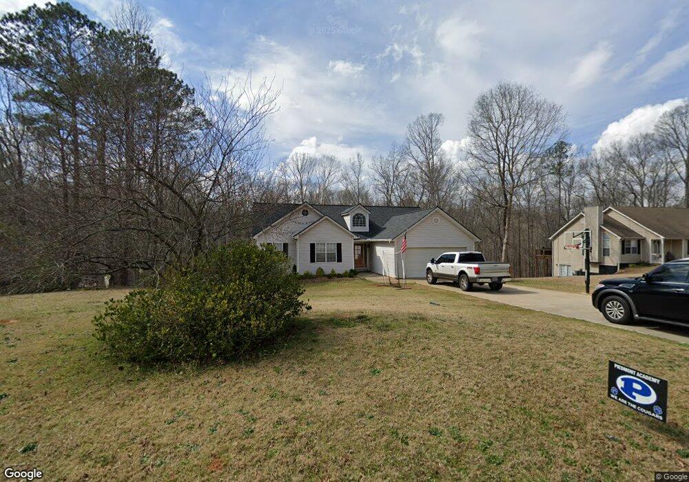
137 Kimbell Farm Dr Unit III Locust Grove, GA 30248
Estimated Value: $304,526 - $329,000
3
Beds
3
Baths
1,825
Sq Ft
$174/Sq Ft
Est. Value
About This Home
This home is located at 137 Kimbell Farm Dr Unit III, Locust Grove, GA 30248 and is currently estimated at $317,382, approximately $173 per square foot. 137 Kimbell Farm Dr Unit III is a home located in Henry County with nearby schools including Unity Grove Elementary School, Locust Grove Middle School, and Locust Grove High School.
Ownership History
Date
Name
Owned For
Owner Type
Purchase Details
Closed on
Apr 3, 2018
Sold by
Federal National Mortgage Association
Bought by
Mccurry Lindsey
Current Estimated Value
Home Financials for this Owner
Home Financials are based on the most recent Mortgage that was taken out on this home.
Original Mortgage
$144,121
Outstanding Balance
$124,563
Interest Rate
4.75%
Mortgage Type
FHA
Estimated Equity
$192,819
Purchase Details
Closed on
Dec 5, 2017
Sold by
Nationstar Mtg Llc
Bought by
Federal National Mtg Associati
Purchase Details
Closed on
Oct 9, 2002
Sold by
Suburban Builders Innc
Bought by
Dacus Lester L and Dacus Myrtie G
Create a Home Valuation Report for This Property
The Home Valuation Report is an in-depth analysis detailing your home's value as well as a comparison with similar homes in the area
Home Values in the Area
Average Home Value in this Area
Purchase History
| Date | Buyer | Sale Price | Title Company |
|---|---|---|---|
| Mccurry Lindsey | -- | -- | |
| Mccurry Lindsey | -- | -- | |
| Federal National Mtg Associati | -- | -- | |
| Nationstar Mtg Llc | $142,337 | -- | |
| Federal National Mtg Associati | -- | -- | |
| Nationstar Mtg Llc | $142,337 | -- | |
| Dacus Lester L | $138,200 | -- | |
| Dacus Lester L | $138,200 | -- |
Source: Public Records
Mortgage History
| Date | Status | Borrower | Loan Amount |
|---|---|---|---|
| Open | Mccurry Lindsey | $144,121 |
Source: Public Records
Tax History Compared to Growth
Tax History
| Year | Tax Paid | Tax Assessment Tax Assessment Total Assessment is a certain percentage of the fair market value that is determined by local assessors to be the total taxable value of land and additions on the property. | Land | Improvement |
|---|---|---|---|---|
| 2025 | $3,955 | $136,320 | $14,000 | $122,320 |
| 2024 | $3,955 | $128,120 | $14,000 | $114,120 |
| 2023 | $3,228 | $123,520 | $14,000 | $109,520 |
| 2022 | $3,214 | $101,560 | $14,000 | $87,560 |
| 2021 | $2,852 | $86,240 | $14,000 | $72,240 |
| 2020 | $2,546 | $73,280 | $12,000 | $61,280 |
| 2019 | $2,762 | $70,960 | $12,000 | $58,960 |
| 2018 | $2,481 | $63,640 | $10,800 | $52,840 |
| 2016 | $603 | $60,560 | $10,000 | $50,560 |
| 2015 | $647 | $55,480 | $10,000 | $45,480 |
| 2014 | -- | $53,160 | $10,000 | $43,160 |
Source: Public Records
Map
Nearby Homes
- 143 Kimbell Farm Dr
- 218 Baxter Ln
- 521 Deadwood Trail
- 601 Amerigo Ct
- 100 Harbin Trail
- 121, 125, 129 Case Dr
- 1000 Coan Dr
- 1126 Old Jackson Rd
- 604 Onieda Dr
- 281 Laney Dr
- 995 Old Jackson Rd
- 705 Seabolt Rd
- 705 S Bethany Rd
- 678 Seabolt Rd
- 215 Laney Rd
- 165 Caraway Rd
- 1850 Old Jackson Rd
- 767 Old Jackson Rd
- 125 Laney Ct
- 201 Nina Cir
- 137 Kimbell Farm Dr
- 139 Kimbell Farm Dr
- 139 Kimbell Farm Dr Unit III
- 141 Kimbell Farm Dr Unit III
- 136 Kimbell Farm Dr
- 136 Kimbell Farm Dr Unit III
- 138 Kimbell Farm Dr
- 138 Kimbell Farm Dr Unit III
- 133 Kimbell Farm Dr
- 140 Kimbell Farm Dr
- 415 Kimbell Way
- 131 Kimbell Farm Dr
- 142 Kimbell Farm Dr
- 400 Kimbell Way Unit 17
- 400 Kimbell Way Unit 400
- 400 Kimbell Way
- 0 Kimbell Way Unit 7175288
- 145 Kimbell Farm Dr
- 420 Kimbell Way Unit 3
- 410 Kimbell Way Unit 410