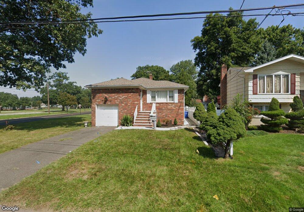
137 Maple St Colonia, NJ 07067
Estimated Value: $460,384 - $651,000
2
Beds
2
Baths
1,334
Sq Ft
$408/Sq Ft
Est. Value
About This Home
This home is located at 137 Maple St, Colonia, NJ 07067 and is currently estimated at $544,346, approximately $408 per square foot. 137 Maple St is a home located in Middlesex County with nearby schools including Oak Ridge Heights Elementary School, Colonia Middle School, and Colonia High School.
Ownership History
Date
Name
Owned For
Owner Type
Purchase Details
Closed on
Dec 14, 2017
Sold by
Green Sheral Scott and Green Frederick
Bought by
Wagner Brendan and Wagner Danielle
Current Estimated Value
Home Financials for this Owner
Home Financials are based on the most recent Mortgage that was taken out on this home.
Original Mortgage
$267,073
Outstanding Balance
$224,852
Interest Rate
3.94%
Mortgage Type
FHA
Estimated Equity
$319,494
Purchase Details
Closed on
Nov 25, 1992
Bought by
Scott Martha and Miller Viola
Create a Home Valuation Report for This Property
The Home Valuation Report is an in-depth analysis detailing your home's value as well as a comparison with similar homes in the area
Home Values in the Area
Average Home Value in this Area
Purchase History
| Date | Buyer | Sale Price | Title Company |
|---|---|---|---|
| Wagner Brendan | $272,000 | Chicago Title | |
| Scott Martha | $145,000 | -- |
Source: Public Records
Mortgage History
| Date | Status | Borrower | Loan Amount |
|---|---|---|---|
| Open | Wagner Brendan | $267,073 |
Source: Public Records
Tax History Compared to Growth
Tax History
| Year | Tax Paid | Tax Assessment Tax Assessment Total Assessment is a certain percentage of the fair market value that is determined by local assessors to be the total taxable value of land and additions on the property. | Land | Improvement |
|---|---|---|---|---|
| 2025 | $12,257 | $101,300 | $24,000 | $77,300 |
| 2024 | $10,796 | $101,300 | $24,000 | $77,300 |
| 2023 | $10,796 | $91,200 | $24,000 | $67,200 |
| 2022 | $10,528 | $91,200 | $24,000 | $67,200 |
| 2021 | $10,441 | $91,200 | $24,000 | $67,200 |
| 2020 | $9,938 | $89,500 | $24,000 | $65,500 |
| 2019 | $9,703 | $89,500 | $24,000 | $65,500 |
| 2018 | $9,518 | $89,500 | $24,000 | $65,500 |
| 2017 | $9,351 | $89,500 | $24,000 | $65,500 |
| 2016 | $9,278 | $89,500 | $24,000 | $65,500 |
| 2015 | $9,116 | $89,500 | $24,000 | $65,500 |
| 2014 | $8,920 | $89,500 | $24,000 | $65,500 |
Source: Public Records
Map
Nearby Homes
- 3 Mckinley Ave
- 99 Cameo Place
- 49 Cleveland Ave
- 25 N Lincoln Ave
- 70 Lancaster Rd
- 80 Mckinley Ave
- 116 Arthur Ave
- 150 Carolyn Ave
- 115 Mckinley Ave
- 24 Frederick Ave
- 19 State St
- 131 Morningside Rd
- 78 Patricia Ave
- 5 Elizabeth Ct
- 80 Gaywood Ave
- 17 Rolling Hill Way
- 27 Stemmer Dr
- 836 W Inman Ave
- 86 Normandy Rd
- 47 Marlboro Ln