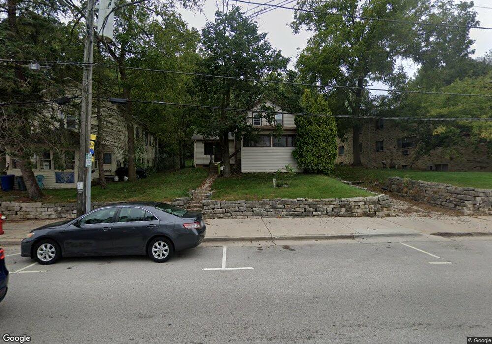
137 North Ave Hartland, WI 53029
Estimated Value: $269,000 - $343,000
4
Beds
1
Bath
1,092
Sq Ft
$290/Sq Ft
Est. Value
About This Home
This home is located at 137 North Ave, Hartland, WI 53029 and is currently estimated at $316,589, approximately $289 per square foot. 137 North Ave is a home with nearby schools including Arrowhead High School, St Charles Parish School, and Zion Lutheran School.
Ownership History
Date
Name
Owned For
Owner Type
Purchase Details
Closed on
Dec 16, 2020
Sold by
Behrend Property Llc
Bought by
Cutler Jason A
Current Estimated Value
Home Financials for this Owner
Home Financials are based on the most recent Mortgage that was taken out on this home.
Original Mortgage
$166,450
Outstanding Balance
$148,190
Interest Rate
2.7%
Mortgage Type
New Conventional
Estimated Equity
$168,399
Purchase Details
Closed on
Jun 27, 2018
Sold by
Behrend James R and Behrend Robert S
Bought by
Behredn Properyt Llc
Purchase Details
Closed on
Aug 9, 2013
Sold by
Behrend Ruth R
Bought by
Ruth R Behrend 2005 Living Trust
Create a Home Valuation Report for This Property
The Home Valuation Report is an in-depth analysis detailing your home's value as well as a comparison with similar homes in the area
Home Values in the Area
Average Home Value in this Area
Purchase History
| Date | Buyer | Sale Price | Title Company |
|---|---|---|---|
| Cutler Jason A | $180,000 | None Available | |
| Behredn Properyt Llc | $157,500 | None Available | |
| Ruth R Behrend 2005 Living Trust | -- | None Available |
Source: Public Records
Mortgage History
| Date | Status | Borrower | Loan Amount |
|---|---|---|---|
| Open | Cutler Jason A | $166,450 |
Source: Public Records
Tax History Compared to Growth
Tax History
| Year | Tax Paid | Tax Assessment Tax Assessment Total Assessment is a certain percentage of the fair market value that is determined by local assessors to be the total taxable value of land and additions on the property. | Land | Improvement |
|---|---|---|---|---|
| 2024 | $2,696 | $247,400 | $73,800 | $173,600 |
| 2023 | $2,546 | $247,400 | $73,800 | $173,600 |
| 2022 | $2,282 | $175,800 | $62,000 | $113,800 |
| 2021 | $2,111 | $158,600 | $62,000 | $96,600 |
| 2020 | $2,079 | $158,600 | $62,000 | $96,600 |
| 2019 | $2,112 | $158,600 | $62,000 | $96,600 |
| 2018 | $2,265 | $148,700 | $60,900 | $87,800 |
| 2017 | $2,554 | $148,700 | $60,900 | $87,800 |
| 2016 | $2,438 | $148,700 | $60,900 | $87,800 |
| 2015 | $2,535 | $148,700 | $60,900 | $87,800 |
| 2014 | $2,444 | $148,700 | $60,900 | $87,800 |
| 2013 | $2,444 | $148,300 | $50,800 | $97,500 |
Source: Public Records
Map
Nearby Homes
- 345 Cottonwood Ave
- 310 Paradise Ct
- 286 Hazel Ln
- Pcl2 Hill St
- W305N5260 Gail Ln
- 459 Sunset Trail Unit 2
- 222 Granary Cir
- N53W30509 Arrowhead Dr
- 447 Merton Ave
- 4821 Easy St Unit 8
- 508 Merton Ave
- 732 River Reserve Dr
- 901 Anton Rd
- W312N4890 Chapel Ridge Rd
- W308N5576 Windrise Cir
- 617 Coventry Ln
- 733 Cardiff Ct
- 328 Hemlock Ct
- 3911 Campbell Trace
- 4848 Wisconsin 83