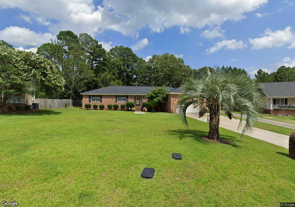
137 Oxford Commons Way Columbia, SC 29209
Southeast Columbia NeighborhoodEstimated Value: $251,000 - $262,000
3
Beds
2
Baths
2,155
Sq Ft
$119/Sq Ft
Est. Value
About This Home
This home is located at 137 Oxford Commons Way, Columbia, SC 29209 and is currently estimated at $255,828, approximately $118 per square foot. 137 Oxford Commons Way is a home located in Richland County with nearby schools including Caughman Road Elementary School, Hopkins Middle School, and Lower Richland High School.
Ownership History
Date
Name
Owned For
Owner Type
Purchase Details
Closed on
Jan 24, 2020
Sold by
Trakas Justin E
Bought by
Doyle Stephanie
Current Estimated Value
Home Financials for this Owner
Home Financials are based on the most recent Mortgage that was taken out on this home.
Original Mortgage
$128,205
Outstanding Balance
$112,494
Interest Rate
3.25%
Mortgage Type
FHA
Estimated Equity
$143,334
Purchase Details
Closed on
Nov 11, 2017
Sold by
Trakas Justin E and Estate Of Billy E Trakas
Bought by
Trakas Justin E
Create a Home Valuation Report for This Property
The Home Valuation Report is an in-depth analysis detailing your home's value as well as a comparison with similar homes in the area
Home Values in the Area
Average Home Value in this Area
Purchase History
| Date | Buyer | Sale Price | Title Company |
|---|---|---|---|
| Doyle Stephanie | $140,000 | None Available | |
| Trakas Justin E | -- | None Available |
Source: Public Records
Mortgage History
| Date | Status | Borrower | Loan Amount |
|---|---|---|---|
| Open | Doyle Stephanie | $128,205 |
Source: Public Records
Tax History Compared to Growth
Tax History
| Year | Tax Paid | Tax Assessment Tax Assessment Total Assessment is a certain percentage of the fair market value that is determined by local assessors to be the total taxable value of land and additions on the property. | Land | Improvement |
|---|---|---|---|---|
| 2024 | $1,460 | $161,000 | $0 | $0 |
| 2023 | $1,401 | $5,600 | $0 | $0 |
| 2022 | $1,271 | $140,000 | $20,000 | $120,000 |
| 2021 | $1,272 | $5,600 | $0 | $0 |
| 2020 | $3,724 | $7,530 | $0 | $0 |
| 2019 | $3,704 | $7,530 | $0 | $0 |
| 2018 | $3,253 | $6,550 | $0 | $0 |
| 2017 | $661 | $4,360 | $0 | $0 |
| 2016 | $1,007 | $4,360 | $0 | $0 |
| 2015 | $981 | $4,360 | $0 | $0 |
| 2014 | $952 | $109,100 | $0 | $0 |
| 2013 | -- | $4,360 | $0 | $0 |
Source: Public Records
Map
Nearby Homes
- 284 Vermillion Dr
- 3121 Ulmer Rd
- 8613 Maywood Dr
- 311 Vermillion Dr
- 96 Ligustrum Ln
- 81 Ridge Lake Dr
- 2812 Cliffside Dr
- 114 Mallard Landing Way
- 2701 Cliffside Dr
- 3632 Trotter Rd
- 1 Gardenwood Ct
- 4 Gardenwood Ct
- 7308 Teague Rd
- 2 Southbury Dr
- 21 Twin Oaks Cir
- 3853 Lochmore Dr
- 201 Twin Oaks Ln
- 2183 Elmridge Rd
- 372 Sandbach Rd
- 104 Crestmore Dr
- 133 Oxford Commons Way
- 141 Oxford Commons Way
- 209 Shropshire Dr
- 6 Landrace Ct
- 145 Oxford Commons Way
- 8 Landrace Ct
- 4 Landrace Ct
- 207 Shropshire Dr
- 129 Oxford Commons Way
- 206 Shropshire Dr
- 120 Oxford Commons Way
- 120 Oxford Commons Way
- 128 Oxford Commons Way
- 124 Oxford Commons Way
- 110 Montadale Dr
- 116 Oxford Commons Way
- 10 Landrace Ct
- 205 Shropshire Dr
- 125 Oxford Commons Way
- 204 Shropshire Dr