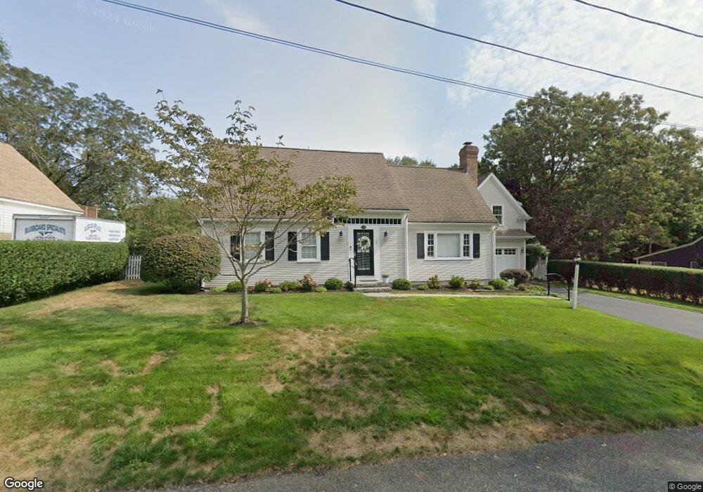
137 Pheasant Way Centerville, MA 02632
Centerville NeighborhoodEstimated Value: $872,855 - $985,000
3
Beds
3
Baths
1,801
Sq Ft
$523/Sq Ft
Est. Value
About This Home
This home is located at 137 Pheasant Way, Centerville, MA 02632 and is currently estimated at $941,714, approximately $522 per square foot. 137 Pheasant Way is a home located in Barnstable County with nearby schools including Centerville Elementary School, Barnstable United Elementary School, and Barnstable Intermediate School.
Ownership History
Date
Name
Owned For
Owner Type
Purchase Details
Closed on
Dec 4, 2024
Sold by
Jones Darlene and Jones Donald R
Bought by
Jones Ret and Jones
Current Estimated Value
Purchase Details
Closed on
Mar 23, 2001
Sold by
Crawford John D and Crawford Sarah G
Bought by
Jones Donald R
Purchase Details
Closed on
Feb 4, 1998
Sold by
Johnson Robert M
Bought by
Crawford Ii Johnd
Purchase Details
Closed on
May 31, 1996
Sold by
Castiello Thomas J and Castiello Frances E
Bought by
Johnson Robert M
Purchase Details
Closed on
Dec 31, 1990
Sold by
Bosworth Warren C
Bought by
Costiello Thomas J
Create a Home Valuation Report for This Property
The Home Valuation Report is an in-depth analysis detailing your home's value as well as a comparison with similar homes in the area
Home Values in the Area
Average Home Value in this Area
Purchase History
| Date | Buyer | Sale Price | Title Company |
|---|---|---|---|
| Jones Ret | -- | None Available | |
| Jones Ret | -- | None Available | |
| Jones Donald R | $295,000 | -- | |
| Crawford Ii Johnd | $106,000 | -- | |
| Johnson Robert M | $85,500 | -- | |
| Jones Donald R | $295,000 | -- | |
| Crawford Johnd | $106,000 | -- | |
| Johnson Robert M | $85,500 | -- | |
| Costiello Thomas J | $118,000 | -- |
Source: Public Records
Mortgage History
| Date | Status | Borrower | Loan Amount |
|---|---|---|---|
| Previous Owner | Costiello Thomas J | $207,850 |
Source: Public Records
Tax History
| Year | Tax Paid | Tax Assessment Tax Assessment Total Assessment is a certain percentage of the fair market value that is determined by local assessors to be the total taxable value of land and additions on the property. | Land | Improvement |
|---|---|---|---|---|
| 2025 | $7,199 | $889,900 | $249,300 | $640,600 |
| 2024 | $6,756 | $865,000 | $249,300 | $615,700 |
| 2023 | $6,701 | $803,500 | $246,700 | $556,800 |
| 2022 | $6,196 | $642,700 | $158,000 | $484,700 |
| 2021 | $6,248 | $595,600 | $167,900 | $427,700 |
| 2020 | $6,354 | $579,700 | $177,800 | $401,900 |
| 2019 | $6,269 | $555,800 | $187,600 | $368,200 |
| 2018 | $5,813 | $518,100 | $187,100 | $331,000 |
| 2017 | $5,286 | $491,300 | $192,300 | $299,000 |
| 2016 | $5,391 | $494,600 | $195,600 | $299,000 |
| 2015 | $5,407 | $498,300 | $186,600 | $311,700 |
Source: Public Records
Map
Nearby Homes
- 156 S Main St
- 290 Riverview Ln
- 443 Elliott Rd
- 180 Pond View Dr
- 40 Sachem Dr
- 498 Elliott Rd
- 103 Pine Tree Dr
- 52 Meadow Farm Rd
- 53 Meadow Farm Rd
- 1060 Craigville Beach Rd
- 576 Strawberry Hill Rd
- 33 Edgewood Rd
- 19 Marrick Ct
- 780 Craigville Beach Rd Unit D-2
- 780 Craigville Beach Rd Unit 1
- 780 Craigville Beach Rd
- 83 Lake Dr
- 10 Sail a Way
- 10 Sail -A-way
- 12 S Cedar Rd
- 127 Pheasant Way
- 117 S Main St
- 138 Pheasant Way
- 107 S Main St
- 130 Pheasant Way
- 129 S Main St
- 22 Partridge Way
- 89 S Main St
- 89 S Main St Unit B1
- 128 S Main St
- 139 S Main St
- 75 S Main St
- 45 Partridge Way
- 12 Partridge Way
- 33 Partridge Way
- 107 Pheasant Way
- 138 S Main St
- 7 Pheasant Way
- 18 Pheasant Way
- 5 Cedar Point Cir
Your Personal Tour Guide
Ask me questions while you tour the home.