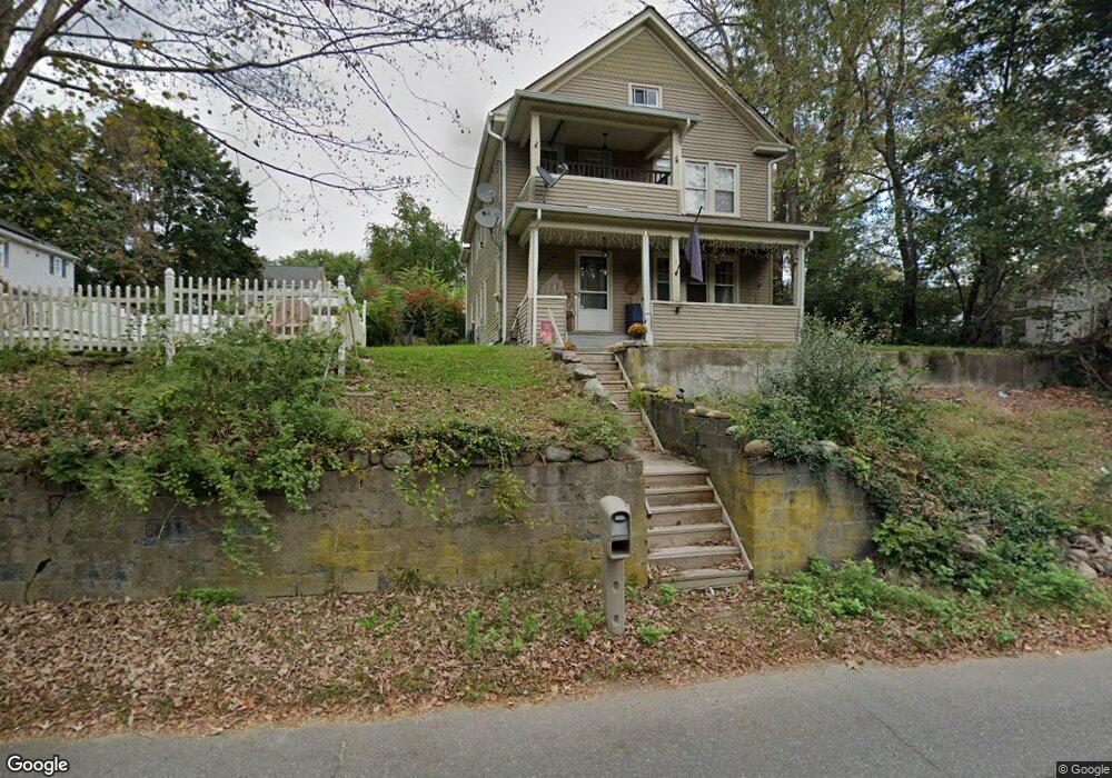
137 Platts Mill Rd Naugatuck, CT 06770
Estimated Value: $310,516 - $428,000
4
Beds
2
Baths
2,104
Sq Ft
$176/Sq Ft
Est. Value
About This Home
This home is located at 137 Platts Mill Rd, Naugatuck, CT 06770 and is currently estimated at $370,379, approximately $176 per square foot. 137 Platts Mill Rd is a home located in New Haven County with nearby schools including City Hill Middle School, Naugatuck High School, and Our Lady Of Mount Carmel School.
Ownership History
Date
Name
Owned For
Owner Type
Purchase Details
Closed on
Dec 30, 1999
Sold by
Naug Valley S & L
Bought by
Justice Elizabeth and Justice Leah
Current Estimated Value
Home Financials for this Owner
Home Financials are based on the most recent Mortgage that was taken out on this home.
Original Mortgage
$117,035
Outstanding Balance
$39,435
Interest Rate
7.71%
Mortgage Type
Purchase Money Mortgage
Estimated Equity
$330,944
Purchase Details
Closed on
May 6, 1994
Sold by
Houlihan Thomas and Houlihan Gary
Bought by
Houlihan Robert
Home Financials for this Owner
Home Financials are based on the most recent Mortgage that was taken out on this home.
Original Mortgage
$100,000
Interest Rate
7.75%
Mortgage Type
Purchase Money Mortgage
Create a Home Valuation Report for This Property
The Home Valuation Report is an in-depth analysis detailing your home's value as well as a comparison with similar homes in the area
Home Values in the Area
Average Home Value in this Area
Purchase History
| Date | Buyer | Sale Price | Title Company |
|---|---|---|---|
| Justice Elizabeth | $118,000 | -- | |
| Houlihan Robert | $70,000 | -- |
Source: Public Records
Mortgage History
| Date | Status | Borrower | Loan Amount |
|---|---|---|---|
| Open | Houlihan Robert | $117,035 | |
| Previous Owner | Houlihan Robert | $100,000 | |
| Previous Owner | Houlihan Robert | $15,000 |
Source: Public Records
Tax History
| Year | Tax Paid | Tax Assessment Tax Assessment Total Assessment is a certain percentage of the fair market value that is determined by local assessors to be the total taxable value of land and additions on the property. | Land | Improvement |
|---|---|---|---|---|
| 2025 | $6,785 | $170,520 | $28,840 | $141,680 |
| 2024 | $7,126 | $170,520 | $28,840 | $141,680 |
| 2023 | $7,631 | $170,520 | $28,840 | $141,680 |
| 2022 | $6,367 | $133,330 | $31,100 | $102,230 |
| 2021 | $6,367 | $133,330 | $31,100 | $102,230 |
| 2020 | $6,325 | $132,470 | $31,100 | $101,370 |
| 2019 | $6,259 | $132,470 | $31,100 | $101,370 |
| 2018 | $5,421 | $112,110 | $37,420 | $74,690 |
| 2017 | $5,443 | $112,110 | $37,420 | $74,690 |
| 2016 | $5,344 | $112,110 | $37,420 | $74,690 |
| 2015 | $5,109 | $112,110 | $37,420 | $74,690 |
| 2014 | $5,052 | $112,110 | $37,420 | $74,690 |
| 2012 | $5,952 | $177,400 | $47,250 | $130,150 |
Source: Public Records
Map
Nearby Homes
- 69 Nancy Ln
- 461 Spring St Unit 9G
- 461 Spring St Unit 9E
- 111 Mallane Ln Unit 14B
- 55 Porter Ave Unit 6E
- 14 Washington St
- 0 Field St Unit 170385250
- 32 Greenwood St
- 925 Oronoke Rd Unit 100I
- 925 Oronoke Rd Unit 36C
- 22 Neagle St
- 465 N Main St
- 350 Bristol St Unit C1
- 350 Bristol St Unit A-6
- 146 Coach Cir Unit 3
- 32 Stanley St
- 545 N Church St
- 855 Oronoke Rd Unit 2
- 20 Alpine Ave
- 18 Bridge St Unit 1O
- 145 Platts Mill Rd
- 133 Platts Mill Rd
- 11 Sande Ave
- 5 Sande Ave
- 3 Sande Ave Unit 3
- 3 Sande Ave
- 1 Sande Ave Unit 1
- 1 Sande Ave
- 96 Radnor Ave
- 98 Radnor Ave
- 76 Radnor Ave
- 104 Radnor Ave
- 2 Sande Ave
- 8 Sande Ave
- 68 Radnor Ave
- 114 Radnor Ave
- 169 Platts Mill Rd
- 113 Platts Mill Rd
- 87 Radnor Ave
- 97 Radnor Ave
Your Personal Tour Guide
Ask me questions while you tour the home.