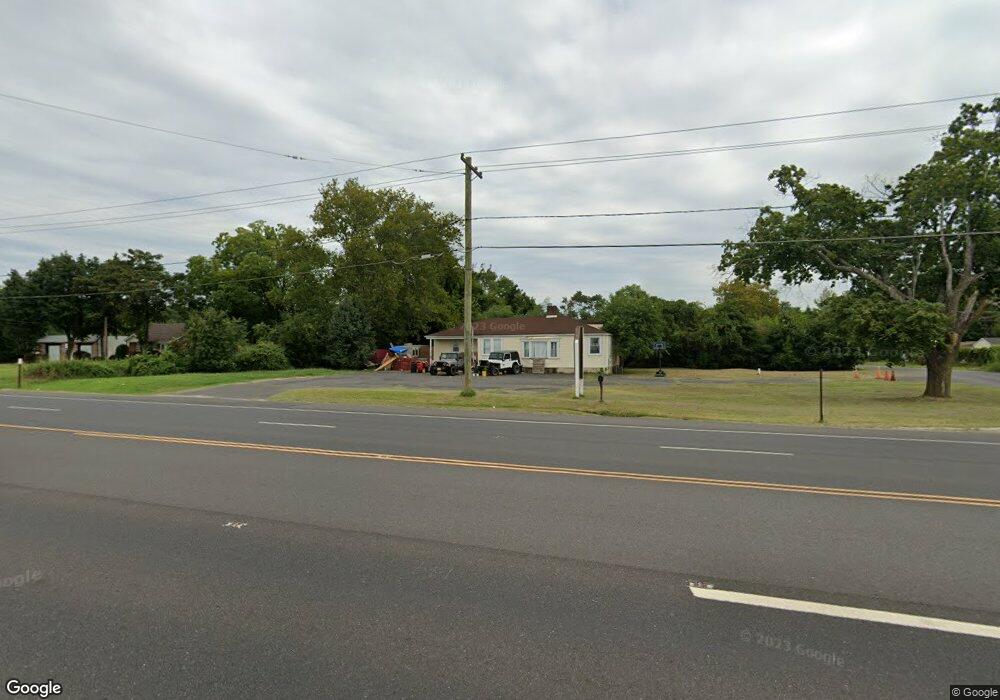
137 Route 530 Southampton, NJ 08088
3
Beds
2
Baths
--
Sq Ft
0.49
Acres
About This Home
This home is located at 137 Route 530, Southampton, NJ 08088. 137 Route 530 is a home located in Burlington County with nearby schools including Southampton Twp School No 1, Southampton Twp School No 2, and Southampton Twp School No 3.
Ownership History
Date
Name
Owned For
Owner Type
Purchase Details
Closed on
Jul 14, 1988
Bought by
Loria Bruce
Create a Home Valuation Report for This Property
The Home Valuation Report is an in-depth analysis detailing your home's value as well as a comparison with similar homes in the area
Home Values in the Area
Average Home Value in this Area
Purchase History
| Date | Buyer | Sale Price | Title Company |
|---|---|---|---|
| Loria Bruce | $37,600 | -- |
Source: Public Records
Tax History Compared to Growth
Tax History
| Year | Tax Paid | Tax Assessment Tax Assessment Total Assessment is a certain percentage of the fair market value that is determined by local assessors to be the total taxable value of land and additions on the property. | Land | Improvement |
|---|---|---|---|---|
| 2025 | $6,370 | $193,100 | $70,400 | $122,700 |
| 2024 | $6,135 | $193,100 | $70,400 | $122,700 |
| 2023 | $6,135 | $193,100 | $70,400 | $122,700 |
| 2022 | $5,919 | $193,100 | $70,400 | $122,700 |
| 2021 | $5,659 | $193,100 | $70,400 | $122,700 |
| 2020 | $5,662 | $193,100 | $70,400 | $122,700 |
| 2019 | $5,540 | $193,100 | $70,400 | $122,700 |
| 2018 | $5,411 | $193,100 | $70,400 | $122,700 |
| 2017 | $5,430 | $193,100 | $70,400 | $122,700 |
| 2016 | $5,314 | $193,100 | $70,400 | $122,700 |
| 2015 | $5,229 | $196,200 | $73,500 | $122,700 |
| 2014 | $5,044 | $196,200 | $73,500 | $122,700 |
Source: Public Records
Map
Nearby Homes
- 19 Sunset Blvd
- 335 Birmingham Rd
- 331 Birmingham Rd
- 176 S Pemberton Rd
- 59 Estates Dr
- 2405 Route 206
- 38 North Rd
- 68 Brandywine Rd
- 195 N Pemberton Rd
- 26 Nicholas St
- 38 Hearthstone Blvd
- 0 Pemberton Vincentown Rd
- 120 Hanover St
- 60 Hanover St
- 0 Ongs Hat Rd Unit NJBL2021664
- 51 Egbert St
- 121 Jane St
- 0 N Pemberton Rd Unit NJBL2097176
- 6 Mulberry Ln
- 141 Arneys Mount Rd
- 703 Washington St
- 707 Washington St
- 709 Washington St
- 207 Route 530
- 207 Route 530 Unit 2B
- 718 Washington St
- 127 Route 530
- 721 Washington St
- 722 Washington St
- 123 Route 530
- 723 Washington St
- 121 Route 530
- 709 Lucas Ln
- 705 Lucas Ln
- 209 Cedar St
- 724 Maple Ave
- 210 Cedar St
- 711 Lucas Ln
- 118 Cherry St
- 726 Maple Ave