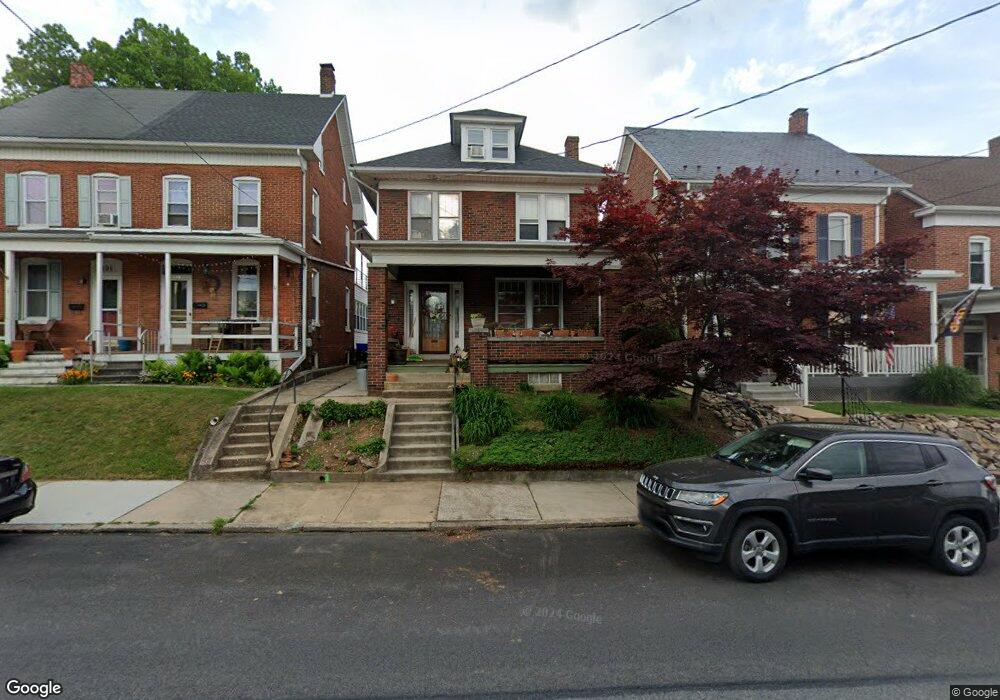
137 S Walnut St Dallastown, PA 17313
Estimated Value: $189,000 - $218,000
3
Beds
2
Baths
1,352
Sq Ft
$148/Sq Ft
Est. Value
About This Home
This home is located at 137 S Walnut St, Dallastown, PA 17313 and is currently estimated at $200,678, approximately $148 per square foot. 137 S Walnut St is a home located in York County with nearby schools including Dallastown Elementary School, Dallastown Area Middle School, and Dallastown Area High School.
Ownership History
Date
Name
Owned For
Owner Type
Purchase Details
Closed on
Sep 14, 2007
Sold by
Krout Robert A and Krout Nancy E
Bought by
Cawthorne David and Harding Cawthorne Jennifer
Current Estimated Value
Home Financials for this Owner
Home Financials are based on the most recent Mortgage that was taken out on this home.
Original Mortgage
$132,000
Outstanding Balance
$84,129
Interest Rate
6.7%
Mortgage Type
Purchase Money Mortgage
Estimated Equity
$116,549
Create a Home Valuation Report for This Property
The Home Valuation Report is an in-depth analysis detailing your home's value as well as a comparison with similar homes in the area
Home Values in the Area
Average Home Value in this Area
Purchase History
| Date | Buyer | Sale Price | Title Company |
|---|---|---|---|
| Cawthorne David | $165,000 | None Available |
Source: Public Records
Mortgage History
| Date | Status | Borrower | Loan Amount |
|---|---|---|---|
| Open | Cawthorne David | $132,000 |
Source: Public Records
Tax History Compared to Growth
Tax History
| Year | Tax Paid | Tax Assessment Tax Assessment Total Assessment is a certain percentage of the fair market value that is determined by local assessors to be the total taxable value of land and additions on the property. | Land | Improvement |
|---|---|---|---|---|
| 2025 | $3,358 | $96,670 | $19,860 | $76,810 |
| 2024 | $3,358 | $96,670 | $19,860 | $76,810 |
| 2023 | $3,358 | $96,670 | $19,860 | $76,810 |
| 2022 | $3,251 | $96,670 | $19,860 | $76,810 |
| 2021 | $3,065 | $96,670 | $19,860 | $76,810 |
| 2020 | $3,065 | $96,670 | $19,860 | $76,810 |
| 2019 | $3,056 | $96,670 | $19,860 | $76,810 |
| 2018 | $3,056 | $96,670 | $19,860 | $76,810 |
| 2017 | $2,937 | $96,670 | $19,860 | $76,810 |
| 2016 | $0 | $96,670 | $19,860 | $76,810 |
| 2015 | -- | $96,670 | $19,860 | $76,810 |
| 2014 | -- | $96,670 | $19,860 | $76,810 |
Source: Public Records
Map
Nearby Homes
- 122 S Pleasant Ave
- 64 S Pleasant Ave
- 106 Teila Dr
- 0 S Franklin St
- 136 Teila Dr
- 355 W Main St
- 435 Frederick Dr
- 56 E Frederick St
- 428 W Main St
- 424 Dartha Dr
- 732 Blossom Hill Ln
- 0 Gary Dr
- 774 Blossom Hill Ln
- 74 S Main St
- 260 Country Ridge Dr
- 2933 Exeter Dr S
- 211 Country Ridge Dr
- 2925 Starfire Dr
- 2960 Starfire Dr
- 156 Country Ridge Dr
- 133 S Walnut St
- 139 S Walnut St
- 131 S Walnut St
- 141 S Walnut St
- 127 S Walnut St
- 125 S Walnut St
- 123 S Walnut St
- 121 S Walnut St
- 180 Devers St
- 117 S Walnut St
- 190 Devers St Unit 1
- 190 Devers St
- 0 E Queen St
- 170 Devers St
- 138 S Walnut St
- 136 S Walnut St
- 115 S Walnut St
- 142 S Walnut St
- 134 S Walnut St
- 132 S Walnut St