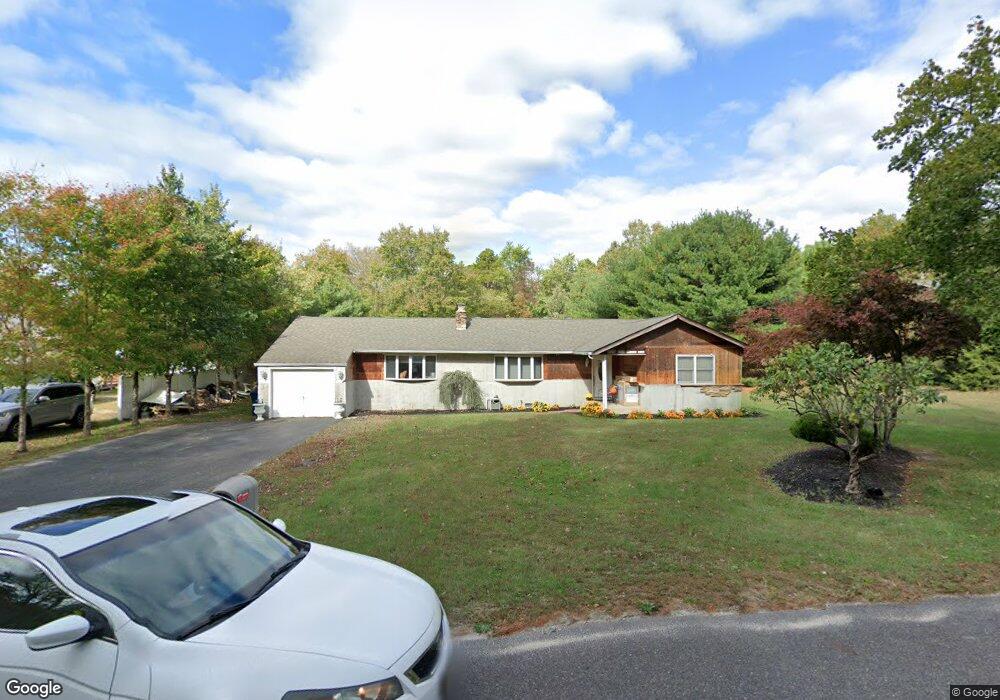
137 Sharp Rd Williamstown, NJ 08094
Monroe Township Gloucester NeighborhoodEstimated Value: $366,000 - $439,000
Studio
--
Bath
1,764
Sq Ft
$227/Sq Ft
Est. Value
About This Home
This home is located at 137 Sharp Rd, Williamstown, NJ 08094 and is currently estimated at $401,092, approximately $227 per square foot. 137 Sharp Rd is a home located in Gloucester County with nearby schools including Williamstown High School and Finest of the Wheat Christian.
Ownership History
Date
Name
Owned For
Owner Type
Purchase Details
Closed on
Jul 27, 2001
Sold by
Morrell Louis
Bought by
Ognissanti Cheryl
Current Estimated Value
Home Financials for this Owner
Home Financials are based on the most recent Mortgage that was taken out on this home.
Original Mortgage
$102,812
Outstanding Balance
$39,960
Interest Rate
7.1%
Mortgage Type
Stand Alone First
Estimated Equity
$361,132
Create a Home Valuation Report for This Property
The Home Valuation Report is an in-depth analysis detailing your home's value as well as a comparison with similar homes in the area
Home Values in the Area
Average Home Value in this Area
Purchase History
| Date | Buyer | Sale Price | Title Company |
|---|---|---|---|
| Ognissanti Cheryl | $117,500 | -- |
Source: Public Records
Mortgage History
| Date | Status | Borrower | Loan Amount |
|---|---|---|---|
| Open | Ognissanti Cheryl | $102,812 |
Source: Public Records
Tax History
| Year | Tax Paid | Tax Assessment Tax Assessment Total Assessment is a certain percentage of the fair market value that is determined by local assessors to be the total taxable value of land and additions on the property. | Land | Improvement |
|---|---|---|---|---|
| 2025 | $6,731 | $183,800 | $49,600 | $134,200 |
| 2024 | $6,681 | $183,800 | $49,600 | $134,200 |
| 2023 | $6,681 | $183,800 | $49,600 | $134,200 |
| 2022 | $6,650 | $183,800 | $49,600 | $134,200 |
| 2021 | $6,692 | $183,800 | $49,600 | $134,200 |
| 2020 | $6,685 | $183,800 | $49,600 | $134,200 |
| 2019 | $6,644 | $183,800 | $49,600 | $134,200 |
| 2018 | $6,536 | $183,800 | $49,600 | $134,200 |
| 2017 | $7,148 | $201,800 | $43,900 | $157,900 |
| 2016 | $7,057 | $201,800 | $43,900 | $157,900 |
| 2015 | $6,855 | $201,800 | $43,900 | $157,900 |
| 2014 | $6,655 | $201,800 | $43,900 | $157,900 |
Source: Public Records
Map
Nearby Homes
- 0 Old Black Horse Park
- 3908 Jackson Rd
- 4440 S Black Horse Pike
- 3109 Jackson Rd
- 0 W Ave
- 3042 S Black Horse Pike
- 2954 S Black Horse Pike
- 0 Cains Mill Rd Unit 598493
- 0 Cains Mill Rd Unit NJAC2018898
- 121 Delwyn Ln
- 723 Bayberry Ln
- 107 Delwyn Ln
- 347 Orange Ln
- 105 Delwyn Ln
- 002 Castleton Dr
- 0 Whitehall Rd Unit NJGL2067450
- 003 Castleton Dr
- 004 Castleton Dr
- 710 Whitehall Rd
- 167 New Hope Ln
- 147 Sharp Rd
- 127 Sharp Rd
- 147 Sharp Rd
- 117 Sharp Rd
- 157 Sharp Rd
- 167 Sharp Rd
- 167 Sharps Rd
- 177 Sharp Rd
- 4027 S Black Horse Pike
- 187 Sharp Rd
- 3986 Monroe St
- 3914 S Black Horse Pike
- 3966 Monroe St
- 4055 S Black Horse Pike
- 211 Sharp Rd
- 3979 Monroe St
- 4028 S Black Horse Pike
- 3959 Monroe St
- 3953 Monroe St
- 3926 Monroe St
Your Personal Tour Guide
Ask me questions while you tour the home.