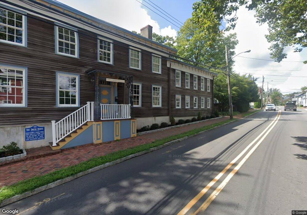
137 Stockton St Hightstown, NJ 08520
Estimated Value: $518,730
--
Bed
--
Bath
3,800
Sq Ft
$137/Sq Ft
Est. Value
About This Home
This home is located at 137 Stockton St, Hightstown, NJ 08520 and is currently estimated at $518,730, approximately $136 per square foot. 137 Stockton St is a home located in Mercer County with nearby schools including Melvin H. Kreps Middle School, Hightstown High School, and SciCore Academy.
Ownership History
Date
Name
Owned For
Owner Type
Purchase Details
Closed on
May 29, 2015
Sold by
Musing Dimitri and Musing Lisa
Bought by
Musing Dimitri
Current Estimated Value
Purchase Details
Closed on
Jul 20, 2005
Sold by
Flores Belen
Bought by
Musing Dimitri and Musing Lisa
Purchase Details
Closed on
Jun 25, 1999
Sold by
Lang Steven
Bought by
Flores Belen
Purchase Details
Closed on
Jan 26, 1998
Sold by
Corestates Bank
Bought by
Lang Steven
Purchase Details
Closed on
Jun 28, 1988
Sold by
Lipson Britt B
Bought by
Caplanson Constantino and Caplanson Mccort,Patr
Create a Home Valuation Report for This Property
The Home Valuation Report is an in-depth analysis detailing your home's value as well as a comparison with similar homes in the area
Home Values in the Area
Average Home Value in this Area
Purchase History
| Date | Buyer | Sale Price | Title Company |
|---|---|---|---|
| Musing Dimitri | $100,000 | Attorney | |
| Musing Dimitri | $330,000 | -- | |
| Flores Belen | $110,000 | -- | |
| Lang Steven | $55,000 | -- | |
| Caplanson Constantino | $207,500 | -- |
Source: Public Records
Tax History Compared to Growth
Tax History
| Year | Tax Paid | Tax Assessment Tax Assessment Total Assessment is a certain percentage of the fair market value that is determined by local assessors to be the total taxable value of land and additions on the property. | Land | Improvement |
|---|---|---|---|---|
| 2025 | $12,949 | $264,100 | $102,800 | $161,300 |
| 2024 | $12,817 | $264,100 | $102,800 | $161,300 |
| 2023 | $12,817 | $264,100 | $102,800 | $161,300 |
| 2022 | $12,373 | $264,100 | $102,800 | $161,300 |
| 2021 | $11,927 | $264,100 | $102,800 | $161,300 |
| 2020 | $11,655 | $264,100 | $102,800 | $161,300 |
| 2019 | $11,330 | $264,100 | $102,800 | $161,300 |
| 2018 | $11,000 | $264,100 | $102,800 | $161,300 |
| 2017 | $10,886 | $264,100 | $102,800 | $161,300 |
| 2016 | $10,791 | $264,100 | $102,800 | $161,300 |
| 2015 | $10,722 | $264,100 | $102,800 | $161,300 |
| 2014 | $10,791 | $264,100 | $102,800 | $161,300 |
Source: Public Records
Map
Nearby Homes
- 128 Monmouth St
- 104 1st Ave
- 302 S Main St
- 344 Monmouth St
- 201 Morrison Ave
- 219 Maxwell Ave
- 309 Lincoln Ave
- 336 Stockton St
- 23 Barton Dr
- 141 Lincoln Ave
- 365 Stockton St
- 145 Lincoln Ave
- 4 Brakeman Ct
- 5 Mill Run W
- 400 Stockton St
- 158 Mill Run E
- 164 Mill Run E Unit 141
- 108 Orchard Ave
- 15 Brownstone Rd
- 23 Powell Ct
- 130 Stockton St Unit 132
- 130 Stockton St
- 140 Stockton St
- 126 Stockton St
- 153 Stockton St Unit 157
- 144 Stockton St Unit 146
- 109 Forman St
- 136 Stockton St
- 115 Forman St
- 117 Forman St
- 148 Stockton St Unit 150
- 119 Forman St
- 159 Stockton St
- 110 Main St
- 148-150 Stockton St
- 163 Stockton St
- 167 Stockton St Unit UPPER
- 167 Stockton St Unit LOWER
- 167 Stockton St Unit 169
- 114 Main St Unit 2ND FL