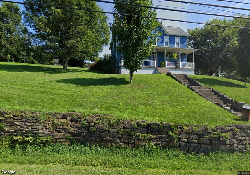
137 Tony Row Rd Perry Township - Fay, PA 15482
Perry Township NeighborhoodEstimated Value: $128,000 - $138,249
3
Beds
2
Baths
2,310
Sq Ft
$57/Sq Ft
Est. Value
About This Home
This home is located at 137 Tony Row Rd, Perry Township - Fay, PA 15482 and is currently estimated at $132,416, approximately $57 per square foot. 137 Tony Row Rd is a home located in Fayette County with nearby schools including Frazier High School.
Ownership History
Date
Name
Owned For
Owner Type
Purchase Details
Closed on
Nov 13, 2023
Sold by
Simmons Nena Taylor and Simmons David
Bought by
Mankin Michael Leslie
Current Estimated Value
Home Financials for this Owner
Home Financials are based on the most recent Mortgage that was taken out on this home.
Original Mortgage
$104,760
Outstanding Balance
$102,865
Interest Rate
7.31%
Mortgage Type
New Conventional
Estimated Equity
$29,551
Purchase Details
Closed on
Oct 31, 2013
Sold by
Carr Bobbi Jo and Estate Of Robert L Taylor
Bought by
Simmons Nena Taylor
Create a Home Valuation Report for This Property
The Home Valuation Report is an in-depth analysis detailing your home's value as well as a comparison with similar homes in the area
Home Values in the Area
Average Home Value in this Area
Purchase History
| Date | Buyer | Sale Price | Title Company |
|---|---|---|---|
| Mankin Michael Leslie | $108,000 | Penn Bridge Land Abstract | |
| Simmons Nena Taylor | -- | None Available |
Source: Public Records
Mortgage History
| Date | Status | Borrower | Loan Amount |
|---|---|---|---|
| Open | Mankin Michael Leslie | $104,760 |
Source: Public Records
Tax History Compared to Growth
Tax History
| Year | Tax Paid | Tax Assessment Tax Assessment Total Assessment is a certain percentage of the fair market value that is determined by local assessors to be the total taxable value of land and additions on the property. | Land | Improvement |
|---|---|---|---|---|
| 2025 | $1,347 | $41,735 | $8,100 | $33,635 |
| 2024 | $1,278 | $41,735 | $8,100 | $33,635 |
| 2023 | $2,412 | $41,735 | $8,100 | $33,635 |
| 2022 | $2,332 | $41,735 | $8,100 | $33,635 |
| 2021 | $2,332 | $41,735 | $8,100 | $33,635 |
| 2020 | $2,272 | $41,735 | $8,100 | $33,635 |
| 2019 | $2,116 | $41,735 | $8,100 | $33,635 |
| 2018 | $2,065 | $41,735 | $8,100 | $33,635 |
| 2017 | $2,000 | $41,735 | $8,100 | $33,635 |
| 2016 | -- | $41,735 | $8,100 | $33,635 |
| 2015 | -- | $41,735 | $8,100 | $33,635 |
| 2014 | -- | $83,470 | $16,200 | $67,270 |
Source: Public Records
Map
Nearby Homes
- 198 Church St
- 0 Tony Row Rd
- 323 Main St
- 141 Grant St
- 320 Cemetery Rd
- 111 Strickler St
- 7 Indian Ln
- 201 Delafayette St
- 304 Liberty St
- 118 Constitution St
- 166 Barneys Rd
- 0 Curfew Rd
- 414 Liberty St
- 0 E Constitution St
- 185 Jefferson Dr
- 217 Virgin Run Rd
- Crabapple Ln
- 933 Fayette City Rd
- Tr 660 Linden Hall Lot Unit WP001
- 65 Sandrock Rd
- 121 Fayette City Rd
- 3249 Pittsburgh Rd
- 154-158 Tony Row
- 162 Tony Row
- 0 Rt51-Star Jct Unit 1046438
- 124/130 Diamond
- 217 1st St
- 0 Rt51-Star Jct Unit 1224049
- 117 Cemetery Rd
- 0 Route 51 Unit 1258703
- 0 Route 51 Unit 1259976
- 112 Church St
- 110 Greenfield Rd
- 0 Route 51 Unit 1319537
- 0 Route 51 Unit 1319536
- 3229 apx State Route 51 - Star Jct
- Old 51 Memorial Dr
- 114 & 116 Grant
- 119 Mattys Ln
- 0 Route 51 Unit 1413928