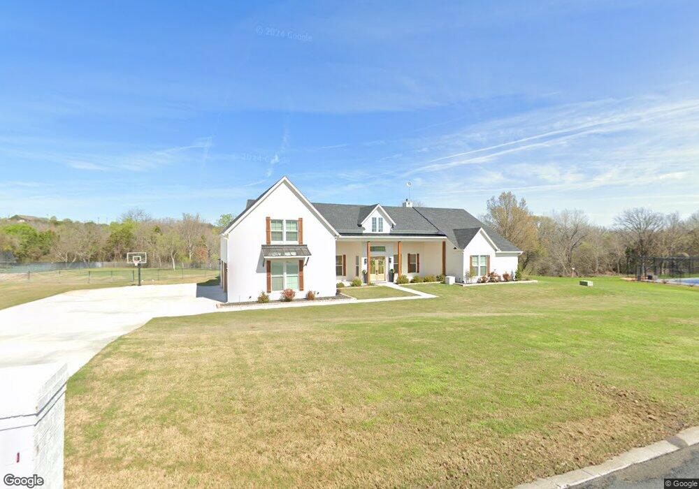
137 Top Flight Dr Weatherford, TX 76087
Estimated Value: $822,096 - $928,000
--
Bed
--
Bath
3,572
Sq Ft
$247/Sq Ft
Est. Value
About This Home
This home is located at 137 Top Flight Dr, Weatherford, TX 76087 and is currently estimated at $883,024, approximately $247 per square foot. 137 Top Flight Dr is a home with nearby schools including Brock Intermediate School, Brock Junior High School, and Brock High School.
Ownership History
Date
Name
Owned For
Owner Type
Purchase Details
Closed on
Jan 22, 2020
Sold by
Elian Properties Lp
Bought by
Eggleston Jack Bryan and Eggleston Jack
Current Estimated Value
Home Financials for this Owner
Home Financials are based on the most recent Mortgage that was taken out on this home.
Original Mortgage
$59,500
Outstanding Balance
$46,861
Interest Rate
3.73%
Mortgage Type
Future Advance Clause Open End Mortgage
Estimated Equity
$836,163
Purchase Details
Closed on
May 5, 2005
Sold by
Goff Aviation Inc
Bought by
Elian Properties Lp
Purchase Details
Closed on
Jan 20, 2003
Sold by
Canyon West Development Co Ltd
Bought by
Elian Properties Lp
Purchase Details
Closed on
Aug 7, 2001
Sold by
Mickle Wesley J
Bought by
Elian Properties Lp
Create a Home Valuation Report for This Property
The Home Valuation Report is an in-depth analysis detailing your home's value as well as a comparison with similar homes in the area
Home Values in the Area
Average Home Value in this Area
Purchase History
| Date | Buyer | Sale Price | Title Company |
|---|---|---|---|
| Eggleston Jack Bryan | -- | Providence Title Company | |
| Elian Properties Lp | -- | -- | |
| Elian Properties Lp | -- | -- | |
| Elian Properties Lp | -- | -- |
Source: Public Records
Mortgage History
| Date | Status | Borrower | Loan Amount |
|---|---|---|---|
| Open | Eggleston Jack Bryan | $59,500 |
Source: Public Records
Tax History Compared to Growth
Tax History
| Year | Tax Paid | Tax Assessment Tax Assessment Total Assessment is a certain percentage of the fair market value that is determined by local assessors to be the total taxable value of land and additions on the property. | Land | Improvement |
|---|---|---|---|---|
| 2025 | $11,847 | $779,131 | -- | -- |
| 2024 | $11,847 | $708,301 | -- | -- |
| 2023 | $11,847 | $643,910 | $0 | $0 |
| 2022 | $11,884 | $585,380 | $65,000 | $520,380 |
| 2021 | $5,832 | $273,150 | $65,000 | $208,150 |
| 2020 | $1,082 | $50,000 | $50,000 | $0 |
| 2019 | $1,165 | $50,000 | $50,000 | $0 |
| 2018 | $585 | $25,000 | $25,000 | $0 |
| 2017 | $575 | $25,000 | $25,000 | $0 |
| 2016 | $575 | $25,000 | $25,000 | $0 |
| 2015 | $568 | $25,000 | $25,000 | $0 |
| 2014 | $574 | $25,000 | $25,000 | $0 |
Source: Public Records
Map
Nearby Homes
- 234 Trail Ridge
- 113 Laser Ln
- 150 Top Flight Dr
- 125 Summer Stone Ct
- 123 Club House Dr
- 1060 Kessler Rd
- 101 Trail Ridge
- 120 Trail Ridge
- 162 Pinnacle Peak Ln
- 873 Canyon Creek Ln
- 197 Pinnacle Peak Ln
- 313 Canyon Creek Cir
- 205 Pinnacle Peak Ln
- 0 Quanah Hill Rd Unit 23872058
- 788 W Canyon Creek Ln
- 393 Canyon Creek Cir
- 833 N Savage Creek Ln
- TBA Old Brock Rd
- 151 Canyon Creek Ct
- 673 E Canyon Creek Ln
- 133 Top Flight Dr
- 130 Top Flight Dr
- 142 Top Flight Dr
- 174 Summer Stone Ct
- 173 Summer Stone Ct
- 126 Top Flight Dr
- 167 Summer Stone Ct
- 164 Summer Stone Ct
- 122 Top Flight Dr
- 121 Top Flight Dr
- 125 Top Flight Dr
- 161 Summer Stone Ct
- 154 Top Flight Dr
- 158 Top Flight Dr
- 156 Summer Stone Ct
- 117 Top Flight Dr
- 155 Summer Stone Ct
- 114 Top Flight Dr
- 108 Top Flight Dr
- 150 Summer Stone Ct