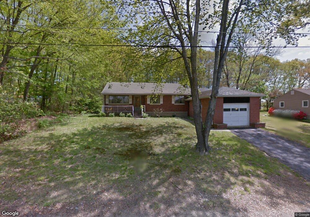
137 Tosun Rd Wolcott, CT 06716
Estimated Value: $560,107
--
Bed
--
Bath
13,865
Sq Ft
$40/Sq Ft
Est. Value
About This Home
This home is located at 137 Tosun Rd, Wolcott, CT 06716 and is currently estimated at $560,107, approximately $40 per square foot. 137 Tosun Rd is a home located in New Haven County with nearby schools including Tyrrell Middle School, Wolcott High School, and St Peter & Paul School.
Ownership History
Date
Name
Owned For
Owner Type
Purchase Details
Closed on
Aug 28, 2024
Sold by
31 Tosun Road Llc
Bought by
Pals Re Holdings Llc
Current Estimated Value
Home Financials for this Owner
Home Financials are based on the most recent Mortgage that was taken out on this home.
Original Mortgage
$403,125
Outstanding Balance
$398,845
Interest Rate
6.77%
Mortgage Type
Purchase Money Mortgage
Estimated Equity
$161,262
Purchase Details
Closed on
Feb 25, 1965
Bought by
31 Tosun Rd Llc
Create a Home Valuation Report for This Property
The Home Valuation Report is an in-depth analysis detailing your home's value as well as a comparison with similar homes in the area
Home Values in the Area
Average Home Value in this Area
Purchase History
| Date | Buyer | Sale Price | Title Company |
|---|---|---|---|
| Pals Re Holdings Llc | $537,500 | None Available | |
| Pals Re Holdings Llc | $537,500 | None Available | |
| 31 Tosun Rd Llc | -- | -- |
Source: Public Records
Mortgage History
| Date | Status | Borrower | Loan Amount |
|---|---|---|---|
| Open | Pals Re Holdings Llc | $403,125 | |
| Closed | Pals Re Holdings Llc | $403,125 | |
| Previous Owner | 31 Tosun Rd Llc | $60,000 |
Source: Public Records
Tax History Compared to Growth
Tax History
| Year | Tax Paid | Tax Assessment Tax Assessment Total Assessment is a certain percentage of the fair market value that is determined by local assessors to be the total taxable value of land and additions on the property. | Land | Improvement |
|---|---|---|---|---|
| 2025 | $9,400 | $261,620 | $89,250 | $172,370 |
| 2024 | $8,652 | $261,620 | $89,250 | $172,370 |
| 2023 | $8,338 | $261,620 | $89,250 | $172,370 |
| 2022 | $8,058 | $261,620 | $89,250 | $172,370 |
| 2021 | $8,387 | $253,090 | $85,530 | $167,560 |
| 2020 | $8,387 | $253,090 | $85,530 | $167,560 |
| 2019 | $8,387 | $253,090 | $85,530 | $167,560 |
| 2018 | $8,149 | $253,090 | $85,530 | $167,560 |
| 2017 | $7,914 | $253,090 | $85,530 | $167,560 |
| 2016 | $7,625 | $263,760 | $85,530 | $178,230 |
| 2015 | $7,406 | $263,760 | $85,530 | $178,230 |
| 2014 | $7,166 | $263,760 | $85,530 | $178,230 |
Source: Public Records
Map
Nearby Homes
- 8 Constitution Dr
- 106 Wakelee Rd Unit 13
- 36 Sharon Rd Unit 9
- 24 Sharon Rd Unit 3
- 47 Finch Rd
- 7 Pimlico Rd
- 3 Pimlico Rd
- 186 Windy Dr
- 0 Arvida Rd Unit 24054898
- 2 Red Fox Run
- 374 Beth Ln
- 20 Blue Trail Dr
- 0 Woodtick Rd Unit 24119429
- 20 Wolf Hill Rd Unit 4D
- 9 Bouffard Ave
- 322 Beth Ln
- 286 Beth Ln Unit 16
- 84 Everitt St
- 210 Munson Rd Unit 2-G
- 210 Munson Rd Unit 2-F