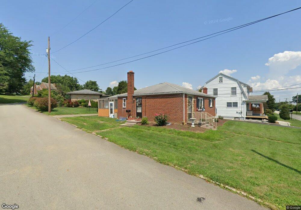
137 Virginia Ave Uniontown, PA 15401
Estimated Value: $89,000 - $163,037
2
Beds
2
Baths
1,152
Sq Ft
$111/Sq Ft
Est. Value
About This Home
This home is located at 137 Virginia Ave, Uniontown, PA 15401 and is currently estimated at $128,009, approximately $111 per square foot. 137 Virginia Ave is a home located in Fayette County with nearby schools including Uniontown Area Senior High School, St. John the Evangelist School, and Chestnut Ridge Christian Academy.
Ownership History
Date
Name
Owned For
Owner Type
Purchase Details
Closed on
Nov 18, 2015
Sold by
Voelker Kathleen R and Estate Of Sally A Leahart
Bought by
Cross David Wayne and Childs Katelyn Elizabeth
Current Estimated Value
Home Financials for this Owner
Home Financials are based on the most recent Mortgage that was taken out on this home.
Original Mortgage
$48,331
Outstanding Balance
$34,451
Interest Rate
3.75%
Mortgage Type
FHA
Estimated Equity
$93,558
Purchase Details
Closed on
Jan 1, 1968
Bought by
Leapheart Donald L and Leapheart Sally A
Create a Home Valuation Report for This Property
The Home Valuation Report is an in-depth analysis detailing your home's value as well as a comparison with similar homes in the area
Home Values in the Area
Average Home Value in this Area
Purchase History
| Date | Buyer | Sale Price | Title Company |
|---|---|---|---|
| Cross David Wayne | $50,000 | None Available | |
| Leapheart Donald L | -- | -- |
Source: Public Records
Mortgage History
| Date | Status | Borrower | Loan Amount |
|---|---|---|---|
| Open | Cross David Wayne | $48,331 |
Source: Public Records
Tax History Compared to Growth
Tax History
| Year | Tax Paid | Tax Assessment Tax Assessment Total Assessment is a certain percentage of the fair market value that is determined by local assessors to be the total taxable value of land and additions on the property. | Land | Improvement |
|---|---|---|---|---|
| 2025 | $1,179 | $31,370 | $7,935 | $23,435 |
| 2024 | $1,142 | $31,370 | $7,935 | $23,435 |
| 2023 | $2,284 | $31,370 | $7,935 | $23,435 |
| 2022 | $2,236 | $31,370 | $7,935 | $23,435 |
| 2021 | $2,236 | $31,370 | $7,935 | $23,435 |
| 2020 | $2,201 | $31,370 | $7,935 | $23,435 |
| 2019 | $2,092 | $31,370 | $7,935 | $23,435 |
| 2018 | $2,019 | $31,370 | $7,935 | $23,435 |
| 2017 | $2,019 | $31,370 | $7,935 | $23,435 |
| 2016 | -- | $31,370 | $7,935 | $23,435 |
| 2015 | -- | $31,370 | $7,935 | $23,435 |
| 2014 | -- | $62,740 | $15,870 | $46,870 |
Source: Public Records
Map
Nearby Homes
- 86 Virginia Ave
- 26 Belmont Cir
- 302 Derrick Ave
- 26 Sycamore St
- 15 Trump Ave
- 25 E Craig St
- 302 Crossland Ave
- 5 Albert St
- 406 Dove Dr
- 54 W Craig St
- 51 E Highland Ave
- 72 W Craig St
- 1019 Kimberly Dr
- 32 Lawton Ave
- 404 Shannon Dr
- 42 Oconnell Ave
- 60 Heritage Hills Rd
- 70 Heritage Hills Rd
- 43 Union St
- 388 Derrick Ave
- 135 Virginia Ave
- 143 Virginia Ave
- 131 Virginia Ave
- 107 Belmont Cir
- 136 Virginia Ave
- 140 Virginia Ave
- 142 Virginia Ave
- 147 Virginia Ave
- 130 Virginia Ave
- 103 Belmont Cir
- 146 Virginia Ave
- 117 Belmont Cir
- 125 Virginia Ave
- 116 Virginia Ave
- 148 Virginia Ave
- 97 Belmont Cir
- 155 Virginia Ave
- 150 Virginia Ave
- 104 Virginia Ave
- 31 Leith St