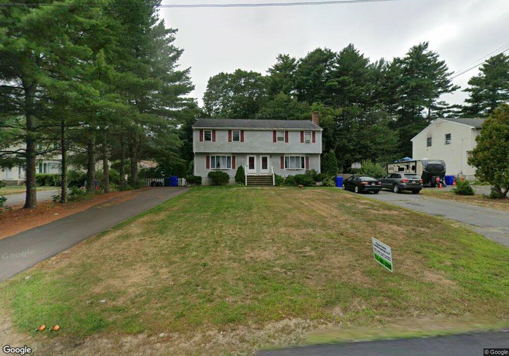
137 Williams St Unit B Taunton, MA 02780
Weir Village NeighborhoodEstimated Value: $379,908 - $451,000
3
Beds
2
Baths
1,334
Sq Ft
$305/Sq Ft
Est. Value
About This Home
This home is located at 137 Williams St Unit B, Taunton, MA 02780 and is currently estimated at $406,727, approximately $304 per square foot. 137 Williams St Unit B is a home located in Bristol County with nearby schools including Elizabeth Pole School, Taunton High School, and John F. Parker Middle School.
Ownership History
Date
Name
Owned For
Owner Type
Purchase Details
Closed on
Apr 8, 2022
Sold by
Boyle Bethany R
Bought by
Hunt Tara and Hunt Brian
Current Estimated Value
Home Financials for this Owner
Home Financials are based on the most recent Mortgage that was taken out on this home.
Original Mortgage
$347,588
Outstanding Balance
$328,066
Interest Rate
4.72%
Mortgage Type
FHA
Estimated Equity
$78,661
Purchase Details
Closed on
May 30, 2008
Sold by
Sabine Jeffrey M and Sabine Erin
Bought by
Boyle Bethany R
Home Financials for this Owner
Home Financials are based on the most recent Mortgage that was taken out on this home.
Original Mortgage
$175,500
Interest Rate
5.91%
Mortgage Type
Purchase Money Mortgage
Purchase Details
Closed on
Aug 28, 2006
Sold by
Sabine Jeffrey M and Buckley Erin
Bought by
Sabine Jeffrey M and Sabine Erin
Home Financials for this Owner
Home Financials are based on the most recent Mortgage that was taken out on this home.
Original Mortgage
$193,000
Interest Rate
6.83%
Mortgage Type
Purchase Money Mortgage
Purchase Details
Closed on
Jan 14, 2000
Sold by
Salomons Jennifer M
Bought by
Fialho Fatima M
Home Financials for this Owner
Home Financials are based on the most recent Mortgage that was taken out on this home.
Original Mortgage
$111,600
Interest Rate
7.79%
Mortgage Type
Purchase Money Mortgage
Purchase Details
Closed on
Oct 1, 1993
Sold by
Kimball Dale D and Kimball Lisa J
Bought by
Lindberg Donald J
Home Financials for this Owner
Home Financials are based on the most recent Mortgage that was taken out on this home.
Original Mortgage
$66,000
Interest Rate
7%
Mortgage Type
Purchase Money Mortgage
Purchase Details
Closed on
Dec 22, 1988
Sold by
Myrk Rt
Bought by
Kimball Dale D
Home Financials for this Owner
Home Financials are based on the most recent Mortgage that was taken out on this home.
Original Mortgage
$82,400
Interest Rate
10.18%
Mortgage Type
Purchase Money Mortgage
Create a Home Valuation Report for This Property
The Home Valuation Report is an in-depth analysis detailing your home's value as well as a comparison with similar homes in the area
Home Values in the Area
Average Home Value in this Area
Purchase History
| Date | Buyer | Sale Price | Title Company |
|---|---|---|---|
| Hunt Tara | $326,000 | None Available | |
| Boyle Bethany R | $195,000 | -- | |
| Sabine Jeffrey M | -- | -- | |
| Fialho Fatima M | $117,500 | -- | |
| Lindberg Donald J | $86,000 | -- | |
| Kimball Dale D | $109,900 | -- |
Source: Public Records
Mortgage History
| Date | Status | Borrower | Loan Amount |
|---|---|---|---|
| Open | Hunt Tara | $347,588 | |
| Previous Owner | Boyle Bethany R | $175,500 | |
| Previous Owner | Sabine Jeffrey M | $193,000 | |
| Previous Owner | Kimball Dale D | $111,600 | |
| Previous Owner | Kimball Dale D | $66,000 | |
| Previous Owner | Kimball Dale D | $82,400 |
Source: Public Records
Tax History Compared to Growth
Tax History
| Year | Tax Paid | Tax Assessment Tax Assessment Total Assessment is a certain percentage of the fair market value that is determined by local assessors to be the total taxable value of land and additions on the property. | Land | Improvement |
|---|---|---|---|---|
| 2025 | $3,547 | $324,200 | $0 | $324,200 |
| 2024 | $3,458 | $309,000 | $0 | $309,000 |
| 2023 | $3,332 | $276,500 | $0 | $276,500 |
| 2022 | $3,547 | $269,100 | $0 | $269,100 |
| 2021 | $2,803 | $197,400 | $0 | $197,400 |
| 2020 | $2,721 | $183,100 | $0 | $183,100 |
| 2019 | $2,886 | $183,100 | $0 | $183,100 |
| 2018 | $2,826 | $179,800 | $0 | $179,800 |
| 2017 | $2,584 | $164,500 | $0 | $164,500 |
| 2016 | $2,496 | $159,200 | $0 | $159,200 |
| 2015 | $2,288 | $152,400 | $0 | $152,400 |
| 2014 | $2,227 | $152,400 | $0 | $152,400 |
Source: Public Records
Map
Nearby Homes
- 26 Maynard St Unit A
- 31 Bruno's Way Unit A
- 55 Donna Terrace
- 28 Barbara Rd
- 600 County St
- 600 County St Lot A
- 600
- 170 Hart St Unit B
- 147 Colonial Dr
- 25 Johnson St Unit B
- 23 Johnson St Unit C
- 222 Harris St
- 218R Hart St Unit B
- 11 Williams St
- 3 Karena Dr Unit 8
- 0 S Main St Unit 73443212
- 1301 Carriage Ln Unit 1301
- 152 Forgeriver
- 1 Fayal Ave
- 29 Williams Ave
- 137 1/2 Williams St Unit B
- 137 1/2 Williams St Unit A
- 137 Williams St
- 137 Williams St
- 137 Williams St Unit B
- 137 Williams St Unit A
- 137B Williams St Unit B
- 135 1/2 Williams St Unit A
- 135 Williams St
- 135 Williams St Unit B
- 135 Williams St Unit A
- 23 Cavalier Ave
- 0 Cavalier Ave-Lot 17 Unit 60031452
- 0 Cavalier Ave-Lot 10 Unit 60031451
- 0 Williams St Unit 71009335
- 0 Williams St Unit 71117826
- 000 Williams St
- 0 Williams St
- Lot 2 Williams St
- 142 Williams St