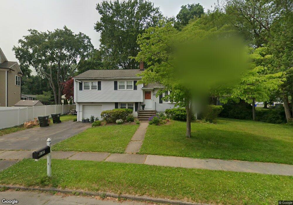
137 Windsor Rd Fairfield, CT 06824
University NeighborhoodEstimated Value: $730,000 - $928,000
3
Beds
2
Baths
1,105
Sq Ft
$717/Sq Ft
Est. Value
About This Home
This home is located at 137 Windsor Rd, Fairfield, CT 06824 and is currently estimated at $792,104, approximately $716 per square foot. 137 Windsor Rd is a home located in Fairfield County with nearby schools including Osborn Hill Elementary School, Fairfield Woods Middle School, and Fairfield Ludlowe High School.
Ownership History
Date
Name
Owned For
Owner Type
Purchase Details
Closed on
Aug 5, 2003
Sold by
Parisi Anthony P and Parisi Carl
Bought by
Naspr Joseph and Naspr Patricia
Current Estimated Value
Home Financials for this Owner
Home Financials are based on the most recent Mortgage that was taken out on this home.
Original Mortgage
$318,750
Outstanding Balance
$136,885
Interest Rate
5.28%
Estimated Equity
$655,219
Create a Home Valuation Report for This Property
The Home Valuation Report is an in-depth analysis detailing your home's value as well as a comparison with similar homes in the area
Home Values in the Area
Average Home Value in this Area
Purchase History
| Date | Buyer | Sale Price | Title Company |
|---|---|---|---|
| Naspr Joseph | $425,000 | -- | |
| Naspr Joseph | $425,000 | -- |
Source: Public Records
Mortgage History
| Date | Status | Borrower | Loan Amount |
|---|---|---|---|
| Open | Naspr Joseph | $318,750 | |
| Closed | Naspr Joseph | $318,750 | |
| Previous Owner | Naspr Joseph | $48,000 | |
| Previous Owner | Naspr Joseph | $50,000 |
Source: Public Records
Tax History
| Year | Tax Paid | Tax Assessment Tax Assessment Total Assessment is a certain percentage of the fair market value that is determined by local assessors to be the total taxable value of land and additions on the property. | Land | Improvement |
|---|---|---|---|---|
| 2025 | $8,677 | $305,620 | $240,800 | $64,820 |
| 2024 | $8,527 | $305,620 | $240,800 | $64,820 |
| 2023 | $8,408 | $305,620 | $240,800 | $64,820 |
| 2022 | $8,325 | $305,620 | $240,800 | $64,820 |
| 2021 | $8,246 | $305,620 | $240,800 | $64,820 |
| 2020 | $6,999 | $261,240 | $197,820 | $63,420 |
| 2019 | $6,999 | $261,240 | $197,820 | $63,420 |
| 2018 | $6,886 | $261,240 | $197,820 | $63,420 |
| 2017 | $6,745 | $261,240 | $197,820 | $63,420 |
| 2016 | $6,649 | $261,240 | $197,820 | $63,420 |
| 2015 | $6,650 | $268,240 | $208,250 | $59,990 |
| 2014 | $6,545 | $268,240 | $208,250 | $59,990 |
Source: Public Records
Map
Nearby Homes
- 115 Mayfair Rd
- 359 Reid St
- 245 Reid St
- 706 Judd St
- 196 Robin Ln
- 42 Robin Cir
- 54 Ridgedale Rd
- 12 Sugar Plum Ln
- 210 Pansy Rd
- 288 Melody Ln
- 41 Pepperbush Ln
- 109 Katona Dr Unit 18
- 28 Country Rd
- 68 Figlar Ave
- 218 Lower Farm Rd
- 106 Stillson Rd
- 164 Farist Rd
- 21 Boroskey Rd
- 148 Millspaugh Dr
- 108 Roseville St
- 131 Denise Terrace
- 170 Windsor Rd
- 207 Greenbriar Rd
- 217 Greenbriar Rd
- 150 Denise Terrace
- 37 Windsor Place
- 107 Denise Terrace
- 34 Windsor Place
- 220 Greenbriar Rd
- 114 Denise Terrace
- 214 Greenbriar Rd
- 163 Windsor Rd
- 21 Windsor Place
- 93 Denise Terrace
- 84 Allen Rd
- 200 Greenbriar Rd
- 98 Denise Terrace
- 93 Windsor Rd
- 76 Windsor Rd
- 7 Windsor Place
Your Personal Tour Guide
Ask me questions while you tour the home.