Estimated Value: $574,000 - $695,000
5
Beds
4
Baths
3,375
Sq Ft
$186/Sq Ft
Est. Value
About This Home
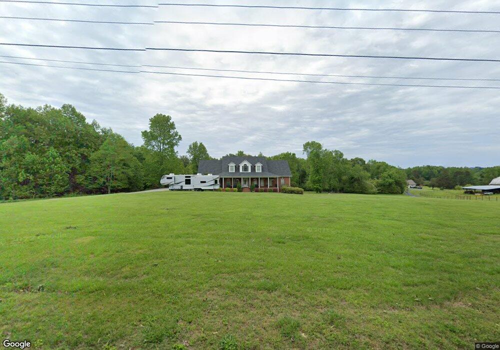
This home is located at 1370 B C Grant Rd, Alto, GA 30510 and is currently estimated at $628,029, approximately $186 per square foot. 1370 B C Grant Rd is a home located in Habersham County with nearby schools including Baldwin Elementary School, South Habersham Middle School, and Habersham Success Academy.
Ownership History
Date
Name
Owned For
Owner Type
Purchase Details
Closed on
Aug 10, 2005
Sold by
Blackburn Fred
Bought by
Blackburn Jason P and Blackburn Angie M
Current Estimated Value
Create a Home Valuation Report for This Property
The Home Valuation Report is an in-depth analysis detailing your home's value as well as a comparison with similar homes in the area
Home Values in the Area
Average Home Value in this Area
Purchase History
| Date | Buyer | Sale Price | Title Company |
|---|---|---|---|
| Blackburn Jason P | -- | -- |
Source: Public Records
Tax History Compared to Growth
Tax History
| Year | Tax Paid | Tax Assessment Tax Assessment Total Assessment is a certain percentage of the fair market value that is determined by local assessors to be the total taxable value of land and additions on the property. | Land | Improvement |
|---|---|---|---|---|
| 2025 | $5,600 | $255,772 | $31,920 | $223,852 |
| 2024 | -- | $245,252 | $13,464 | $231,788 |
| 2023 | $5,018 | $200,704 | $13,464 | $187,240 |
| 2022 | $4,552 | $174,568 | $13,464 | $161,104 |
| 2021 | $4,239 | $163,340 | $12,344 | $150,996 |
| 2020 | $3,839 | $142,740 | $12,344 | $130,396 |
| 2019 | $3,843 | $142,740 | $12,344 | $130,396 |
| 2018 | $3,813 | $142,740 | $12,344 | $130,396 |
| 2017 | $3,478 | $129,516 | $10,100 | $119,416 |
| 2016 | $3,377 | $323,790 | $10,100 | $119,416 |
| 2015 | $3,338 | $323,790 | $10,100 | $119,416 |
| 2014 | $3,152 | $300,150 | $10,100 | $109,960 |
| 2013 | -- | $121,180 | $11,220 | $109,960 |
Source: Public Records
Map
Nearby Homes
- 3568 State Route 365
- 738 Wilbanks Rd
- 135 Oak Terrace Dr
- 117 Oak Terrace Dr
- 0 State Route 365 Unit 10496178
- 0 State Route 365 Unit 10496183
- 752 Dawn Place
- 324 Highland Pointe Dr
- 130 E Railroad Ave
- 179 Sunset Oaks Dr
- 603 Nix Rd
- 190 Sunset Oaks Dr
- 2000 Alto Mud Creek Rd
- 933 Alto Mud Creek Rd
- 1246 Duncan Bridge Rd
- 2484 Apple Pie Ridge Rd Unit 11 ACRES
- 3073 Gainesville Hwy
- 0 Hubert Harris
- 429 Hubert Harris Rd
- 2154 Apple Pie Ridge Rd
- 1363 B C Grant Rd
- 1405 B C Grant Rd
- 1405 B C Grant Rd
- 1214 B C Grant Rd
- 1140 B C Grant Rd
- 1175 B C Grant Rd
- 1113 B C Grant Rd
- 255 Wilbanks Rd
- 167 Wilbanks Rd
- 1123 B C Grant Rd
- 1123 B C Grant Rd
- 1578 B C Grant Rd
- 415 Caudell Hill Ln
- 342 Caudell Hill Ln
- 3568 State Highway 365
- 227 Wilbanks Rd
- 3656 State Highway 365
- 1035 B C Grant Rd
- 1540 B C Grant Rd
- 995 B C Grant Rd