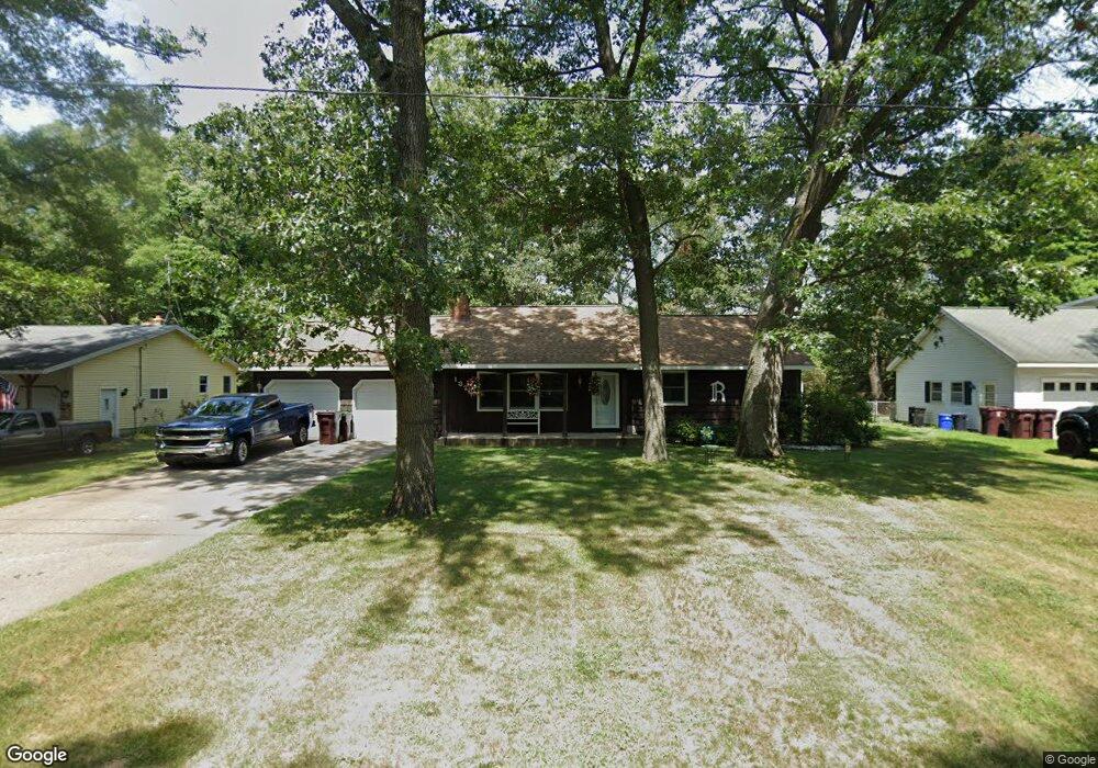
1370 Cardinal Circle Dr Muskegon, MI 49445
Estimated Value: $253,631 - $292,000
3
Beds
3
Baths
1,280
Sq Ft
$216/Sq Ft
Est. Value
About This Home
This home is located at 1370 Cardinal Circle Dr, Muskegon, MI 49445 and is currently estimated at $276,158, approximately $215 per square foot. 1370 Cardinal Circle Dr is a home located in Muskegon County with nearby schools including Reeths-Puffer High School.
Ownership History
Date
Name
Owned For
Owner Type
Purchase Details
Closed on
Aug 26, 2022
Sold by
Runyan Rodney L and Runyan Patricia L
Bought by
Rodney And Patricia Runyan Trust
Current Estimated Value
Home Financials for this Owner
Home Financials are based on the most recent Mortgage that was taken out on this home.
Original Mortgage
$30,000
Outstanding Balance
$18,321
Interest Rate
5.3%
Mortgage Type
New Conventional
Estimated Equity
$257,837
Purchase Details
Closed on
Jan 20, 2021
Sold by
Runyan Rodney L and Runyan Patricia L
Bought by
Runyan Rodney L and Runyan Patricia L
Home Financials for this Owner
Home Financials are based on the most recent Mortgage that was taken out on this home.
Original Mortgage
$92,000
Interest Rate
2.67%
Mortgage Type
Purchase Money Mortgage
Purchase Details
Closed on
Jun 27, 2016
Sold by
Runyan Rodney L and Runyan Patricia L
Bought by
Runyan Rodney L and Runyan Patricta L
Create a Home Valuation Report for This Property
The Home Valuation Report is an in-depth analysis detailing your home's value as well as a comparison with similar homes in the area
Home Values in the Area
Average Home Value in this Area
Purchase History
| Date | Buyer | Sale Price | Title Company |
|---|---|---|---|
| Rodney And Patricia Runyan Trust | -- | -- | |
| Runyan Rodney L | -- | -- | |
| Runyan Rodney L | -- | None Available | |
| Runyan Rodney L | -- | None Available | |
| Runyan Rodney L | -- | Attorney |
Source: Public Records
Mortgage History
| Date | Status | Borrower | Loan Amount |
|---|---|---|---|
| Open | Runyan Rodney L | $30,000 | |
| Previous Owner | Runyan Rodney L | $92,000 |
Source: Public Records
Tax History Compared to Growth
Tax History
| Year | Tax Paid | Tax Assessment Tax Assessment Total Assessment is a certain percentage of the fair market value that is determined by local assessors to be the total taxable value of land and additions on the property. | Land | Improvement |
|---|---|---|---|---|
| 2025 | $2,162 | $103,200 | $0 | $0 |
| 2024 | $647 | $95,000 | $0 | $0 |
| 2023 | $619 | $85,500 | $0 | $0 |
| 2022 | $1,974 | $75,100 | $0 | $0 |
| 2021 | $1,928 | $69,200 | $0 | $0 |
| 2020 | $1,904 | $66,000 | $0 | $0 |
| 2019 | $1,876 | $62,800 | $0 | $0 |
| 2018 | $1,841 | $60,400 | $0 | $0 |
| 2017 | $1,833 | $59,000 | $0 | $0 |
| 2016 | $527 | $53,200 | $0 | $0 |
| 2015 | -- | $49,900 | $0 | $0 |
| 2014 | -- | $50,200 | $0 | $0 |
| 2013 | -- | $43,800 | $0 | $0 |
Source: Public Records
Map
Nearby Homes
- 2060 N Roberts Rd
- 2021 Queens Ct
- 1925 Shady Oak Dr
- 0 N Getty St
- 0 Holton Vl Rd Unit 20027438
- 2026 N Port Blvd
- 1960 Nielwood Dr
- V/L Holton Rd
- 764 E Giles Rd
- 787 E Giles Rd
- 2624 Holton Rd
- 2551 Hiawatha Trail
- 0 E Mcmillan Rd
- 2337 Northwind Dr
- 1850 Mildred St
- V/L Reed Ave
- 1353 Holton Rd
- 2635 E River Rd
- 129 Maple Ct
- 1699 Sycamore Dr
- 1358 Cardinal Circle Dr
- 1380 Cardinal Circle Dr
- 1346 Cardinal Circle Dr
- 1400 Cardinal Circle Dr
- 1359 Cardinal Circle Dr
- 1375 Cardinal Circle Dr
- 1345 Cardinal Circle Dr
- 1336 Cardinal Circle Dr
- 1414 Cardinal Circle Dr
- 1325 Cardinal Circle Dr
- 1364 Robin Rd
- 1401 Cardinal Circle Dr
- 1330 Cardinal Circle Dr
- 1352 Robin Rd
- 1340 Robin Rd
- 2034 Bluebird Ln
- 2014 Bluebird Ln
- 1306 Cardinal Circle Dr
- 1315 Robin Rd
- 2061 Bluebird Ln