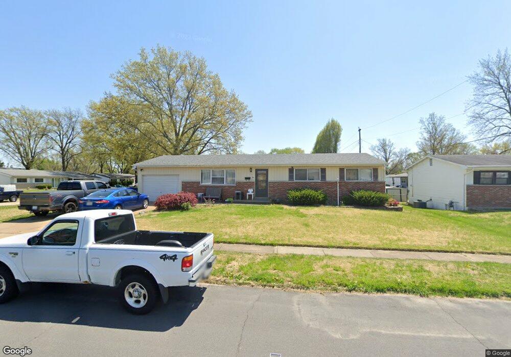
1370 Harkee Dr Florissant, MO 63031
Estimated Value: $176,000 - $208,000
3
Beds
2
Baths
1,344
Sq Ft
$143/Sq Ft
Est. Value
About This Home
This home is located at 1370 Harkee Dr, Florissant, MO 63031 and is currently estimated at $192,121, approximately $142 per square foot. 1370 Harkee Dr is a home located in St. Louis County with nearby schools including McCurdy Elementary School, Northwest Middle School, and Hazelwood West High School.
Ownership History
Date
Name
Owned For
Owner Type
Purchase Details
Closed on
Jan 17, 2003
Sold by
Gerst David S and Gerst Elizabeth
Bought by
Parrish Shane and Parrish Amy
Current Estimated Value
Home Financials for this Owner
Home Financials are based on the most recent Mortgage that was taken out on this home.
Original Mortgage
$94,410
Outstanding Balance
$49,905
Interest Rate
9.4%
Estimated Equity
$142,216
Purchase Details
Closed on
Jan 26, 1998
Sold by
Gerst Ann C
Bought by
Gerst David S and Gerst Leo J
Create a Home Valuation Report for This Property
The Home Valuation Report is an in-depth analysis detailing your home's value as well as a comparison with similar homes in the area
Home Values in the Area
Average Home Value in this Area
Purchase History
| Date | Buyer | Sale Price | Title Company |
|---|---|---|---|
| Parrish Shane | $104,900 | -- | |
| Gerst David S | -- | -- |
Source: Public Records
Mortgage History
| Date | Status | Borrower | Loan Amount |
|---|---|---|---|
| Open | Parrish Shane | $94,410 |
Source: Public Records
Tax History Compared to Growth
Tax History
| Year | Tax Paid | Tax Assessment Tax Assessment Total Assessment is a certain percentage of the fair market value that is determined by local assessors to be the total taxable value of land and additions on the property. | Land | Improvement |
|---|---|---|---|---|
| 2025 | $2,869 | $34,120 | $4,900 | $29,220 |
| 2024 | $2,869 | $32,150 | $3,270 | $28,880 |
| 2023 | $2,865 | $32,150 | $3,270 | $28,880 |
| 2022 | $2,331 | $23,260 | $3,270 | $19,990 |
| 2021 | $2,271 | $23,260 | $3,270 | $19,990 |
| 2020 | $2,281 | $21,970 | $3,270 | $18,700 |
| 2019 | $2,246 | $21,970 | $3,270 | $18,700 |
| 2018 | $1,893 | $16,990 | $2,870 | $14,120 |
| 2017 | $1,891 | $16,990 | $2,870 | $14,120 |
| 2016 | $1,795 | $15,900 | $2,110 | $13,790 |
| 2015 | $1,757 | $15,900 | $2,110 | $13,790 |
| 2014 | $2,047 | $19,130 | $3,170 | $15,960 |
Source: Public Records
Map
Nearby Homes
- 1505 Swallow Ln
- 1395 Bluebird Dr
- 1415 Boulder Dr
- 1825 Swallow Ln
- 1155 Mullanphy Rd
- 1120 Bluebird Dr
- 1150 Verlene Dr
- 2040 Splendor Dr
- 200 Francisca Dr
- 1270 Bobolink Dr
- 1290 Jackson Ln
- 2048 New Sun Dr
- 1830 New Sun Ct
- 1380 Thrush Ln
- 1920 Shackelford Rd
- 915 Iris Dr
- 1863 High Sun Dr Unit 51863
- 2186 Aristocrat Dr
- 890 Tyson Dr
- 25 Francisca Dr
- 1520 Bluebird Dr
- 1360 Harkee Dr
- 1525 Swallow Ln
- 1545 Bluebird Dr
- 1500 Bluebird Dr
- 1525 Bluebird Dr
- 1355 Harkee Dr
- 1505 Bluebird Dr
- 1490 Bluebird Dr
- 1540 Swallow Ln
- 1495 Swallow Ln
- 1400 Harkee Dr
- 1560 Swallow Ln
- 1580 Flamingo Dr
- 1520 Swallow Ln
- 1495 Bluebird Dr
- 1570 Swallow Ln
- 1560 Flamingo Dr
- 1500 Swallow Ln
- 1480 Bluebird Dr