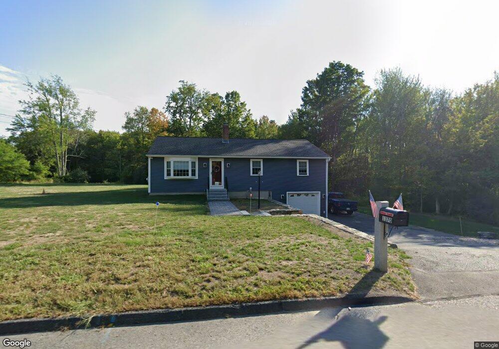
1370 Massachusetts Ave Lunenburg, MA 01462
Estimated Value: $444,823 - $513,000
3
Beds
2
Baths
1,288
Sq Ft
$374/Sq Ft
Est. Value
About This Home
This home is located at 1370 Massachusetts Ave, Lunenburg, MA 01462 and is currently estimated at $482,206, approximately $374 per square foot. 1370 Massachusetts Ave is a home located in Worcester County with nearby schools including Lunenburg Primary School and Lunenburg High School.
Ownership History
Date
Name
Owned For
Owner Type
Purchase Details
Closed on
Jan 20, 2016
Sold by
Allen Clifford M and Marrama-Allen Tina M
Bought by
Tina M Marrama-Allen R and Allen Clifford M
Current Estimated Value
Purchase Details
Closed on
Nov 15, 1993
Sold by
Pierce Russell C and Pierce Helen D
Bought by
Hanscome Tina Marie
Home Financials for this Owner
Home Financials are based on the most recent Mortgage that was taken out on this home.
Original Mortgage
$100,000
Interest Rate
6.79%
Mortgage Type
Purchase Money Mortgage
Create a Home Valuation Report for This Property
The Home Valuation Report is an in-depth analysis detailing your home's value as well as a comparison with similar homes in the area
Home Values in the Area
Average Home Value in this Area
Purchase History
| Date | Buyer | Sale Price | Title Company |
|---|---|---|---|
| Tina M Marrama-Allen R | -- | -- | |
| Hanscome Tina Marie | $111,500 | -- |
Source: Public Records
Mortgage History
| Date | Status | Borrower | Loan Amount |
|---|---|---|---|
| Previous Owner | Hanscome Tina Marie | $36,000 | |
| Previous Owner | Hanscome Tina Marie | $100,000 |
Source: Public Records
Tax History Compared to Growth
Tax History
| Year | Tax Paid | Tax Assessment Tax Assessment Total Assessment is a certain percentage of the fair market value that is determined by local assessors to be the total taxable value of land and additions on the property. | Land | Improvement |
|---|---|---|---|---|
| 2025 | $5,557 | $387,000 | $112,700 | $274,300 |
| 2024 | $5,235 | $371,300 | $106,300 | $265,000 |
| 2023 | $5,193 | $355,200 | $100,200 | $255,000 |
| 2022 | $4,805 | $279,500 | $83,500 | $196,000 |
| 2020 | $4,847 | $267,500 | $83,800 | $183,700 |
| 2019 | $4,425 | $236,900 | $69,200 | $167,700 |
| 2018 | $4,356 | $221,100 | $81,500 | $139,600 |
| 2017 | $4,072 | $203,800 | $69,900 | $133,900 |
| 2016 | $3,820 | $194,800 | $73,500 | $121,300 |
| 2015 | $3,442 | $187,900 | $69,900 | $118,000 |
Source: Public Records
Map
Nearby Homes
- 44 Hemlock Dr
- 185 Hemlock Dr
- 372 Townsend Harbor Rd
- 1790 Massachusetts Ave Unit 25
- 1790 Massachusetts Ave Unit 22
- 35 Leominster Rd
- 166 Elmwood Rd
- 31 School St
- 9 Fairview Rd
- 91 Valley Rd
- 29 West St
- 167 S Row Rd
- 830 Massachusetts Ave
- 63 Holman St
- 319 Highland St
- 110 Burrage St
- 230 S Row Rd
- 6 Riley Rd Unit 6
- 711 Massachusetts Ave Unit 2
- 601 Flat Hill Rd
- 1382 Massachusetts Ave
- 1373 Massachusetts Ave
- 1353 Massachusetts Ave
- 1348 Massachusetts Ave
- 1387 Massachusetts Ave
- 1387 Mass Ave
- 1402 Massachusetts Ave
- 6 Arbor St
- 1396 Massachusetts Ave
- 1335 Massachusetts Ave
- 12 Arbor St
- 1345 Massachusetts Ave
- 1417 Massachusetts Ave
- 1351 Massachusetts Ave
- 1361 Massachusetts Ave
- 1331 Massachusetts Ave
- 32 Arbor St
- 1431 Massachusetts Ave
- 1442 Massachusetts Ave
- 1325 Massachusetts Ave